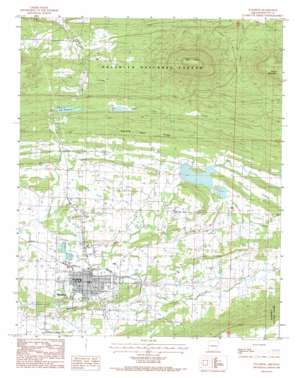
Waldron Topo Map Arkansas
To zoom in, hover over the map of Waldron
USGS Topo Quad 34094h1 - 1:24,000 scale
| Topo Map Name: | Waldron |
| USGS Topo Quad ID: | 34094h1 |
| Print Size: | ca. 21 1/4" wide x 27" high |
| Southeast Coordinates: | 34.875° N latitude / 94° W longitude |
| Map Center Coordinates: | 34.9375° N latitude / 94.0625° W longitude |
| U.S. State: | AR |
| Filename: | o34094h1.jpg |
| Download Map JPG Image: | Waldron topo map 1:24,000 scale |
| Map Type: | Topographic |
| Topo Series: | 7.5´ |
| Map Scale: | 1:24,000 |
| Source of Map Images: | United States Geological Survey (USGS) |
| Alternate Map Versions: |
Waldron AR 1983, updated 1984 Download PDF Buy paper map Waldron AR 2011 Download PDF Buy paper map Waldron AR 2014 Download PDF Buy paper map |
| FStopo: | US Forest Service topo Waldron is available: Download FStopo PDF Download FStopo TIF |
1:24,000 Topo Quads surrounding Waldron
> Back to 34094e1 at 1:100,000 scale
> Back to 34094a1 at 1:250,000 scale
> Back to U.S. Topo Maps home
Waldron topo map: Gazetteer
Waldron: Airports
Waldron Municipal Airport elevation 209m 685′Waldron: Dams
Lake Waldron Dam elevation 211m 692′Poteau River Watershed Site Five Dam elevation 207m 679′
Poteau River Watershed Site Four Dam elevation 221m 725′
Poteau River Watershed Site Six Dam elevation 231m 757′
Waldron: Parks
Sodie Davidson Park elevation 222m 728′Truman Baker Park elevation 222m 728′
Waldron: Populated Places
Anderson elevation 198m 649′Colburn Spring (historical) elevation 281m 921′
Green Ridge elevation 232m 761′
Lone Elm elevation 223m 731′
Pleasant Hill elevation 210m 688′
Pleasant Valley elevation 225m 738′
Waldron elevation 201m 659′
Waldron: Post Offices
Waldron Post Office elevation 205m 672′Waldron: Reservoirs
Lake Waldron elevation 211m 692′Poteau River Site Five Lake elevation 207m 679′
Waldron Lake elevation 210m 688′
Waldron Lake elevation 218m 715′
Waldron: Ridges
Square Rock Ridge elevation 283m 928′Waldron: Streams
Clear Creek elevation 198m 649′East Fork Poteau River elevation 200m 656′
Mud Creek elevation 196m 643′
Prairie Creek elevation 214m 702′
Self Branch elevation 216m 708′
Square Rock Creek elevation 196m 643′
Waldron: Summits
Bohnstein Hill elevation 246m 807′Pilot Knob elevation 602m 1975′
Round Mountain elevation 495m 1624′
Waldron digital topo map on disk
Buy this Waldron topo map showing relief, roads, GPS coordinates and other geographical features, as a high-resolution digital map file on DVD:


