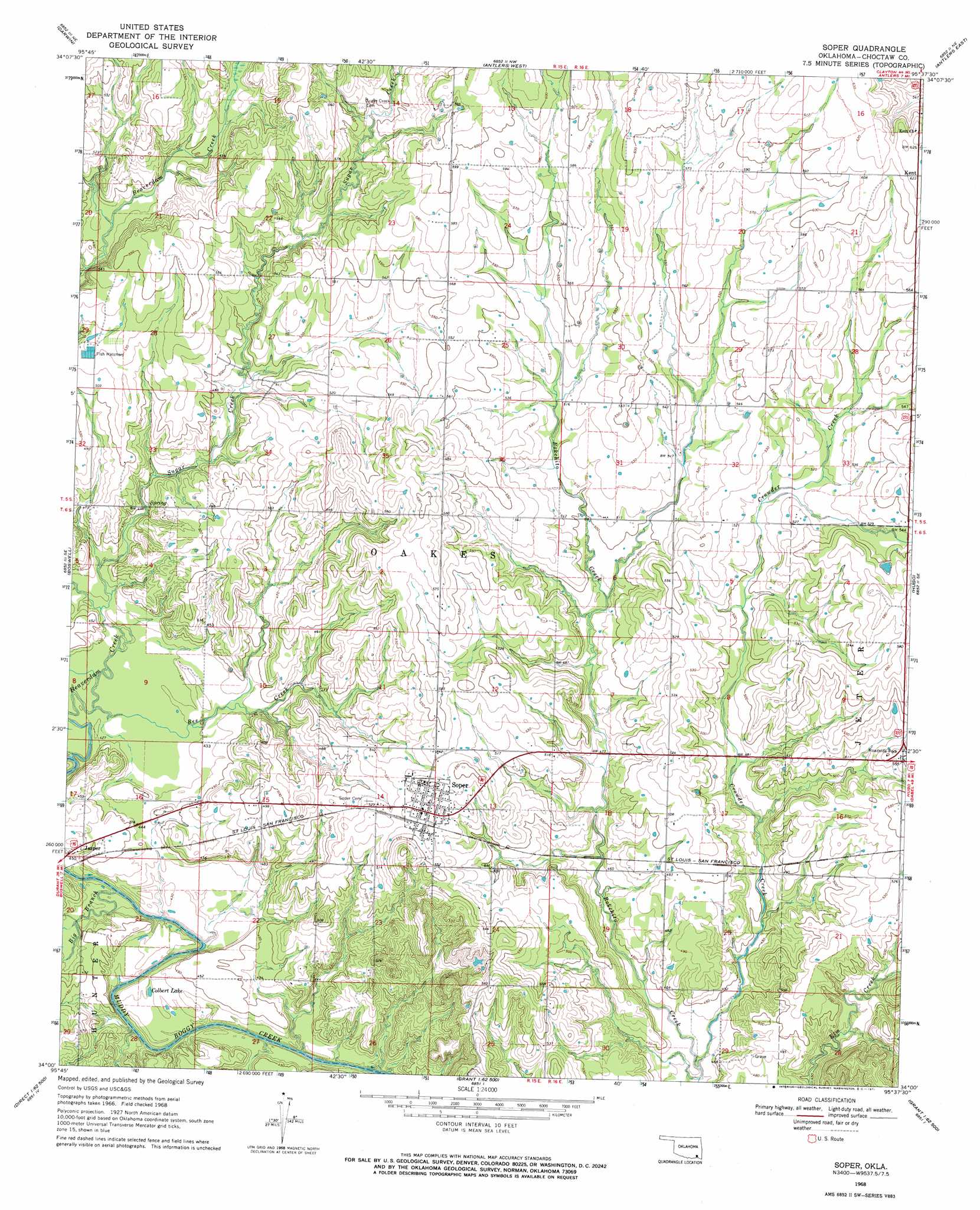
Soper Topo Map Oklahoma
To zoom in, hover over the map of Soper
USGS Topo Quad 34095a6 - 1:24,000 scale
| Topo Map Name: | Soper |
| USGS Topo Quad ID: | 34095a6 |
| Print Size: | ca. 21 1/4" wide x 27" high |
| Southeast Coordinates: | 34° N latitude / 95.625° W longitude |
| Map Center Coordinates: | 34.0625° N latitude / 95.6875° W longitude |
| U.S. State: | OK |
| Filename: | o34095a6.jpg |
| Download Map JPG Image: | Soper topo map 1:24,000 scale |
| Map Type: | Topographic |
| Topo Series: | 7.5´ |
| Map Scale: | 1:24,000 |
| Source of Map Images: | United States Geological Survey (USGS) |
| Alternate Map Versions: |
Soper OK 1968, updated 1971 Download PDF Buy paper map Soper OK 2010 Download PDF Buy paper map Soper OK 2012 Download PDF Buy paper map Soper OK 2016 Download PDF Buy paper map |
1:24,000 Topo Quads surrounding Soper
Lane |
Farris |
Moyers |
Kosoma |
Finley |
Boswell Nw |
Darwin |
Antlers West |
Antlers East |
Rattan |
Boswell Sw |
Boswell |
Soper |
Hugo |
Hugo Dam |
Lake West |
New Oberlin |
Bluff |
Grant |
Shoals |
Monkstown |
Direct |
Pat Mayse Lake West |
Pat Mayse Lake East |
Slate Shoals |
> Back to 34095a1 at 1:100,000 scale
> Back to 34094a1 at 1:250,000 scale
> Back to U.S. Topo Maps home
Soper topo map: Gazetteer
Soper: Lakes
Colbert Lake elevation 131m 429′Soper: Populated Places
Jasper elevation 141m 462′Soper elevation 163m 534′
Soper: Streams
Beaverdam Creek elevation 125m 410′Bee Creek elevation 128m 419′
Big Branch elevation 124m 406′
Crowder Creek elevation 128m 419′
Sugar Creek elevation 128m 419′
Soper digital topo map on disk
Buy this Soper topo map showing relief, roads, GPS coordinates and other geographical features, as a high-resolution digital map file on DVD: