Boswell Topo Map Oklahoma
To zoom in, hover over the map of Boswell
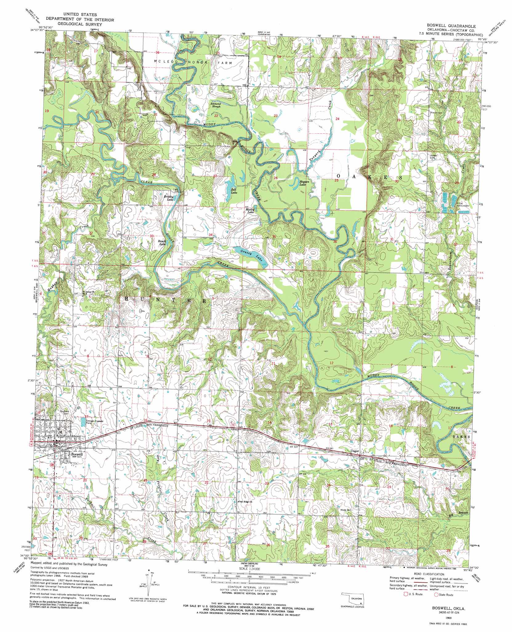
USGS Topo Quad 34095a7 - 1:24,000 scale
| Topo Map Name: | Boswell |
| USGS Topo Quad ID: | 34095a7 |
| Print Size: | ca. 21 1/4" wide x 27" high |
| Southeast Coordinates: | 34° N latitude / 95.75° W longitude |
| Map Center Coordinates: | 34.0625° N latitude / 95.8125° W longitude |
| U.S. State: | OK |
| Filename: | o34095a7.jpg |
| Download Map JPG Image: | Boswell topo map 1:24,000 scale |
| Map Type: | Topographic |
| Topo Series: | 7.5´ |
| Map Scale: | 1:24,000 |
| Source of Map Images: | United States Geological Survey (USGS) |
| Alternate Map Versions: |
Boswell OK 1969, updated 1971 Download PDF Buy paper map Boswell OK 1969, updated 1989 Download PDF Buy paper map Boswell OK 2009 Download PDF Buy paper map Boswell OK 2012 Download PDF Buy paper map Boswell OK 2016 Download PDF Buy paper map |
1:24,000 Topo Quads surrounding Boswell
Bruno |
Lane |
Farris |
Moyers |
Kosoma |
Bentley |
Boswell Nw |
Darwin |
Antlers West |
Antlers East |
Bennington North |
Boswell Sw |
Boswell |
Soper |
Hugo |
Bennington South |
Lake West |
New Oberlin |
Bluff |
Grant |
Telephone |
Monkstown |
Direct |
Pat Mayse Lake West |
Pat Mayse Lake East |
> Back to 34095a1 at 1:100,000 scale
> Back to 34094a1 at 1:250,000 scale
> Back to U.S. Topo Maps home
Boswell topo map: Gazetteer
Boswell: Guts
Edmond Slough elevation 132m 433′Boswell: Lakes
Bench Lake elevation 133m 436′Brushy Lake elevation 130m 426′
Hogpen Lake elevation 133m 436′
Mosley Lake elevation 131m 429′
Salt Lake elevation 130m 426′
Boswell: Populated Places
Boswell elevation 186m 610′Unger elevation 155m 508′
Boswell: Reservoirs
Grassy Lake elevation 134m 439′Boswell: Streams
Clear Boggy Creek elevation 129m 423′Dry Pointer Creek elevation 154m 505′
Mayhew Creek elevation 134m 439′
Tanyard Creek elevation 129m 423′
Boswell digital topo map on disk
Buy this Boswell topo map showing relief, roads, GPS coordinates and other geographical features, as a high-resolution digital map file on DVD: