Sobol Topo Map Oklahoma
To zoom in, hover over the map of Sobol
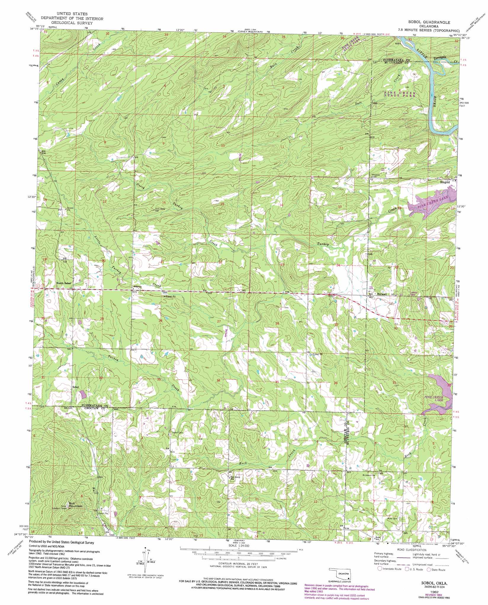
USGS Topo Quad 34095b2 - 1:24,000 scale
| Topo Map Name: | Sobol |
| USGS Topo Quad ID: | 34095b2 |
| Print Size: | ca. 21 1/4" wide x 27" high |
| Southeast Coordinates: | 34.125° N latitude / 95.125° W longitude |
| Map Center Coordinates: | 34.1875° N latitude / 95.1875° W longitude |
| U.S. State: | OK |
| Filename: | o34095b2.jpg |
| Download Map JPG Image: | Sobol topo map 1:24,000 scale |
| Map Type: | Topographic |
| Topo Series: | 7.5´ |
| Map Scale: | 1:24,000 |
| Source of Map Images: | United States Geological Survey (USGS) |
| Alternate Map Versions: |
Sobol OK 1962, updated 1964 Download PDF Buy paper map Sobol OK 1962, updated 1976 Download PDF Buy paper map Sobol OK 1962, updated 1993 Download PDF Buy paper map Sobol OK 2010 Download PDF Buy paper map Sobol OK 2012 Download PDF Buy paper map Sobol OK 2016 Download PDF Buy paper map |
1:24,000 Topo Quads surrounding Sobol
Snow |
Wildhorse Mountain |
Nashoba |
Clebit |
Battiest |
Finley |
Cloudy |
Caney Mountain |
Signal Mountain |
Rockey Creek |
Rattan |
Spencerville |
Sobol |
Alikchi |
Bear Mountain |
Hugo Dam |
Fort Towson |
Swink |
Wright City |
Golden |
Shoals |
Frogville |
Kiomatia |
Millerton |
Garvin |
> Back to 34095a1 at 1:100,000 scale
> Back to 34094a1 at 1:250,000 scale
> Back to U.S. Topo Maps home
Sobol topo map: Gazetteer
Sobol: Parks
Pine Creek State Park elevation 147m 482′Sobol: Populated Places
Burwell elevation 148m 485′North Sobol elevation 212m 695′
Pine Knot Crossing elevation 133m 436′
Ringold elevation 140m 459′
Sobol elevation 194m 636′
Sobol: Streams
Little Turkey Creek elevation 160m 524′North Turkey Creek elevation 143m 469′
Salt Creek elevation 133m 436′
Terrapin Creek elevation 134m 439′
Sobol: Summits
Bull Mountain elevation 256m 839′Sobol digital topo map on disk
Buy this Sobol topo map showing relief, roads, GPS coordinates and other geographical features, as a high-resolution digital map file on DVD: