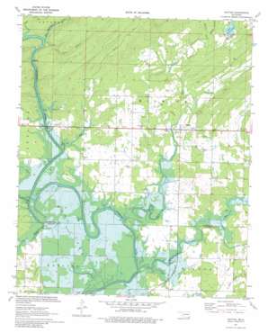
Rattan Topo Map Oklahoma
To zoom in, hover over the map of Rattan
USGS Topo Quad 34095b4 - 1:24,000 scale
| Topo Map Name: | Rattan |
| USGS Topo Quad ID: | 34095b4 |
| Print Size: | ca. 21 1/4" wide x 27" high |
| Southeast Coordinates: | 34.125° N latitude / 95.375° W longitude |
| Map Center Coordinates: | 34.1875° N latitude / 95.4375° W longitude |
| U.S. State: | OK |
| Filename: | o34095b4.jpg |
| Download Map JPG Image: | Rattan topo map 1:24,000 scale |
| Map Type: | Topographic |
| Topo Series: | 7.5´ |
| Map Scale: | 1:24,000 |
| Source of Map Images: | United States Geological Survey (USGS) |
| Alternate Map Versions: |
Rattan OK 1971, updated 1973 Download PDF Buy paper map Rattan OK 1971, updated 1980 Download PDF Buy paper map Rattan OK 2010 Download PDF Buy paper map Rattan OK 2012 Download PDF Buy paper map Rattan OK 2016 Download PDF Buy paper map |
1:24,000 Topo Quads surrounding Rattan
> Back to 34095a1 at 1:100,000 scale
> Back to 34094a1 at 1:250,000 scale
> Back to U.S. Topo Maps home
Rattan topo map: Gazetteer
Rattan: Dams
Ozzie Cobb Lake Dam elevation 165m 541′Rattan: Parks
Hugo Wildlife Management Area elevation 139m 456′Waterfowl Refuge elevation 129m 423′
Rattan: Populated Places
Apple elevation 142m 465′Belzoni elevation 140m 459′
Rattan elevation 142m 465′
Rattan: Reservoirs
Lake Ozzie Cobb elevation 158m 518′Ozzie Cobb Lake elevation 165m 541′
Rattan: Streams
Big Waterhole Creek elevation 127m 416′Duck Creek elevation 128m 419′
Fish Creek elevation 148m 485′
Frazier Creek elevation 122m 400′
Glade Branch elevation 134m 439′
Hog Creek elevation 133m 436′
Lick Branch elevation 127m 416′
Mill Creek elevation 122m 400′
Negro Creek elevation 122m 400′
Nelson Branch elevation 149m 488′
One Creek elevation 122m 400′
Possum Creek elevation 138m 452′
Rock Creek elevation 122m 400′
Spencer Creek elevation 128m 419′
Rattan digital topo map on disk
Buy this Rattan topo map showing relief, roads, GPS coordinates and other geographical features, as a high-resolution digital map file on DVD:


