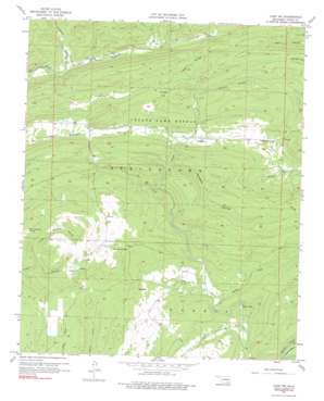
Lane Nw Topo Map Oklahoma
To zoom in, hover over the map of Lane Nw
USGS Topo Quad 34095d8 - 1:24,000 scale
| Topo Map Name: | Lane Nw |
| USGS Topo Quad ID: | 34095d8 |
| Print Size: | ca. 21 1/4" wide x 27" high |
| Southeast Coordinates: | 34.375° N latitude / 95.875° W longitude |
| Map Center Coordinates: | 34.4375° N latitude / 95.9375° W longitude |
| U.S. State: | OK |
| Filename: | o34095d8.jpg |
| Download Map JPG Image: | Lane Nw topo map 1:24,000 scale |
| Map Type: | Topographic |
| Topo Series: | 7.5´ |
| Map Scale: | 1:24,000 |
| Source of Map Images: | United States Geological Survey (USGS) |
| Alternate Map Versions: |
Lane NW OK 1957, updated 1958 Download PDF Buy paper map Lane NW OK 1957, updated 1976 Download PDF Buy paper map Lane NW OK 2010 Download PDF Buy paper map Lane NW OK 2012 Download PDF Buy paper map Lane NW OK 2016 Download PDF Buy paper map |
1:24,000 Topo Quads surrounding Lane Nw
> Back to 34095a1 at 1:100,000 scale
> Back to 34094a1 at 1:250,000 scale
> Back to U.S. Topo Maps home
Lane Nw topo map: Gazetteer
Lane Nw: Bends
Horseshoe Bend (historical) elevation 180m 590′Lane Nw: Dams
Atoka County Dam elevation 236m 774′Oknoname 135004 Dam elevation 211m 692′
Lane Nw: Flats
Hiawana Prairie elevation 242m 793′Hickory Flat elevation 249m 816′
Lane Nw: Lakes
Texas Hole elevation 170m 557′Lane Nw: Parks
Stringtown Public Hunting Area elevation 207m 679′Wildlife Management Area elevation 183m 600′
Lane Nw: Populated Places
Fugate elevation 202m 662′Lane Nw: Reservoirs
Atoka County Lake elevation 236m 774′Oknoname 135004 Reservoir elevation 211m 692′
Lane Nw: Streams
Breadtown Creek elevation 180m 590′Cat Creek elevation 182m 597′
Hiawana Creek elevation 179m 587′
Panther Creek elevation 170m 557′
Lane Nw: Valleys
Cedar Hollow elevation 201m 659′Kennedy Hollow elevation 195m 639′
Peacock Hollow elevation 211m 692′
Wildcat Hollow elevation 190m 623′
Lane Nw digital topo map on disk
Buy this Lane Nw topo map showing relief, roads, GPS coordinates and other geographical features, as a high-resolution digital map file on DVD:


