Sardis Topo Map Oklahoma
To zoom in, hover over the map of Sardis
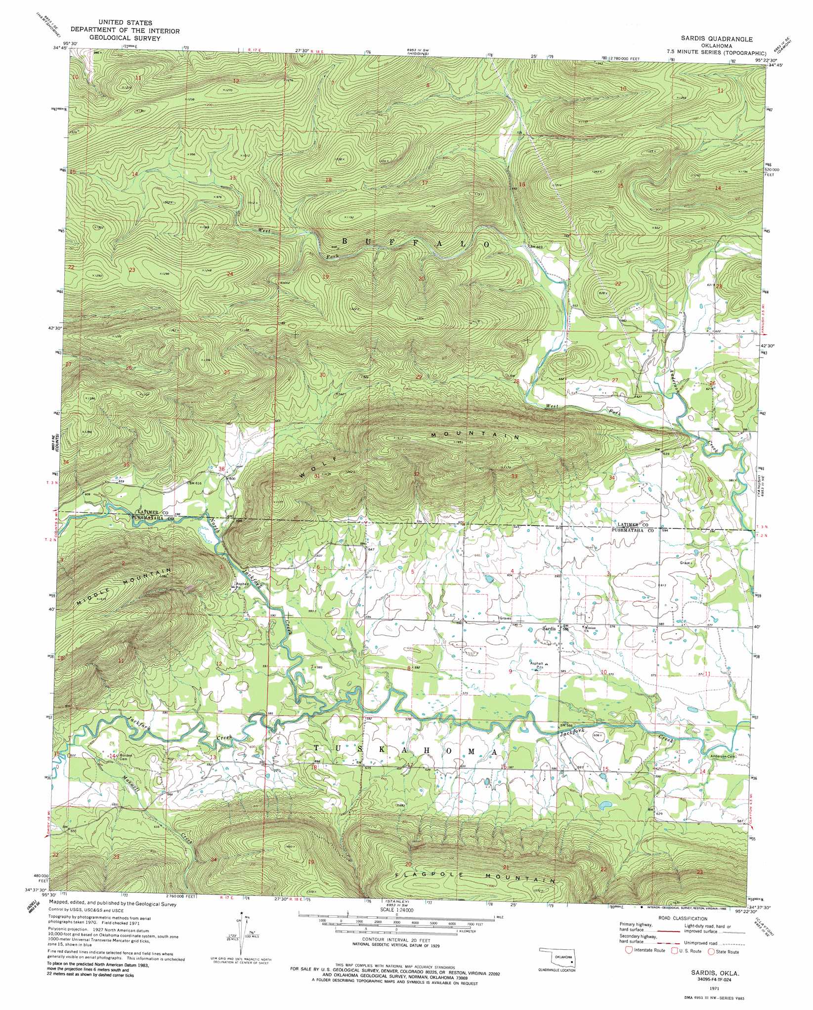
USGS Topo Quad 34095f4 - 1:24,000 scale
| Topo Map Name: | Sardis |
| USGS Topo Quad ID: | 34095f4 |
| Print Size: | ca. 21 1/4" wide x 27" high |
| Southeast Coordinates: | 34.625° N latitude / 95.375° W longitude |
| Map Center Coordinates: | 34.6875° N latitude / 95.4375° W longitude |
| U.S. State: | OK |
| Filename: | o34095f4.jpg |
| Download Map JPG Image: | Sardis topo map 1:24,000 scale |
| Map Type: | Topographic |
| Topo Series: | 7.5´ |
| Map Scale: | 1:24,000 |
| Source of Map Images: | United States Geological Survey (USGS) |
| Alternate Map Versions: |
Sardis OK 1971, updated 1973 Download PDF Buy paper map Sardis OK 1971, updated 1986 Download PDF Buy paper map Sardis OK 2010 Download PDF Buy paper map Sardis OK 2013 Download PDF Buy paper map Sardis OK 2016 Download PDF Buy paper map |
1:24,000 Topo Quads surrounding Sardis
Krebs |
Adamson |
Gowen |
Wilburton |
Panola |
Hartshorne Sw |
Hartshorne |
Higgins |
Damon |
Baker Mountain |
Ti |
Counts |
Sardis |
Yanush |
Kiamichi |
Daisy |
Adel |
Stanley |
Clayton |
Albion Sw |
Jumbo |
Dunbar |
Snow |
Wildhorse Mountain |
Nashoba |
> Back to 34095e1 at 1:100,000 scale
> Back to 34094a1 at 1:250,000 scale
> Back to U.S. Topo Maps home
Sardis topo map: Gazetteer
Sardis: Populated Places
Sardis elevation 177m 580′Sardis: Streams
Maxwell Creek elevation 180m 590′North Jackfork Creek elevation 171m 561′
West Fork Anderson Creek elevation 177m 580′
Sardis: Summits
Flagpole Mountain elevation 476m 1561′Middle Mountain elevation 492m 1614′
Wolf Mountain elevation 503m 1650′
Sardis digital topo map on disk
Buy this Sardis topo map showing relief, roads, GPS coordinates and other geographical features, as a high-resolution digital map file on DVD: