Baker Mountain Topo Map Oklahoma
To zoom in, hover over the map of Baker Mountain
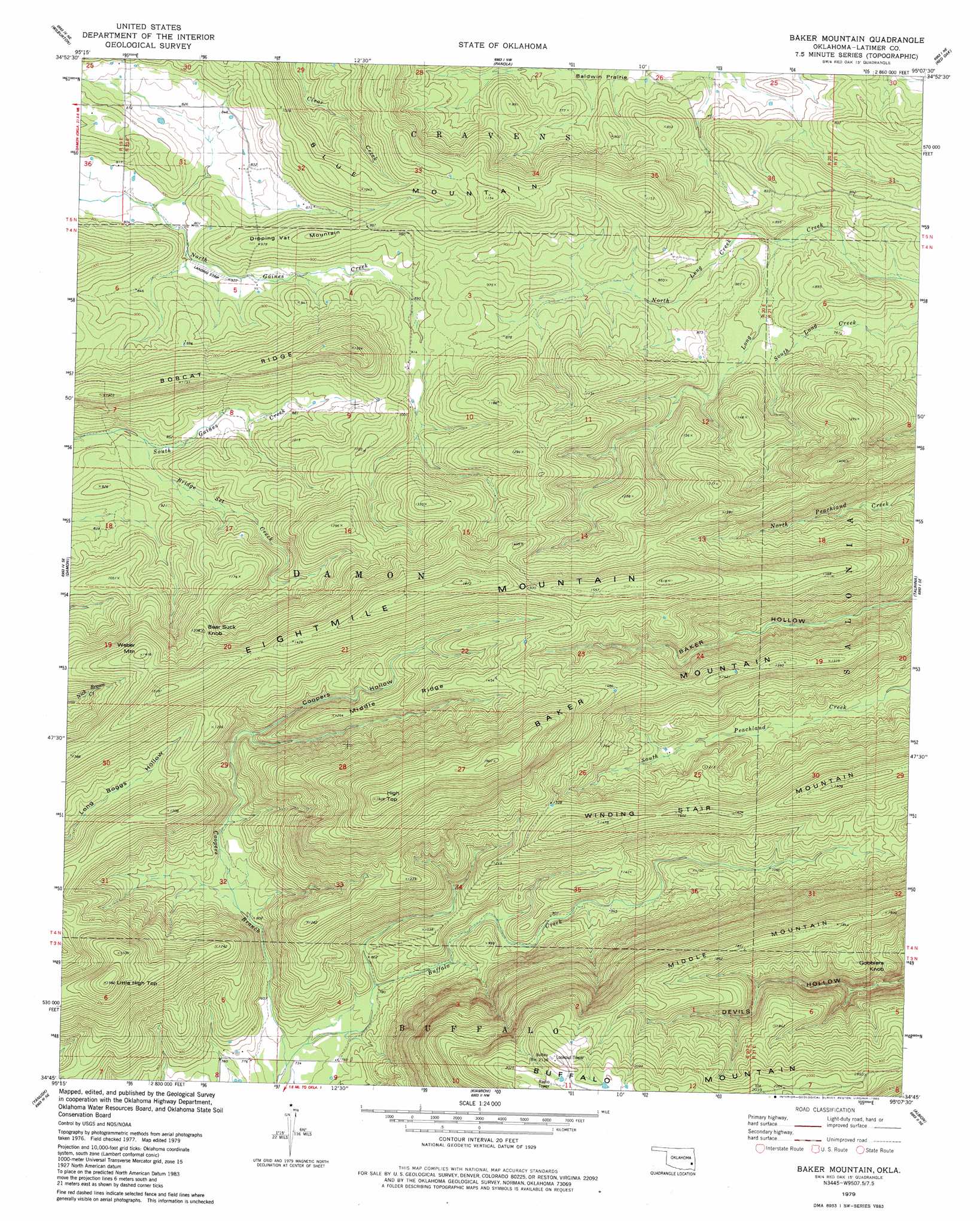
USGS Topo Quad 34095g2 - 1:24,000 scale
| Topo Map Name: | Baker Mountain |
| USGS Topo Quad ID: | 34095g2 |
| Print Size: | ca. 21 1/4" wide x 27" high |
| Southeast Coordinates: | 34.75° N latitude / 95.125° W longitude |
| Map Center Coordinates: | 34.8125° N latitude / 95.1875° W longitude |
| U.S. State: | OK |
| Filename: | o34095g2.jpg |
| Download Map JPG Image: | Baker Mountain topo map 1:24,000 scale |
| Map Type: | Topographic |
| Topo Series: | 7.5´ |
| Map Scale: | 1:24,000 |
| Source of Map Images: | United States Geological Survey (USGS) |
| Alternate Map Versions: |
Baker Mountain OK 1979, updated 1980 Download PDF Buy paper map Baker Mountain OK 2010 Download PDF Buy paper map Baker Mountain OK 2012 Download PDF Buy paper map Baker Mountain OK 2016 Download PDF Buy paper map |
1:24,000 Topo Quads surrounding Baker Mountain
Featherston |
Quinton South |
Kinta |
Lequire |
Mccurtain Sw |
Gowen |
Wilburton |
Panola |
Red Oak |
Leflore |
Higgins |
Damon |
Baker Mountain |
Talihina |
Blackjack Ridge |
Sardis |
Yanush |
Kiamichi |
Albion |
Whitesboro |
Stanley |
Clayton |
Albion Sw |
Albion Se |
Honobia |
> Back to 34095e1 at 1:100,000 scale
> Back to 34094a1 at 1:250,000 scale
> Back to U.S. Topo Maps home
Baker Mountain topo map: Gazetteer
Baker Mountain: Ridges
Bobcat Ridge elevation 360m 1181′Middle Ridge elevation 441m 1446′
Baker Mountain: Streams
Bridge Set Creek elevation 246m 807′Coopers Branch elevation 220m 721′
North Long Creek elevation 229m 751′
Baker Mountain: Summits
Baker Mountain elevation 581m 1906′Bear Suck Knob elevation 397m 1302′
Buffalo Mountain elevation 646m 2119′
Dripping Vat Mountain elevation 313m 1026′
Eightmile Mountain elevation 493m 1617′
Gobblers Knob elevation 476m 1561′
High Top elevation 587m 1925′
Little High Top elevation 482m 1581′
Middle Mountain elevation 568m 1863′
Weber Mountain elevation 430m 1410′
Baker Mountain: Valleys
Baker Hollow elevation 263m 862′Coopers Hollow elevation 261m 856′
Baker Mountain digital topo map on disk
Buy this Baker Mountain topo map showing relief, roads, GPS coordinates and other geographical features, as a high-resolution digital map file on DVD: