Hartshorne Topo Map Oklahoma
To zoom in, hover over the map of Hartshorne
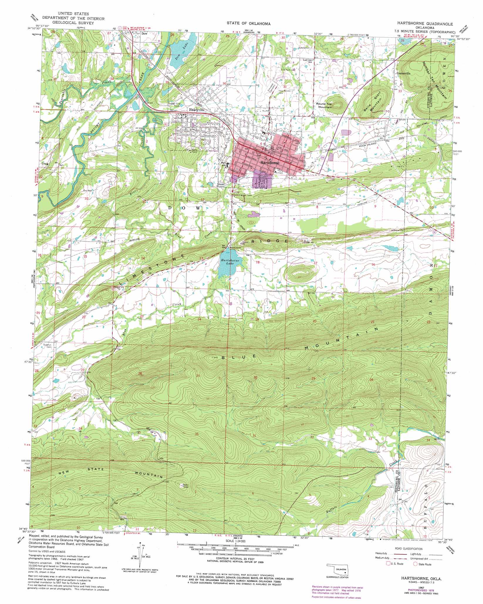
USGS Topo Quad 34095g5 - 1:24,000 scale
| Topo Map Name: | Hartshorne |
| USGS Topo Quad ID: | 34095g5 |
| Print Size: | ca. 21 1/4" wide x 27" high |
| Southeast Coordinates: | 34.75° N latitude / 95.5° W longitude |
| Map Center Coordinates: | 34.8125° N latitude / 95.5625° W longitude |
| U.S. State: | OK |
| Filename: | o34095g5.jpg |
| Download Map JPG Image: | Hartshorne topo map 1:24,000 scale |
| Map Type: | Topographic |
| Topo Series: | 7.5´ |
| Map Scale: | 1:24,000 |
| Source of Map Images: | United States Geological Survey (USGS) |
| Alternate Map Versions: |
Hartshorne OK 1967, updated 1968 Download PDF Buy paper map Hartshorne OK 1967, updated 1978 Download PDF Buy paper map Hartshorne OK 2010 Download PDF Buy paper map Hartshorne OK 2012 Download PDF Buy paper map Hartshorne OK 2016 Download PDF Buy paper map |
1:24,000 Topo Quads surrounding Hartshorne
Lake Mcalester |
Crowder |
Blocker |
Featherston |
Quinton South |
Mcalester |
Krebs |
Adamson |
Gowen |
Wilburton |
Savanna |
Hartshorne Sw |
Hartshorne |
Higgins |
Damon |
Pittsburg |
Ti |
Counts |
Sardis |
Yanush |
Redden |
Daisy |
Adel |
Stanley |
Clayton |
> Back to 34095e1 at 1:100,000 scale
> Back to 34094a1 at 1:250,000 scale
> Back to U.S. Topo Maps home
Hartshorne topo map: Gazetteer
Hartshorne: Airports
Flying A Ranch Airport elevation 203m 666′Hartshorne: Dams
Hartshorne Lake Dam elevation 213m 698′Oknoname 121007 Dam elevation 208m 682′
Hartshorne: Populated Places
Centerville elevation 212m 695′Haileyville elevation 193m 633′
Hartshorne elevation 214m 702′
Hartshorne: Reservoirs
Dow Lake elevation 186m 610′Hartshorne Lake elevation 213m 698′
Hartshorne Lake elevation 200m 656′
Oknoname 121007 Reservoir elevation 208m 682′
Hartshorne: Streams
Blue Creek elevation 187m 613′Peaceable Creek elevation 181m 593′
Hartshorne: Summits
Belle Starr Mountain elevation 271m 889′Number Ten Mountain elevation 288m 944′
Round Top Mountain elevation 272m 892′
Hartshorne digital topo map on disk
Buy this Hartshorne topo map showing relief, roads, GPS coordinates and other geographical features, as a high-resolution digital map file on DVD: