Bokchito Topo Map Oklahoma
To zoom in, hover over the map of Bokchito
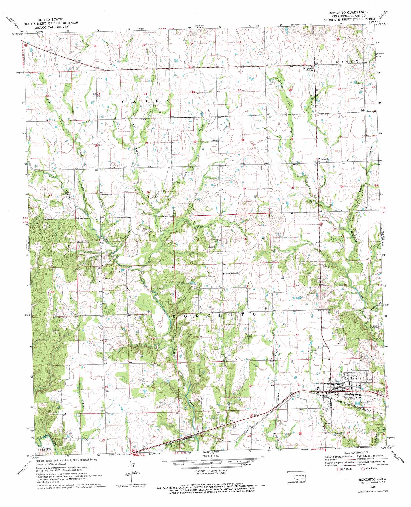
USGS Topo Quad 34096a2 - 1:24,000 scale
| Topo Map Name: | Bokchito |
| USGS Topo Quad ID: | 34096a2 |
| Print Size: | ca. 21 1/4" wide x 27" high |
| Southeast Coordinates: | 34° N latitude / 96.125° W longitude |
| Map Center Coordinates: | 34.0625° N latitude / 96.1875° W longitude |
| U.S. State: | OK |
| Filename: | o34096a2.jpg |
| Download Map JPG Image: | Bokchito topo map 1:24,000 scale |
| Map Type: | Topographic |
| Topo Series: | 7.5´ |
| Map Scale: | 1:24,000 |
| Source of Map Images: | United States Geological Survey (USGS) |
| Alternate Map Versions: |
Bokchito OK 1969, updated 1971 Download PDF Buy paper map Bokchito OK 2010 Download PDF Buy paper map Bokchito OK 2012 Download PDF Buy paper map Bokchito OK 2016 Download PDF Buy paper map |
1:24,000 Topo Quads surrounding Bokchito
Wapanucka South |
Boggy Depot |
Tushka |
Bruno |
Lane |
Caddo Nw |
Caddo North |
Caney |
Bentley |
Boswell Nw |
Durant North |
Caddo South |
Bokchito |
Bennington North |
Boswell Sw |
Durant South |
Roberta |
Blue |
Bennington South |
Lake West |
Achille |
Kemp |
Yuba |
Telephone |
Monkstown |
> Back to 34096a1 at 1:100,000 scale
> Back to 34096a1 at 1:250,000 scale
> Back to U.S. Topo Maps home
Bokchito topo map: Gazetteer
Bokchito: Airports
Big Creek Airport elevation 170m 557′Frank Ranch Field elevation 186m 610′
Bokchito: Dams
Frank Lake Dam elevation 179m 587′Oknoname 013020 Dam elevation 181m 593′
Bokchito: Populated Places
Bokchito elevation 195m 639′Pritchard elevation 192m 629′
Sevenmile Corner elevation 207m 679′
Bokchito: Reservoirs
Frank Lake elevation 179m 587′Oknoname 013020 Reservoir elevation 181m 593′
Bokchito: Streams
Academy Creek elevation 167m 547′Elm Creek elevation 176m 577′
Little Creek elevation 177m 580′
Mail Rider Creek elevation 166m 544′
Rocky Branch elevation 174m 570′
Bokchito digital topo map on disk
Buy this Bokchito topo map showing relief, roads, GPS coordinates and other geographical features, as a high-resolution digital map file on DVD: