Tushka Topo Map Oklahoma
To zoom in, hover over the map of Tushka
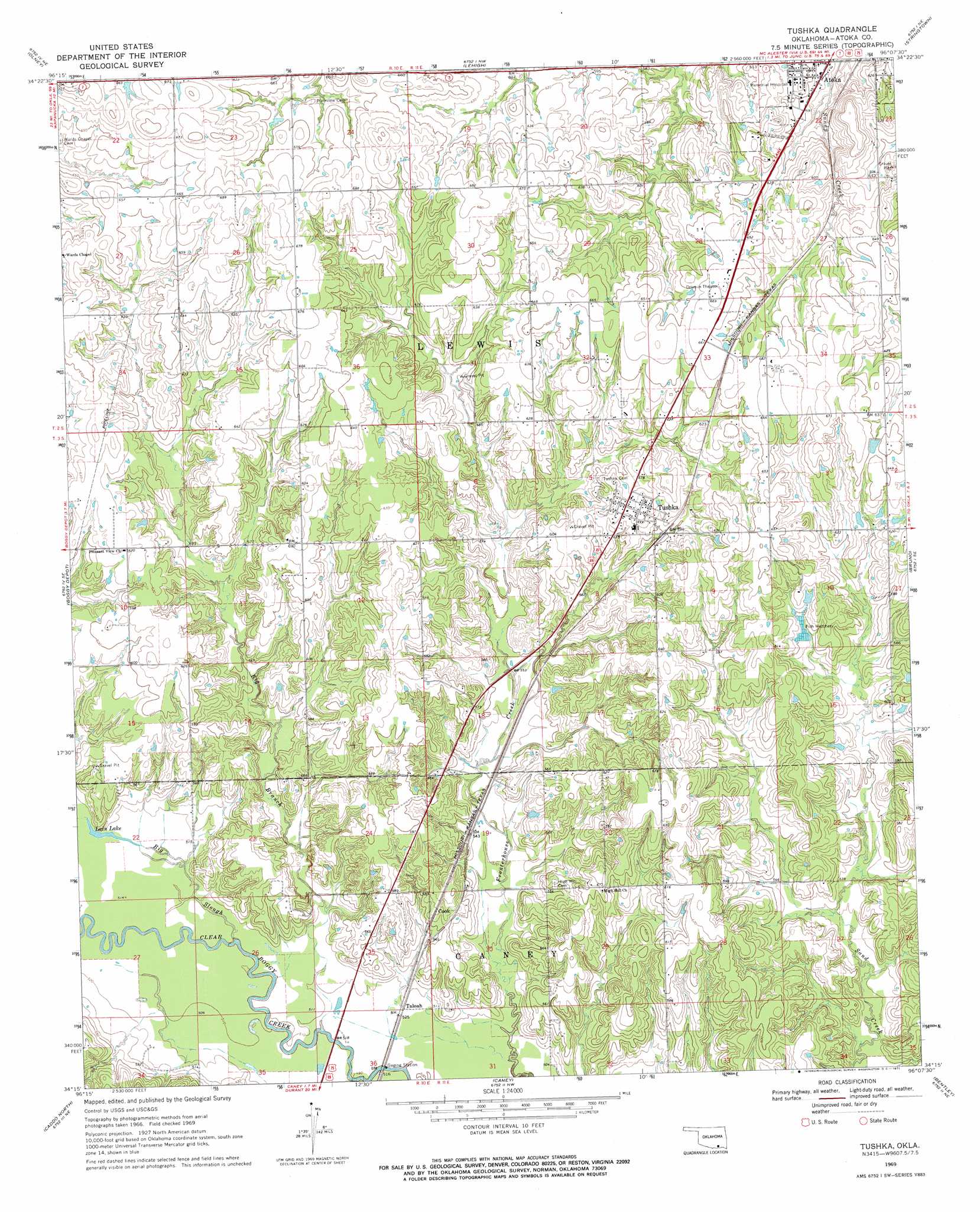
USGS Topo Quad 34096c2 - 1:24,000 scale
| Topo Map Name: | Tushka |
| USGS Topo Quad ID: | 34096c2 |
| Print Size: | ca. 21 1/4" wide x 27" high |
| Southeast Coordinates: | 34.25° N latitude / 96.125° W longitude |
| Map Center Coordinates: | 34.3125° N latitude / 96.1875° W longitude |
| U.S. State: | OK |
| Filename: | o34096c2.jpg |
| Download Map JPG Image: | Tushka topo map 1:24,000 scale |
| Map Type: | Topographic |
| Topo Series: | 7.5´ |
| Map Scale: | 1:24,000 |
| Source of Map Images: | United States Geological Survey (USGS) |
| Alternate Map Versions: |
Tushka OK 1969, updated 1971 Download PDF Buy paper map Tushka OK 2010 Download PDF Buy paper map Tushka OK 2013 Download PDF Buy paper map Tushka OK 2016 Download PDF Buy paper map |
1:24,000 Topo Quads surrounding Tushka
Tupelo |
Centrahoma |
Coalgate |
Coalgate Se |
Limestone Gap |
Wapanucka North |
Olney |
Lehigh |
Stringtown |
Lane Nw |
Wapanucka South |
Boggy Depot |
Tushka |
Bruno |
Lane |
Caddo Nw |
Caddo North |
Caney |
Bentley |
Boswell Nw |
Durant North |
Caddo South |
Bokchito |
Bennington North |
Boswell Sw |
> Back to 34096a1 at 1:100,000 scale
> Back to 34096a1 at 1:250,000 scale
> Back to U.S. Topo Maps home
Tushka topo map: Gazetteer
Tushka: Airports
Atoka Memorial Hospital Heliport elevation 181m 593′Tushka: Lakes
Lain Lake elevation 158m 518′Tushka: Populated Places
Cook elevation 171m 561′Taloah elevation 156m 511′
Tushka elevation 190m 623′
Tushka: Streams
Big Branch elevation 152m 498′Big Slough elevation 153m 501′
Caney Creek elevation 149m 488′
Tushka digital topo map on disk
Buy this Tushka topo map showing relief, roads, GPS coordinates and other geographical features, as a high-resolution digital map file on DVD: