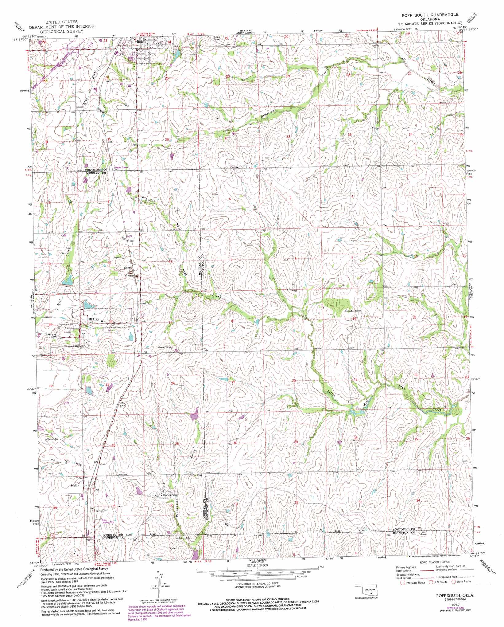
Roff South Topo Map Oklahoma
To zoom in, hover over the map of Roff South
USGS Topo Quad 34096e7 - 1:24,000 scale
| Topo Map Name: | Roff South |
| USGS Topo Quad ID: | 34096e7 |
| Print Size: | ca. 21 1/4" wide x 27" high |
| Southeast Coordinates: | 34.5° N latitude / 96.75° W longitude |
| Map Center Coordinates: | 34.5625° N latitude / 96.8125° W longitude |
| U.S. State: | OK |
| Filename: | o34096e7.jpg |
| Download Map JPG Image: | Roff South topo map 1:24,000 scale |
| Map Type: | Topographic |
| Topo Series: | 7.5´ |
| Map Scale: | 1:24,000 |
| Source of Map Images: | United States Geological Survey (USGS) |
| Alternate Map Versions: |
Roff South OK 1967, updated 1968 Download PDF Buy paper map Roff South OK 1967, updated 1991 Download PDF Buy paper map Roff South OK 1967, updated 1993 Download PDF Buy paper map Roff South OK 2009 Download PDF Buy paper map Roff South OK 2012 Download PDF Buy paper map Roff South OK 2016 Download PDF Buy paper map |
1:24,000 Topo Quads surrounding Roff South
Byars |
Stratford |
Vanoss |
Ada |
Francis |
Pauls Valley Ne |
Hart |
Roff North |
Ahloso |
Stonewall |
Davis |
Sulphur North |
Roff South |
Fittstown |
Harden City |
Dougherty |
Sulphur South |
Mill Creek |
Connerville |
Connerville Ne |
Gene Autry |
Nebo |
Troy |
Reagan |
Connerville Se |
> Back to 34096e1 at 1:100,000 scale
> Back to 34096a1 at 1:250,000 scale
> Back to U.S. Topo Maps home
Roff South topo map: Gazetteer
Roff South: Airports
Roos Landing Strip elevation 377m 1236′Roff South: Dams
Mill Creek Watershed 1 Dam elevation 364m 1194′Mill Creek Watershed 3 Dam elevation 365m 1197′
Mill Creek Watershed 4 Dam elevation 367m 1204′
Roff South: Populated Places
Denny elevation 382m 1253′Hickory elevation 368m 1207′
Scullin elevation 379m 1243′
Winrock Farms elevation 359m 1177′
Roff South: Reservoirs
Mill Creek Watershed 1 Reservoir elevation 364m 1194′Mill Creek Watershed 3 Reservoir elevation 365m 1197′
Mill Creek Watershed 4 Reservoir elevation 367m 1204′
Roff South: Streams
Limestone Creek elevation 343m 1125′Roff South digital topo map on disk
Buy this Roff South topo map showing relief, roads, GPS coordinates and other geographical features, as a high-resolution digital map file on DVD: