Wardville Topo Map Oklahoma
To zoom in, hover over the map of Wardville
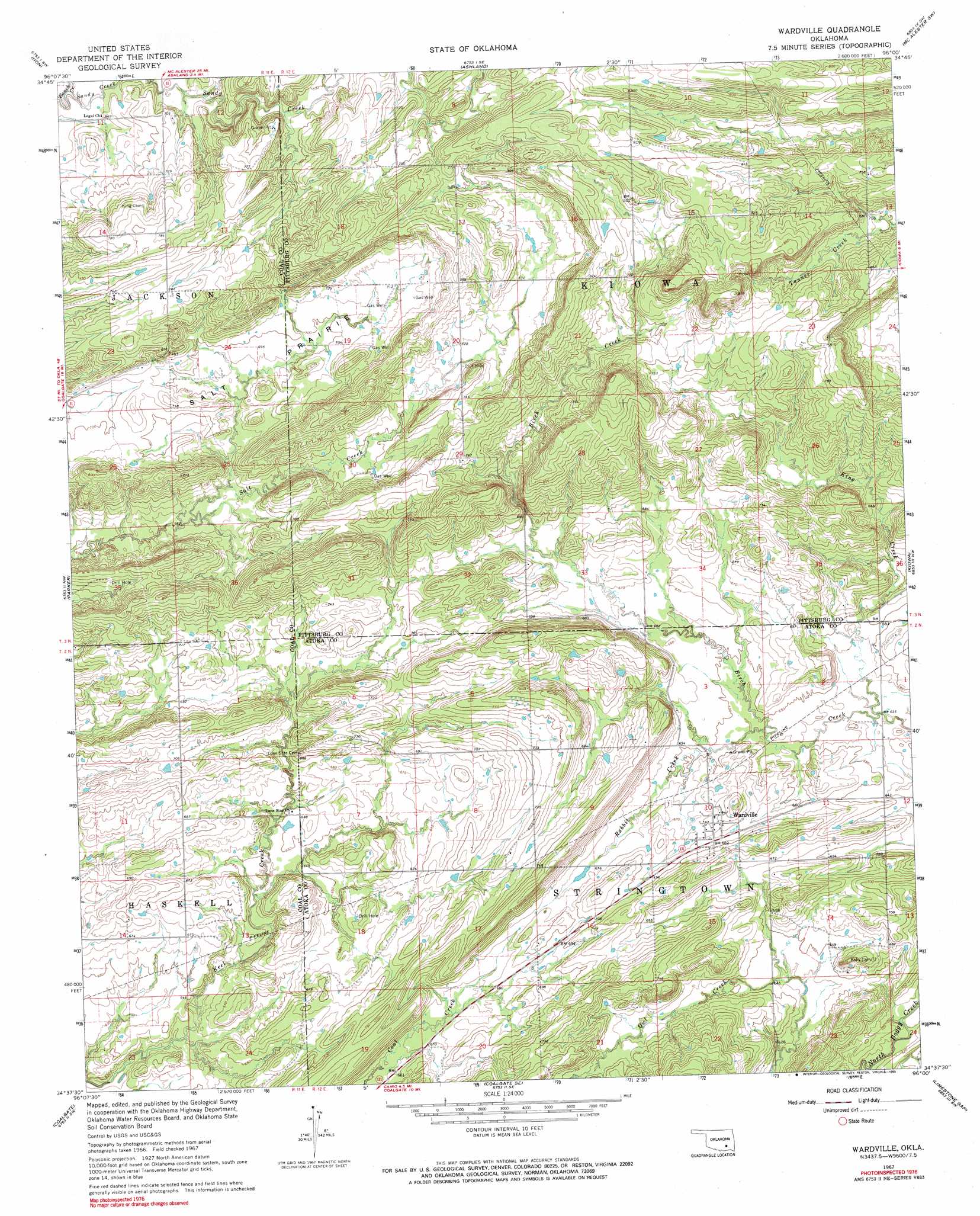
USGS Topo Quad 34096f1 - 1:24,000 scale
| Topo Map Name: | Wardville |
| USGS Topo Quad ID: | 34096f1 |
| Print Size: | ca. 21 1/4" wide x 27" high |
| Southeast Coordinates: | 34.625° N latitude / 96° W longitude |
| Map Center Coordinates: | 34.6875° N latitude / 96.0625° W longitude |
| U.S. State: | OK |
| Filename: | o34096f1.jpg |
| Download Map JPG Image: | Wardville topo map 1:24,000 scale |
| Map Type: | Topographic |
| Topo Series: | 7.5´ |
| Map Scale: | 1:24,000 |
| Source of Map Images: | United States Geological Survey (USGS) |
| Alternate Map Versions: |
Wardville OK 1967, updated 1968 Download PDF Buy paper map Wardville OK 1967, updated 1990 Download PDF Buy paper map Wardville OK 2010 Download PDF Buy paper map Wardville OK 2012 Download PDF Buy paper map Wardville OK 2016 Download PDF Buy paper map |
1:24,000 Topo Quads surrounding Wardville
Calvin West |
Calvin East |
Stuart |
Haywood |
Mcalester |
Gerty |
Non |
Ashland |
Mcalester Sw |
Savanna |
Tupelo Ne |
Parker |
Wardville |
Kiowa |
Pittsburg |
Centrahoma |
Coalgate |
Coalgate Se |
Limestone Gap |
Redden |
Olney |
Lehigh |
Stringtown |
Lane Nw |
Lane Ne |
> Back to 34096e1 at 1:100,000 scale
> Back to 34096a1 at 1:250,000 scale
> Back to U.S. Topo Maps home
Wardville topo map: Gazetteer
Wardville: Flats
Salt Prairie elevation 210m 688′Wardville: Populated Places
Wardville elevation 210m 688′Wardville: Streams
King Creek elevation 192m 629′Owl Creek elevation 188m 616′
Rabbit Creek elevation 195m 639′
Sandy Creek elevation 198m 649′
Wardville digital topo map on disk
Buy this Wardville topo map showing relief, roads, GPS coordinates and other geographical features, as a high-resolution digital map file on DVD: