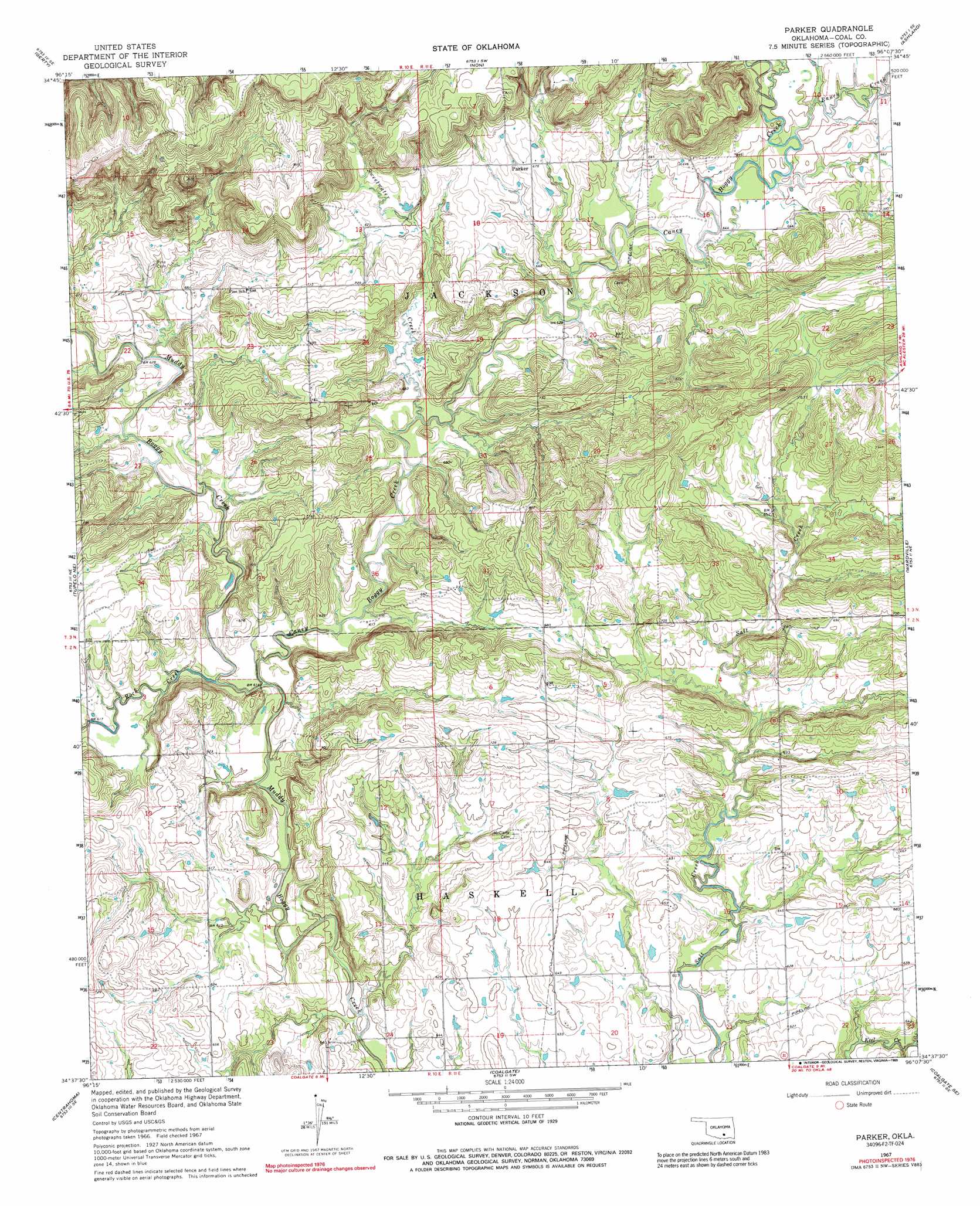
Parker Topo Map Oklahoma
To zoom in, hover over the map of Parker
USGS Topo Quad 34096f2 - 1:24,000 scale
| Topo Map Name: | Parker |
| USGS Topo Quad ID: | 34096f2 |
| Print Size: | ca. 21 1/4" wide x 27" high |
| Southeast Coordinates: | 34.625° N latitude / 96.125° W longitude |
| Map Center Coordinates: | 34.6875° N latitude / 96.1875° W longitude |
| U.S. State: | OK |
| Filename: | o34096f2.jpg |
| Download Map JPG Image: | Parker topo map 1:24,000 scale |
| Map Type: | Topographic |
| Topo Series: | 7.5´ |
| Map Scale: | 1:24,000 |
| Source of Map Images: | United States Geological Survey (USGS) |
| Alternate Map Versions: |
Parker OK 1967, updated 1968 Download PDF Buy paper map Parker OK 1967, updated 1989 Download PDF Buy paper map Parker OK 2010 Download PDF Buy paper map Parker OK 2012 Download PDF Buy paper map Parker OK 2016 Download PDF Buy paper map |
1:24,000 Topo Quads surrounding Parker
Allen |
Calvin West |
Calvin East |
Stuart |
Haywood |
Steedman |
Gerty |
Non |
Ashland |
Mcalester Sw |
Lula |
Tupelo Ne |
Parker |
Wardville |
Kiowa |
Tupelo |
Centrahoma |
Coalgate |
Coalgate Se |
Limestone Gap |
Wapanucka North |
Olney |
Lehigh |
Stringtown |
Lane Nw |
> Back to 34096e1 at 1:100,000 scale
> Back to 34096a1 at 1:250,000 scale
> Back to U.S. Topo Maps home
Parker topo map: Gazetteer
Parker: Populated Places
Parker elevation 207m 679′Parker: Streams
Caney Boggy Creek elevation 181m 593′Ranch Creek elevation 193m 633′
Rock Creek elevation 181m 593′
Sweetwater Creek elevation 186m 610′
Parker digital topo map on disk
Buy this Parker topo map showing relief, roads, GPS coordinates and other geographical features, as a high-resolution digital map file on DVD: