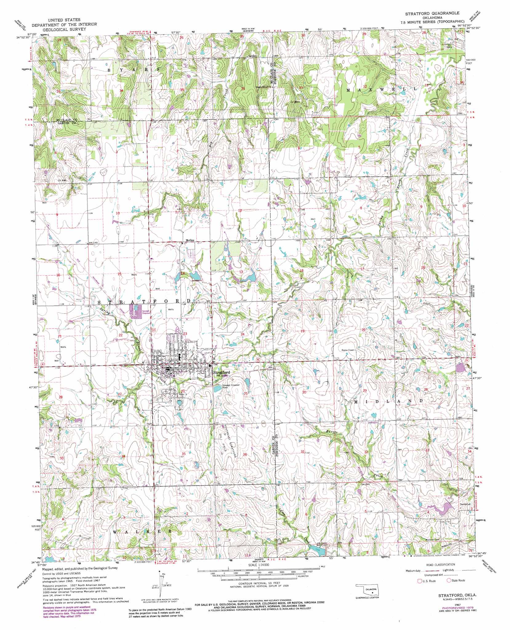
Stratford Topo Map Oklahoma
To zoom in, hover over the map of Stratford
USGS Topo Quad 34096g8 - 1:24,000 scale
| Topo Map Name: | Stratford |
| USGS Topo Quad ID: | 34096g8 |
| Print Size: | ca. 21 1/4" wide x 27" high |
| Southeast Coordinates: | 34.75° N latitude / 96.875° W longitude |
| Map Center Coordinates: | 34.8125° N latitude / 96.9375° W longitude |
| U.S. State: | OK |
| Filename: | o34096g8.jpg |
| Download Map JPG Image: | Stratford topo map 1:24,000 scale |
| Map Type: | Topographic |
| Topo Series: | 7.5´ |
| Map Scale: | 1:24,000 |
| Source of Map Images: | United States Geological Survey (USGS) |
| Alternate Map Versions: |
Stratford OK 1967, updated 1968 Download PDF Buy paper map Stratford OK 1967, updated 1979 Download PDF Buy paper map Stratford OK 1967, updated 1983 Download PDF Buy paper map Stratford OK 2009 Download PDF Buy paper map Stratford OK 2012 Download PDF Buy paper map Stratford OK 2016 Download PDF Buy paper map |
1:24,000 Topo Quads surrounding Stratford
Eason |
Tribbey |
Pearson |
Saint Louis |
Wolf |
Rosedale |
Wanette |
Asher |
Konawa |
Vamoosa |
Byars Sw |
Byars |
Stratford |
Vanoss |
Ada |
Pauls Valley |
Pauls Valley Ne |
Hart |
Roff North |
Ahloso |
Joy |
Davis |
Sulphur North |
Roff South |
Fittstown |
> Back to 34096e1 at 1:100,000 scale
> Back to 34096a1 at 1:250,000 scale
> Back to U.S. Topo Maps home
Stratford topo map: Gazetteer
Stratford: Airports
Diamond C Ranch Airport elevation 347m 1138′Stratford: Dams
Cherokee Sandy Site 8a Dam elevation 319m 1046′Sandy Creek Site 17 Dam elevation 316m 1036′
Sandy Creek Site 18 Dam elevation 309m 1013′
Sandy Creek Site 19 Dam elevation 309m 1013′
Sandy Creek Site 27 Dam elevation 333m 1092′
Sandy Creek Site 28 Dam elevation 326m 1069′
Stratford: Oilfields
Southeast Stratford Oil Field elevation 349m 1145′Stratford: Populated Places
McGee elevation 342m 1122′Stratford elevation 341m 1118′
Stratford: Reservoirs
Cherokee Sandy Site 8a Reservoir elevation 319m 1046′Sandy Creek Site 17 Reservoir elevation 316m 1036′
Sandy Creek Site 18 Reservoir elevation 309m 1013′
Sandy Creek Site 19 Reservoir elevation 309m 1013′
Sandy Creek Site 27 Reservoir elevation 333m 1092′
Sandy Creek Site 28 Reservoir elevation 326m 1069′
Stratford digital topo map on disk
Buy this Stratford topo map showing relief, roads, GPS coordinates and other geographical features, as a high-resolution digital map file on DVD: