Healdton Topo Map Oklahoma
To zoom in, hover over the map of Healdton
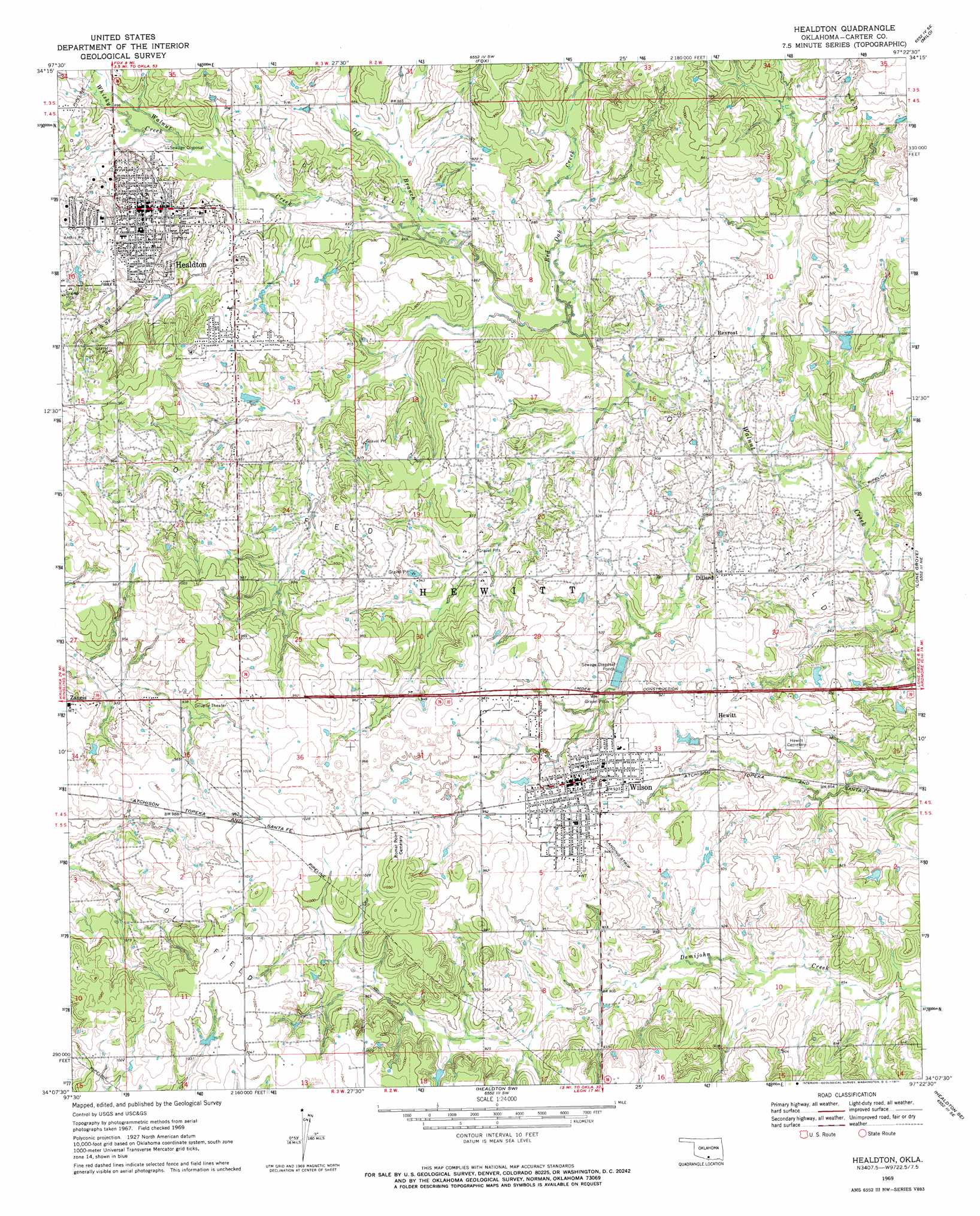
USGS Topo Quad 34097b4 - 1:24,000 scale
| Topo Map Name: | Healdton |
| USGS Topo Quad ID: | 34097b4 |
| Print Size: | ca. 21 1/4" wide x 27" high |
| Southeast Coordinates: | 34.125° N latitude / 97.375° W longitude |
| Map Center Coordinates: | 34.1875° N latitude / 97.4375° W longitude |
| U.S. State: | OK |
| Filename: | o34097b4.jpg |
| Download Map JPG Image: | Healdton topo map 1:24,000 scale |
| Map Type: | Topographic |
| Topo Series: | 7.5´ |
| Map Scale: | 1:24,000 |
| Source of Map Images: | United States Geological Survey (USGS) |
| Alternate Map Versions: |
Healdton OK 1969, updated 1971 Download PDF Buy paper map Healdton OK 2009 Download PDF Buy paper map Healdton OK 2012 Download PDF Buy paper map Healdton OK 2016 Download PDF Buy paper map |
1:24,000 Topo Quads surrounding Healdton
Velma |
Ratliff City |
Tatums |
Fox Ne |
Turner Falls |
Loco |
Cottonwood Creek |
Fox |
Milo |
Springer |
Ringling Nw |
Ringling |
Healdton |
Lone Grove |
Ardmore West |
Grady |
Orr |
Healdton Sw |
Healdton Se |
Overbrook |
Prairie Valley School |
Spanish Fort |
Leon North |
Burneyville |
Marietta West |
> Back to 34097a1 at 1:100,000 scale
> Back to 34096a1 at 1:250,000 scale
> Back to U.S. Topo Maps home
Healdton topo map: Gazetteer
Healdton: Airports
Cockwell Airport elevation 299m 980′Healdton Municipal Airport elevation 289m 948′
Healdton: Dams
Upper Bayou Site 10 Dam elevation 263m 862′Upper Bayou Site 17 Dam elevation 278m 912′
Upper Bayou Site 18 Dam elevation 265m 869′
Upper Bayou Site 8 Dam elevation 268m 879′
Healdton: Parks
Anthis Park elevation 289m 948′Healdton: Populated Places
Dillard elevation 275m 902′Healdton elevation 294m 964′
Hewitt elevation 277m 908′
Rexroat elevation 268m 879′
Wilson elevation 285m 935′
Zaneis elevation 296m 971′
Healdton: Reservoirs
Healdton Lake elevation 277m 908′Upper Bayou Site 10 Reservoir elevation 263m 862′
Upper Bayou Site 17 Reservoir elevation 278m 912′
Upper Bayou Site 18 Reservoir elevation 265m 869′
Upper Bayou Site 8 Reservoir elevation 268m 879′
Healdton: Streams
Oil Branch elevation 263m 862′Red Oak Creek elevation 259m 849′
Whisky Creek elevation 267m 875′
Healdton digital topo map on disk
Buy this Healdton topo map showing relief, roads, GPS coordinates and other geographical features, as a high-resolution digital map file on DVD: