Waurika East Topo Map Oklahoma
To zoom in, hover over the map of Waurika East
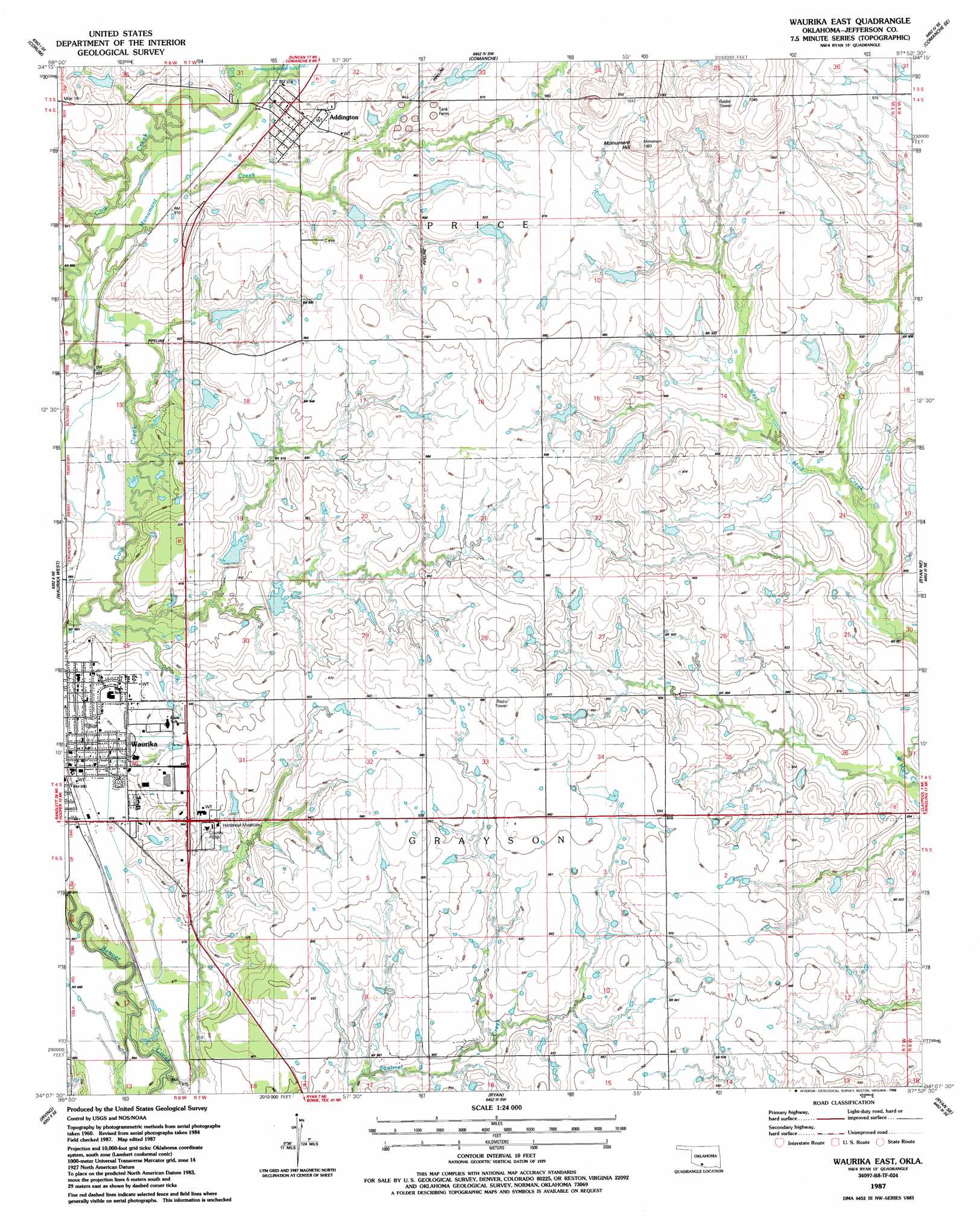
USGS Topo Quad 34097b8 - 1:24,000 scale
| Topo Map Name: | Waurika East |
| USGS Topo Quad ID: | 34097b8 |
| Print Size: | ca. 21 1/4" wide x 27" high |
| Southeast Coordinates: | 34.125° N latitude / 97.875° W longitude |
| Map Center Coordinates: | 34.1875° N latitude / 97.9375° W longitude |
| U.S. State: | OK |
| Filename: | o34097b8.jpg |
| Download Map JPG Image: | Waurika East topo map 1:24,000 scale |
| Map Type: | Topographic |
| Topo Series: | 7.5´ |
| Map Scale: | 1:24,000 |
| Source of Map Images: | United States Geological Survey (USGS) |
| Alternate Map Versions: |
Waurika East OK 1987, updated 1988 Download PDF Buy paper map Waurika East OK 2009 Download PDF Buy paper map Waurika East OK 2012 Download PDF Buy paper map Waurika East OK 2016 Download PDF Buy paper map |
1:24,000 Topo Quads surrounding Waurika East
Temple Nw |
Empire City |
Duncan South |
Harrisburg |
Velma |
Temple |
Corum |
Comanche |
Comanche Se |
Loco |
Hooper |
Waurika West |
Waurika East |
Ryan Ne |
Ringling Nw |
Byers |
Irving |
Ryan |
Ryan Se |
Grady |
Hurnville |
Riverland Cemetery |
Terral |
Fleetwood |
Prairie Valley School |
> Back to 34097a1 at 1:100,000 scale
> Back to 34096a1 at 1:250,000 scale
> Back to U.S. Topo Maps home
Waurika East topo map: Gazetteer
Waurika East: Crossings
Mile 16 elevation 298m 977′Waurika East: Dams
Cow Creek Site 2 Dam elevation 285m 935′Cow Creek Site 3 Dam elevation 283m 928′
Cow Creek Site 47 Dam elevation 279m 915′
Cow Creek Site 5 Dam elevation 289m 948′
Oknoname 067011 Dam elevation 300m 984′
Oknoname 067012 Dam elevation 294m 964′
Waurika East: Populated Places
Addington elevation 286m 938′Waurika elevation 273m 895′
Waurika East: Reservoirs
Cow Creek Site 2 Reservoir elevation 285m 935′Cow Creek Site 3 Reservoir elevation 283m 928′
Cow Creek Site 47 Reservoir elevation 279m 915′
Cow Creek Site 5 Reservoir elevation 289m 948′
Oknoname 067011 Reservoir elevation 300m 984′
Oknoname 067012 Reservoir elevation 294m 964′
Waurika East: Streams
Dry Creek elevation 277m 908′Monument Creek elevation 268m 879′
Waurika East: Summits
Monument Hill elevation 330m 1082′Waurika East digital topo map on disk
Buy this Waurika East topo map showing relief, roads, GPS coordinates and other geographical features, as a high-resolution digital map file on DVD: