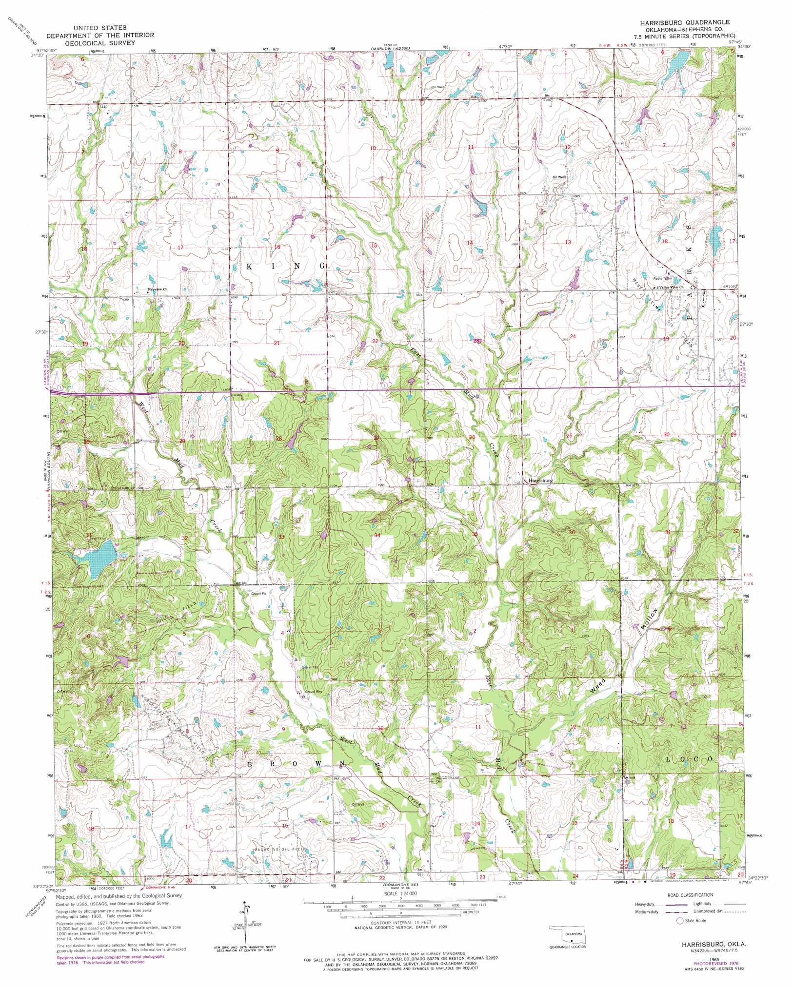
Harrisburg Topo Map Oklahoma
To zoom in, hover over the map of Harrisburg
USGS Topo Quad 34097d7 - 1:24,000 scale
| Topo Map Name: | Harrisburg |
| USGS Topo Quad ID: | 34097d7 |
| Print Size: | ca. 21 1/4" wide x 27" high |
| Southeast Coordinates: | 34.375° N latitude / 97.75° W longitude |
| Map Center Coordinates: | 34.4375° N latitude / 97.8125° W longitude |
| U.S. State: | OK |
| Filename: | o34097d7.jpg |
| Download Map JPG Image: | Harrisburg topo map 1:24,000 scale |
| Map Type: | Topographic |
| Topo Series: | 7.5´ |
| Map Scale: | 1:24,000 |
| Source of Map Images: | United States Geological Survey (USGS) |
| Alternate Map Versions: |
Harrisburg OK 1963, updated 1964 Download PDF Buy paper map Harrisburg OK 1963, updated 1977 Download PDF Buy paper map Harrisburg OK 2010 Download PDF Buy paper map Harrisburg OK 2012 Download PDF Buy paper map Harrisburg OK 2016 Download PDF Buy paper map |
1:24,000 Topo Quads surrounding Harrisburg
Denton |
Marlow |
Bray |
Cox City |
Purdy |
Nellie |
Duncan North |
Hope |
Lake Fuqua |
Pernell |
Empire City |
Duncan South |
Harrisburg |
Velma |
Ratliff City |
Corum |
Comanche |
Comanche Se |
Loco |
Cottonwood Creek |
Waurika West |
Waurika East |
Ryan Ne |
Ringling Nw |
Ringling |
> Back to 34097a1 at 1:100,000 scale
> Back to 34096a1 at 1:250,000 scale
> Back to U.S. Topo Maps home
Harrisburg topo map: Gazetteer
Harrisburg: Dams
Oknoname 137045 Dam elevation 326m 1069′Oknoname 137047 Dam elevation 326m 1069′
Oknoname 137048 Dam elevation 316m 1036′
Oknoname 137083 Dam elevation 329m 1079′
Oknoname 137093 Dam elevation 319m 1046′
Wildhorse Creek Site 18 Dam elevation 318m 1043′
Harrisburg: Oilfields
Northwest Palacine Oil Field elevation 321m 1053′West Velma Oil Field elevation 330m 1082′
Harrisburg: Populated Places
Harrisburg elevation 311m 1020′Harrisburg: Reservoirs
Oknoname 137046 Reservoir elevation 326m 1069′Oknoname 137047 Reservoir elevation 326m 1069′
Oknoname 137048 Reservoir elevation 316m 1036′
Oknoname 137083 Reservoir elevation 329m 1079′
Oknoname 137093 Reservoir elevation 319m 1046′
Wildhorse Creek Site 18 Reservoir elevation 318m 1043′
Harrisburg: Valleys
Weed Hollow elevation 290m 951′Harrisburg digital topo map on disk
Buy this Harrisburg topo map showing relief, roads, GPS coordinates and other geographical features, as a high-resolution digital map file on DVD: