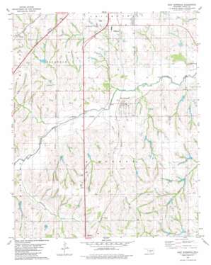
East Ninnekah Topo Map Oklahoma
To zoom in, hover over the map of East Ninnekah
USGS Topo Quad 34097h8 - 1:24,000 scale
| Topo Map Name: | East Ninnekah |
| USGS Topo Quad ID: | 34097h8 |
| Print Size: | ca. 21 1/4" wide x 27" high |
| Southeast Coordinates: | 34.875° N latitude / 97.875° W longitude |
| Map Center Coordinates: | 34.9375° N latitude / 97.9375° W longitude |
| U.S. State: | OK |
| Filename: | o34097h8.jpg |
| Download Map JPG Image: | East Ninnekah topo map 1:24,000 scale |
| Map Type: | Topographic |
| Topo Series: | 7.5´ |
| Map Scale: | 1:24,000 |
| Source of Map Images: | United States Geological Survey (USGS) |
| Alternate Map Versions: |
Rush Springs NW OK 1975, updated 1976 Download PDF Buy paper map East Ninnekah OK 1981, updated 1982 Download PDF Buy paper map Ninnekah OK 2009 Download PDF Buy paper map Ninnekah OK 2012 Download PDF Buy paper map Ninnekah OK 2016 Download PDF Buy paper map |
1:24,000 Topo Quads surrounding East Ninnekah
> Back to 34097e1 at 1:100,000 scale
> Back to 34096a1 at 1:250,000 scale
> Back to U.S. Topo Maps home
East Ninnekah topo map: Gazetteer
East Ninnekah: Airports
Stidham/Private Airport elevation 339m 1112′East Ninnekah: Dams
Little Washita Site 1 Dam elevation 329m 1079′Little Washita Site 10 Dam elevation 366m 1200′
Little Washita Site 11 Dam elevation 352m 1154′
Little Washita Site 2 Dam elevation 331m 1085′
Little Washita Site 3 Dam elevation 338m 1108′
Little Washita Site 4 Dam elevation 367m 1204′
Little Washita Site 45 Dam elevation 345m 1131′
Little Washita Site 46 Dam elevation 353m 1158′
Little Washita Site 48 Dam elevation 332m 1089′
Little Washita Site 6 Dam elevation 345m 1131′
Little Washita Site 7 Dam elevation 341m 1118′
Oknoname 051030 Dam elevation 360m 1181′
Oknoname 051054 Dam elevation 367m 1204′
Oknoname 051055 Dam elevation 391m 1282′
Oknoname 051056 Dam elevation 360m 1181′
Oknoname 051057 Dam elevation 365m 1197′
Rainy Mountain Creek Site 20 Dam elevation 373m 1223′
Roaring Creek Site D-4 Dam elevation 345m 1131′
Roaring Creek Site D-5 Dam elevation 350m 1148′
East Ninnekah: Populated Places
Ninnekah elevation 339m 1112′Norge elevation 387m 1269′
East Ninnekah: Post Offices
Ninnekah Post Office elevation 342m 1122′East Ninnekah: Reservoirs
Little Washita Site 1 Reservoir elevation 329m 1079′Little Washita Site 10 Reservoir elevation 366m 1200′
Little Washita Site 11 Reservoir elevation 352m 1154′
Little Washita Site 2 Reservoir elevation 331m 1085′
Little Washita Site 3 Reservoir elevation 338m 1108′
Little Washita Site 4 Reservoir elevation 367m 1204′
Little Washita Site 45 Reservoir elevation 345m 1131′
Little Washita Site 46 Reservoir elevation 353m 1158′
Little Washita Site 48 Reservoir elevation 332m 1089′
Little Washita Site 6 Reservoir elevation 345m 1131′
Little Washita Site 7 Reservoir elevation 341m 1118′
Oknoname 051030 Reservoir elevation 360m 1181′
Oknoname 051054 Reservoir elevation 367m 1204′
Oknoname 051055 Reservoir elevation 391m 1282′
Oknoname 051056 Reservoir elevation 360m 1181′
Oknoname 051057 Reservoir elevation 365m 1197′
Rainy Mountain Creek Site 20 Reservoir elevation 373m 1223′
Roaring Creek Site D-4 Reservoir elevation 345m 1131′
Roaring Creek Site D-5 Reservoir elevation 350m 1148′
East Ninnekah: Streams
Hog Creek elevation 332m 1089′Latheran Creek elevation 340m 1115′
Rock Creek elevation 326m 1069′
Turtle Creek elevation 352m 1154′
East Ninnekah digital topo map on disk
Buy this East Ninnekah topo map showing relief, roads, GPS coordinates and other geographical features, as a high-resolution digital map file on DVD:


