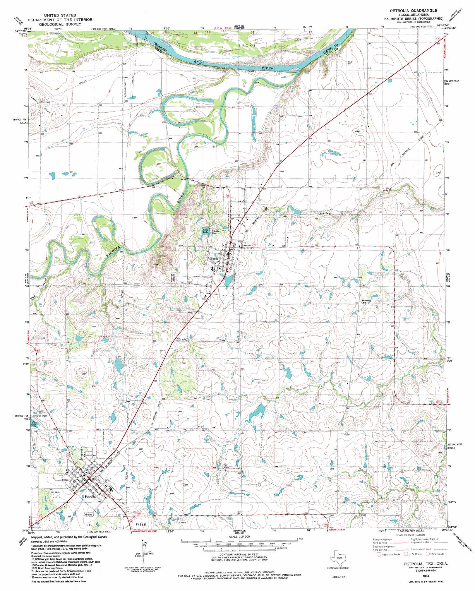
Byers Topo Map Texas
To zoom in, hover over the map of Byers
USGS Topo Quad 34098a2 - 1:24,000 scale
| Topo Map Name: | Byers |
| USGS Topo Quad ID: | 34098a2 |
| Print Size: | ca. 21 1/4" wide x 27" high |
| Southeast Coordinates: | 34° N latitude / 98.125° W longitude |
| Map Center Coordinates: | 34.0625° N latitude / 98.1875° W longitude |
| U.S. States: | TX, OK |
| Filename: | o34098a2.jpg |
| Download Map JPG Image: | Byers topo map 1:24,000 scale |
| Map Type: | Topographic |
| Topo Series: | 7.5´ |
| Map Scale: | 1:24,000 |
| Source of Map Images: | United States Geological Survey (USGS) |
| Alternate Map Versions: |
Petrolia TX 1984, updated 1985 Download PDF Buy paper map Petrolia TX 2010 Download PDF Buy paper map Petrolia TX 2012 Download PDF Buy paper map Petrolia TX 2016 Download PDF Buy paper map |
1:24,000 Topo Quads surrounding Byers
Cookietown |
Walters |
Temple |
Corum |
Comanche |
Randlett |
Taylor |
Hooper |
Waurika West |
Waurika East |
Thornberry |
Charlie |
Byers |
Irving |
Ryan |
Wichita Falls East |
Dean |
Hurnville |
Riverland Cemetery |
Terral |
Sloop Creek |
Jolly |
Henrietta |
Dickworsham |
Ringgold |
> Back to 34098a1 at 1:100,000 scale
> Back to 34098a1 at 1:250,000 scale
> Back to U.S. Topo Maps home
Byers topo map: Gazetteer
Byers: Dams
Byers City Reservoir Dam elevation 283m 928′Mayo Lake Dam elevation 283m 928′
Parker Lake Number 1 Dam elevation 283m 928′
Parker Lake Number 2 Dam elevation 277m 908′
Parker Lake Number 3 Dam elevation 277m 908′
Byers: Populated Places
Byers elevation 308m 1010′Petrolia elevation 304m 997′
Byers: Reservoirs
Byers City Reservoir elevation 283m 928′Mayo Lake elevation 283m 928′
Parker Lake Number 1 elevation 283m 928′
Parker Lake Number 2 elevation 277m 908′
Parker Lake Number 3 elevation 277m 908′
Byers: Streams
Hay Creek elevation 269m 882′Wichita River elevation 265m 869′
Byers digital topo map on disk
Buy this Byers topo map showing relief, roads, GPS coordinates and other geographical features, as a high-resolution digital map file on DVD: