Sunshine Hill Topo Map Texas
To zoom in, hover over the map of Sunshine Hill
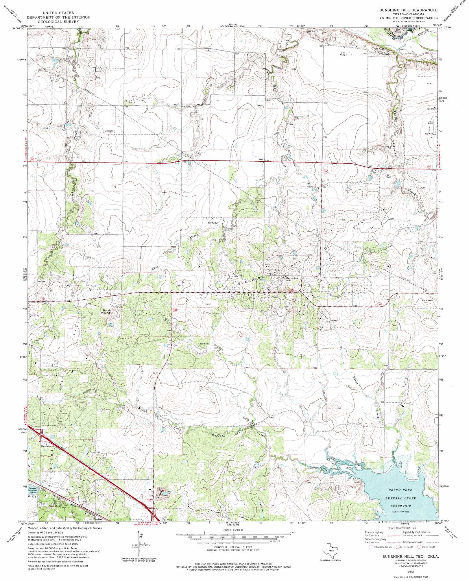
USGS Topo Quad 34098a7 - 1:24,000 scale
| Topo Map Name: | Sunshine Hill |
| USGS Topo Quad ID: | 34098a7 |
| Print Size: | ca. 21 1/4" wide x 27" high |
| Southeast Coordinates: | 34° N latitude / 98.75° W longitude |
| Map Center Coordinates: | 34.0625° N latitude / 98.8125° W longitude |
| U.S. States: | TX, OK |
| Filename: | o34098a7.jpg |
| Download Map JPG Image: | Sunshine Hill topo map 1:24,000 scale |
| Map Type: | Topographic |
| Topo Series: | 7.5´ |
| Map Scale: | 1:24,000 |
| Source of Map Images: | United States Geological Survey (USGS) |
| Alternate Map Versions: |
Barwise School TX 1915, updated 1961 Download PDF Buy paper map Sunshine Hill TX 1972, updated 1975 Download PDF Buy paper map Sunshine Hill TX 2011 Download PDF Buy paper map Sunshine Hill TX 2012 Download PDF Buy paper map Sunshine Hill TX 2016 Download PDF Buy paper map |
1:24,000 Topo Quads surrounding Sunshine Hill
Frederick Se |
Hackberry Flat |
Hollister |
Chattanooga Sw |
Whites Lake |
Davidson |
Cowboy Springs |
Augar Creek |
Grandfield |
Devol |
Harrold |
Electra |
Sunshine Hill |
Clara |
Burkburnett |
Lake Electra |
Beaver Creek |
Fowlkes |
Iowa Park |
Wichita Falls West |
Franklin Bend |
Lake Diversion |
Mankins |
Holliday |
Lake Wichita |
> Back to 34098a1 at 1:100,000 scale
> Back to 34098a1 at 1:250,000 scale
> Back to U.S. Topo Maps home
Sunshine Hill topo map: Gazetteer
Sunshine Hill: Oilfields
Sunshine Hill Oil Field elevation 354m 1161′Sunshine Hill: Streams
Long Creek elevation 324m 1062′Short Creek elevation 320m 1049′
Sunshine Hill: Summits
Floral Mound elevation 367m 1204′Sunshine Hill elevation 368m 1207′
Sunshine Hill digital topo map on disk
Buy this Sunshine Hill topo map showing relief, roads, GPS coordinates and other geographical features, as a high-resolution digital map file on DVD: