Hollister Topo Map Oklahoma
To zoom in, hover over the map of Hollister
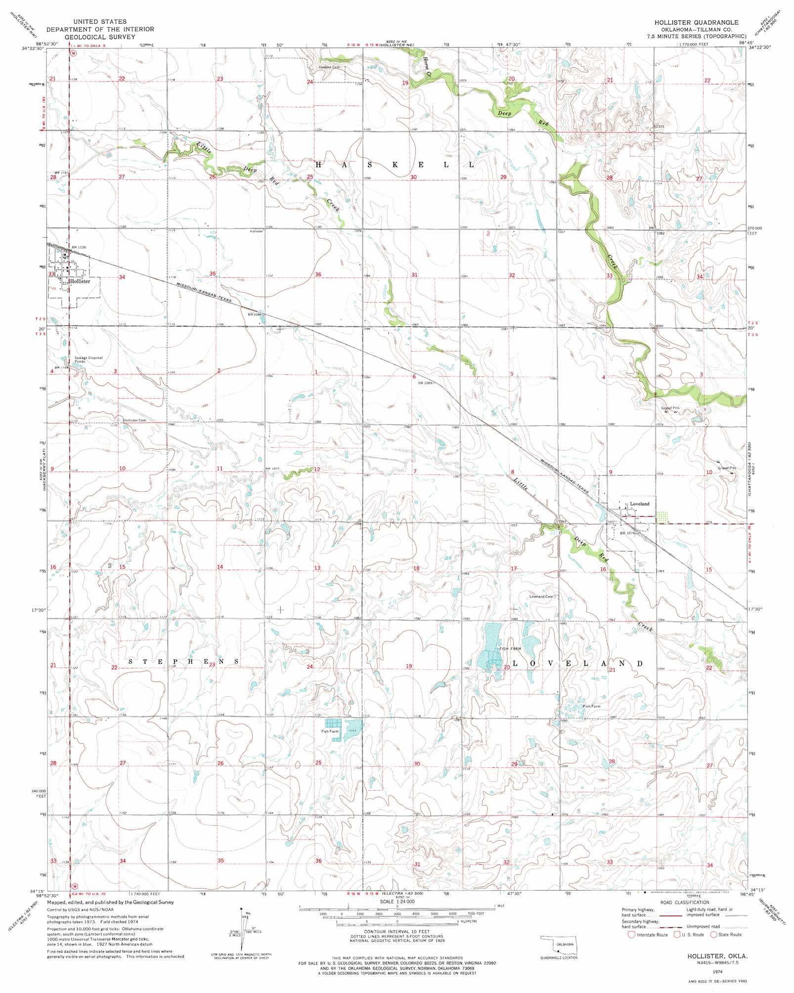
USGS Topo Quad 34098c7 - 1:24,000 scale
| Topo Map Name: | Hollister |
| USGS Topo Quad ID: | 34098c7 |
| Print Size: | ca. 21 1/4" wide x 27" high |
| Southeast Coordinates: | 34.25° N latitude / 98.75° W longitude |
| Map Center Coordinates: | 34.3125° N latitude / 98.8125° W longitude |
| U.S. State: | OK |
| Filename: | o34098c7.jpg |
| Download Map JPG Image: | Hollister topo map 1:24,000 scale |
| Map Type: | Topographic |
| Topo Series: | 7.5´ |
| Map Scale: | 1:24,000 |
| Source of Map Images: | United States Geological Survey (USGS) |
| Alternate Map Versions: |
Hollister OK 1974, updated 1977 Download PDF Buy paper map Hollister OK 2010 Download PDF Buy paper map Hollister OK 2012 Download PDF Buy paper map Hollister OK 2016 Download PDF Buy paper map |
1:24,000 Topo Quads surrounding Hollister
Tipton Se |
Manitou |
Indiahoma |
Post Oak Creek |
Taupa |
Frederick |
Hollister Nw |
Hollister Ne |
Chattanooga |
Faxon |
Frederick Se |
Hackberry Flat |
Hollister |
Chattanooga Sw |
Whites Lake |
Davidson |
Cowboy Springs |
Augar Creek |
Grandfield |
Devol |
Harrold |
Electra |
Sunshine Hill |
Clara |
Burkburnett |
> Back to 34098a1 at 1:100,000 scale
> Back to 34098a1 at 1:250,000 scale
> Back to U.S. Topo Maps home
Hollister topo map: Gazetteer
Hollister: Populated Places
Hollister elevation 343m 1125′Loveland elevation 327m 1072′
Hollister: Streams
Horse Creek elevation 323m 1059′Hollister digital topo map on disk
Buy this Hollister topo map showing relief, roads, GPS coordinates and other geographical features, as a high-resolution digital map file on DVD: