Empire City Topo Map Oklahoma
To zoom in, hover over the map of Empire City
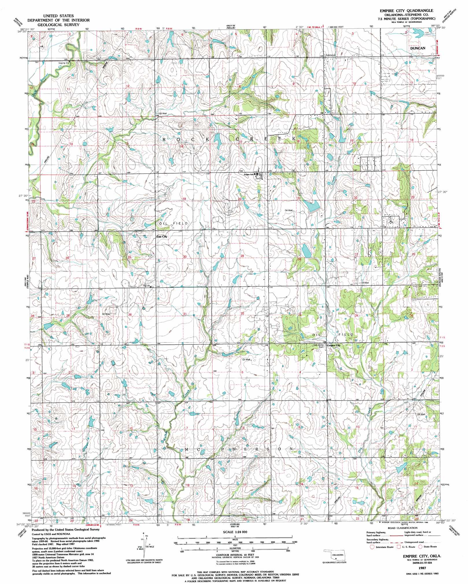
USGS Topo Quad 34098d1 - 1:24,000 scale
| Topo Map Name: | Empire City |
| USGS Topo Quad ID: | 34098d1 |
| Print Size: | ca. 21 1/4" wide x 27" high |
| Southeast Coordinates: | 34.375° N latitude / 98° W longitude |
| Map Center Coordinates: | 34.4375° N latitude / 98.0625° W longitude |
| U.S. State: | OK |
| Filename: | o34098d1.jpg |
| Download Map JPG Image: | Empire City topo map 1:24,000 scale |
| Map Type: | Topographic |
| Topo Series: | 7.5´ |
| Map Scale: | 1:24,000 |
| Source of Map Images: | United States Geological Survey (USGS) |
| Alternate Map Versions: |
Empire City OK 1987, updated 1988 Download PDF Buy paper map Empire City OK 2010 Download PDF Buy paper map Empire City OK 2012 Download PDF Buy paper map Empire City OK 2016 Download PDF Buy paper map |
1:24,000 Topo Quads surrounding Empire City
Arbuckle Hill |
Sterling |
Denton |
Marlow |
Bray |
Ninemile Creek |
Letitia |
Nellie |
Duncan North |
Hope |
Walters Ne |
Temple Nw |
Empire City |
Duncan South |
Harrisburg |
Walters |
Temple |
Corum |
Comanche |
Comanche Se |
Taylor |
Hooper |
Waurika West |
Waurika East |
Ryan Ne |
> Back to 34098a1 at 1:100,000 scale
> Back to 34098a1 at 1:250,000 scale
> Back to U.S. Topo Maps home
Empire City topo map: Gazetteer
Empire City: Dams
Cow Creek Site 35 Dam elevation 311m 1020′Oknoname 137013 Dam elevation 345m 1131′
Oknoname 137014 Dam elevation 329m 1079′
Oknoname 137015 Dam elevation 315m 1033′
Oknoname 137016 Dam elevation 351m 1151′
Oknoname 137017 Dam elevation 346m 1135′
Oknoname 137089 Dam elevation 343m 1125′
Empire City: Oilfields
Empire Oil Field elevation 323m 1059′West Duncan Oil and Gas Field elevation 340m 1115′
Empire City: Populated Places
Empire City elevation 325m 1066′Gas City elevation 330m 1082′
Empire City: Reservoirs
Cow Creek Site 35 Reservoir elevation 311m 1020′Oknoname 137013 Reservoir elevation 345m 1131′
Oknoname 137014 Reservoir elevation 329m 1079′
Oknoname 137015 Reservoir elevation 315m 1033′
Oknoname 137016 Reservoir elevation 351m 1151′
Oknoname 137017 Reservoir elevation 346m 1135′
Oknoname 137089 Reservoir elevation 343m 1125′
Empire City digital topo map on disk
Buy this Empire City topo map showing relief, roads, GPS coordinates and other geographical features, as a high-resolution digital map file on DVD: