Geronimo Topo Map Oklahoma
To zoom in, hover over the map of Geronimo
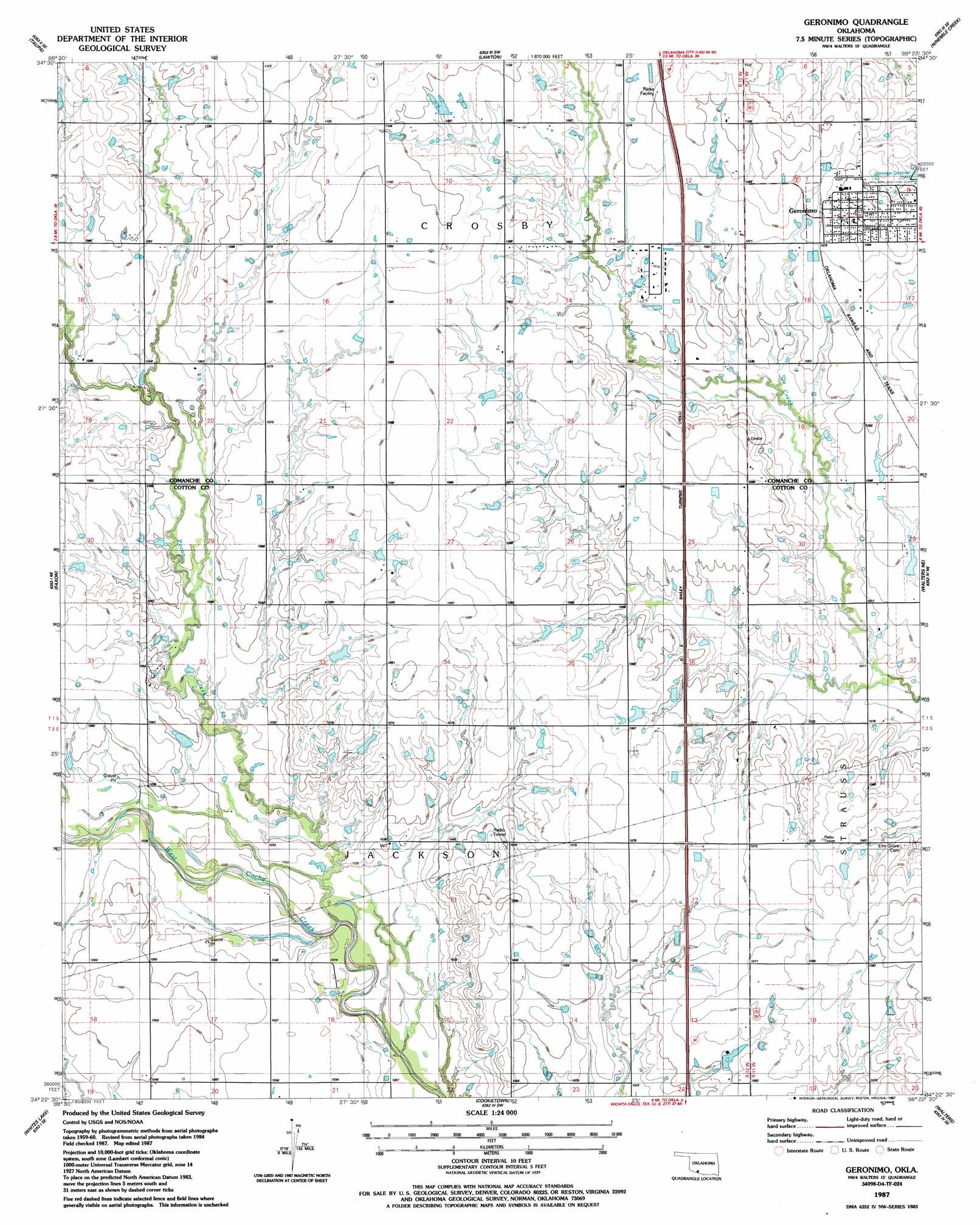
USGS Topo Quad 34098d4 - 1:24,000 scale
| Topo Map Name: | Geronimo |
| USGS Topo Quad ID: | 34098d4 |
| Print Size: | ca. 21 1/4" wide x 27" high |
| Southeast Coordinates: | 34.375° N latitude / 98.375° W longitude |
| Map Center Coordinates: | 34.4375° N latitude / 98.4375° W longitude |
| U.S. State: | OK |
| Filename: | o34098d4.jpg |
| Download Map JPG Image: | Geronimo topo map 1:24,000 scale |
| Map Type: | Topographic |
| Topo Series: | 7.5´ |
| Map Scale: | 1:24,000 |
| Source of Map Images: | United States Geological Survey (USGS) |
| Alternate Map Versions: |
Geronimo OK 1987, updated 1987 Download PDF Buy paper map Geronimo OK 2009 Download PDF Buy paper map Geronimo OK 2012 Download PDF Buy paper map Geronimo OK 2016 Download PDF Buy paper map |
1:24,000 Topo Quads surrounding Geronimo
Quanah Mountain |
Mount Scott |
Fort Sill |
Arbuckle Hill |
Sterling |
Post Oak Creek |
Taupa |
Lawton |
Ninemile Creek |
Letitia |
Chattanooga |
Faxon |
Geronimo |
Walters Ne |
Temple Nw |
Chattanooga Sw |
Whites Lake |
Cookietown |
Walters |
Temple |
Grandfield |
Devol |
Randlett |
Taylor |
Hooper |
> Back to 34098a1 at 1:100,000 scale
> Back to 34098a1 at 1:250,000 scale
> Back to U.S. Topo Maps home
Geronimo topo map: Gazetteer
Geronimo: Dams
Oknoname 031060 Dam elevation 326m 1069′Geronimo: Populated Places
Geronimo elevation 338m 1108′Geronimo: Reservoirs
Oknoname 031060 Reservoir elevation 326m 1069′Geronimo: Streams
Pecan Creek elevation 309m 1013′Geronimo digital topo map on disk
Buy this Geronimo topo map showing relief, roads, GPS coordinates and other geographical features, as a high-resolution digital map file on DVD: