Hollister Nw Topo Map Oklahoma
To zoom in, hover over the map of Hollister Nw
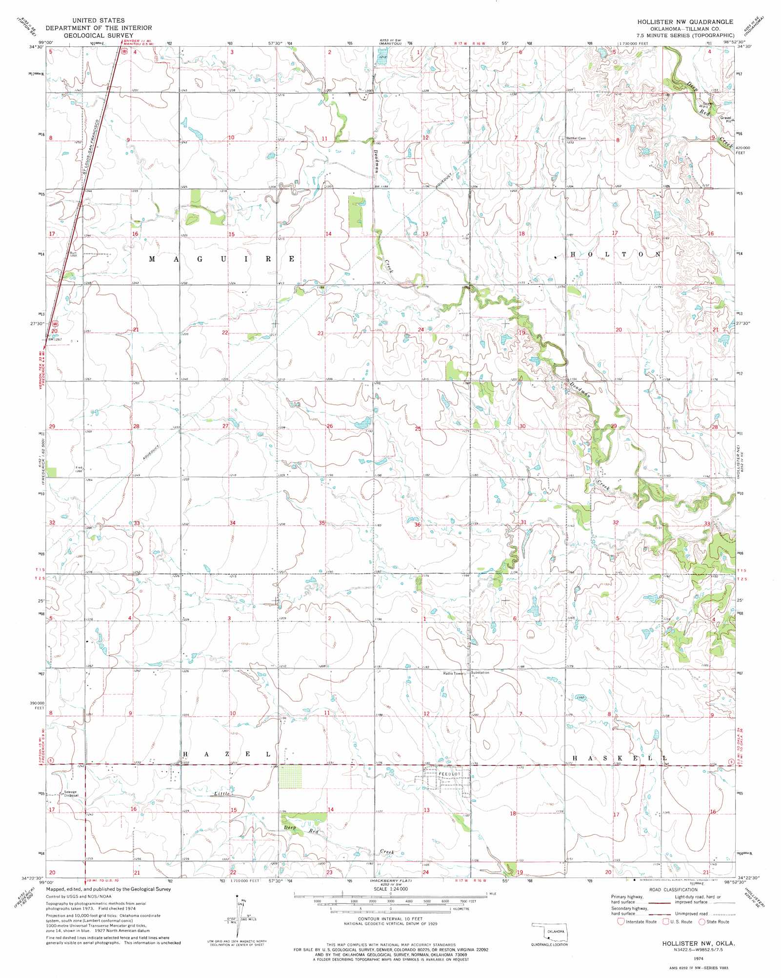
USGS Topo Quad 34098d8 - 1:24,000 scale
| Topo Map Name: | Hollister Nw |
| USGS Topo Quad ID: | 34098d8 |
| Print Size: | ca. 21 1/4" wide x 27" high |
| Southeast Coordinates: | 34.375° N latitude / 98.875° W longitude |
| Map Center Coordinates: | 34.4375° N latitude / 98.9375° W longitude |
| U.S. State: | OK |
| Filename: | o34098d8.jpg |
| Download Map JPG Image: | Hollister Nw topo map 1:24,000 scale |
| Map Type: | Topographic |
| Topo Series: | 7.5´ |
| Map Scale: | 1:24,000 |
| Source of Map Images: | United States Geological Survey (USGS) |
| Alternate Map Versions: |
Hollister NW OK 1974, updated 1977 Download PDF Buy paper map Hollister NW OK 2010 Download PDF Buy paper map Hollister NW OK 2012 Download PDF Buy paper map Hollister NW OK 2016 Download PDF Buy paper map |
1:24,000 Topo Quads surrounding Hollister Nw
Headrick |
Long Mountain |
Snyder |
Odetta |
Quanah Mountain |
Tipton |
Tipton Se |
Manitou |
Indiahoma |
Post Oak Creek |
Frederick Nw |
Frederick |
Hollister Nw |
Hollister Ne |
Chattanooga |
Frederick Sw |
Frederick Se |
Hackberry Flat |
Hollister |
Chattanooga Sw |
Oklaunion |
Davidson |
Cowboy Springs |
Augar Creek |
Grandfield |
> Back to 34098a1 at 1:100,000 scale
> Back to 34098a1 at 1:250,000 scale
> Back to U.S. Topo Maps home
Hollister Nw topo map: Gazetteer
Hollister Nw: Dams
Oknoname 141008 Dam elevation 368m 1207′Oknoname 141009 Dam elevation 356m 1167′
Oknoname 141010 Dam elevation 354m 1161′
Oknoname 141011 Dam elevation 349m 1145′
Hollister Nw: Reservoirs
Oknoname 141008 Reservoir elevation 368m 1207′Oknoname 141009 Reservoir elevation 356m 1167′
Oknoname 141010 Reservoir elevation 354m 1161′
Oknoname 141011 Reservoir elevation 349m 1145′
Hollister Nw digital topo map on disk
Buy this Hollister Nw topo map showing relief, roads, GPS coordinates and other geographical features, as a high-resolution digital map file on DVD: