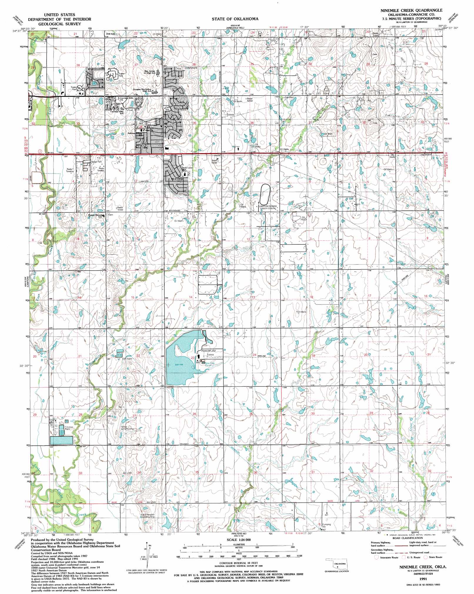
Ninemile Creek Topo Map Oklahoma
To zoom in, hover over the map of Ninemile Creek
USGS Topo Quad 34098e3 - 1:24,000 scale
| Topo Map Name: | Ninemile Creek |
| USGS Topo Quad ID: | 34098e3 |
| Print Size: | ca. 21 1/4" wide x 27" high |
| Southeast Coordinates: | 34.5° N latitude / 98.25° W longitude |
| Map Center Coordinates: | 34.5625° N latitude / 98.3125° W longitude |
| U.S. State: | OK |
| Filename: | o34098e3.jpg |
| Download Map JPG Image: | Ninemile Creek topo map 1:24,000 scale |
| Map Type: | Topographic |
| Topo Series: | 7.5´ |
| Map Scale: | 1:24,000 |
| Source of Map Images: | United States Geological Survey (USGS) |
| Alternate Map Versions: |
Ninemile Creek OK 1956, updated 1959 Download PDF Buy paper map Ninemile Creek OK 1956, updated 1971 Download PDF Buy paper map Ninemile Creek OK 1956, updated 1976 Download PDF Buy paper map Ninemile Creek OK 1991, updated 1991 Download PDF Buy paper map Ninemile Creek OK 2009 Download PDF Buy paper map Ninemile Creek OK 2012 Download PDF Buy paper map Ninemile Creek OK 2016 Download PDF Buy paper map |
1:24,000 Topo Quads surrounding Ninemile Creek
Meers |
Richards Spur |
Elgin |
Fletcher |
Rocky Ford |
Mount Scott |
Fort Sill |
Arbuckle Hill |
Sterling |
Denton |
Taupa |
Lawton |
Ninemile Creek |
Letitia |
Nellie |
Faxon |
Geronimo |
Walters Ne |
Temple Nw |
Empire City |
Whites Lake |
Cookietown |
Walters |
Temple |
Corum |
> Back to 34098e1 at 1:100,000 scale
> Back to 34098a1 at 1:250,000 scale
> Back to U.S. Topo Maps home
Ninemile Creek topo map: Gazetteer
Ninemile Creek: Airports
Hill Top/Private Airport elevation 320m 1049′Hilltop Landing Strip elevation 333m 1092′
Jerry-Wright Airfield elevation 337m 1105′
R and D Aviation Landing Strip elevation 330m 1082′
Ninemile Creek: Dams
Oknoname 031014 Dam elevation 357m 1171′Oknoname 031033 Dam elevation 329m 1079′
Oknoname 031053 Dam elevation 339m 1112′
Oknoname 031054 Dam elevation 342m 1122′
Oknoname 031055 Dam elevation 359m 1177′
Oknoname 031058 Dam elevation 327m 1072′
Oknoname 031059 Dam elevation 349m 1145′
Ninemile Creek: Reservoirs
Oknoname 031014 Reservoir elevation 357m 1171′Oknoname 031033 Reservoir elevation 329m 1079′
Oknoname 031053 Reservoir elevation 339m 1112′
Oknoname 031054 Reservoir elevation 342m 1122′
Oknoname 031055 Reservoir elevation 359m 1177′
Oknoname 031058 Reservoir elevation 327m 1072′
Oknoname 031059 Reservoir elevation 349m 1145′
Ninemile Creek: Streams
Ninemile Creek elevation 313m 1026′Ninemile Creek digital topo map on disk
Buy this Ninemile Creek topo map showing relief, roads, GPS coordinates and other geographical features, as a high-resolution digital map file on DVD: