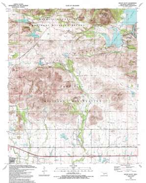
Mount Scott Topo Map Oklahoma
To zoom in, hover over the map of Mount Scott
USGS Topo Quad 34098f5 - 1:24,000 scale
| Topo Map Name: | Mount Scott |
| USGS Topo Quad ID: | 34098f5 |
| Print Size: | ca. 21 1/4" wide x 27" high |
| Southeast Coordinates: | 34.625° N latitude / 98.5° W longitude |
| Map Center Coordinates: | 34.6875° N latitude / 98.5625° W longitude |
| U.S. State: | OK |
| Filename: | o34098f5.jpg |
| Download Map JPG Image: | Mount Scott topo map 1:24,000 scale |
| Map Type: | Topographic |
| Topo Series: | 7.5´ |
| Map Scale: | 1:24,000 |
| Source of Map Images: | United States Geological Survey (USGS) |
| Alternate Map Versions: |
Mount Scott OK 1949, updated 1952 Download PDF Buy paper map Mount Scott OK 1956, updated 1959 Download PDF Buy paper map Mount Scott OK 1956, updated 1971 Download PDF Buy paper map Mount Scott OK 1956, updated 1973 Download PDF Buy paper map Mount Scott OK 1956, updated 1990 Download PDF Buy paper map Mount Scott OK 1956, updated 1992 Download PDF Buy paper map Mount Scott OK 1991, updated 1992 Download PDF Buy paper map Mount Scott OK 1997, updated 2000 Download PDF Buy paper map Mount Scott OK 2010 Download PDF Buy paper map Mount Scott OK 2012 Download PDF Buy paper map Mount Scott OK 2016 Download PDF Buy paper map |
1:24,000 Topo Quads surrounding Mount Scott
> Back to 34098e1 at 1:100,000 scale
> Back to 34098a1 at 1:250,000 scale
> Back to U.S. Topo Maps home
Mount Scott topo map: Gazetteer
Mount Scott: Dams
Elmer Thomas Lake Dam elevation 415m 1361′Jed Johnston Lake Dam elevation 523m 1715′
Ketch Lake Dam elevation 454m 1489′
Lawton Dam elevation 394m 1292′
Lawtonka Dam elevation 409m 1341′
Oknoname 031038 Dam elevation 379m 1243′
Quanah Parker Lake Dam elevation 473m 1551′
Rush Lake Dam elevation 538m 1765′
Mount Scott: Flats
Graham Flat elevation 543m 1781′Jed Flat elevation 531m 1742′
Sulphur Flat elevation 455m 1492′
Mount Scott: Lakes
Engineer Pond elevation 449m 1473′Logan Lake elevation 389m 1276′
Osceola Pond elevation 394m 1292′
Quanah Lake elevation 422m 1384′
Three Crows Pond elevation 385m 1263′
Mount Scott: Parks
Craterville Park elevation 405m 1328′Mount Scott: Populated Places
Medicine Park elevation 388m 1272′The Holy City elevation 501m 1643′
Mount Scott: Reservoirs
Crater Lake elevation 444m 1456′Elmer Thomas Lake elevation 422m 1384′
Jed Johnston Lake elevation 523m 1715′
Ketch Lake elevation 453m 1486′
Lake Jed Johnson elevation 489m 1604′
Lake Lawtonka elevation 409m 1341′
Lake Lawtonka elevation 402m 1318′
Lake Rush elevation 510m 1673′
Oknoname 031038 Reservoir elevation 379m 1243′
Quanah Parker Lake elevation 473m 1551′
Rush Lake elevation 538m 1765′
Tank X Pond elevation 394m 1292′
West Lake elevation 414m 1358′
Mount Scott: Springs
Turtle Springs elevation 520m 1706′Mount Scott: Streams
Little Medicine Creek elevation 385m 1263′Mount Scott: Summits
Arapaho Point elevation 591m 1938′Browne Hill elevation 484m 1587′
Carlton Mountain elevation 538m 1765′
Central Peak elevation 629m 2063′
Costain Hill elevation 556m 1824′
Cross Mountain elevation 651m 2135′
Davidson Hill elevation 494m 1620′
Fern Mountain elevation 489m 1604′
Gruber Hill elevation 479m 1571′
Hunting Horse Hill elevation 603m 1978′
Indian Hill elevation 454m 1489′
Kerr Hill elevation 413m 1354′
Koehler Hill elevation 504m 1653′
Mount McKinley elevation 612m 2007′
Mount Scott elevation 751m 2463′
Mount Scotts Boy elevation 609m 1998′
Mount Sherman elevation 668m 2191′
Newt Jones Hill elevation 478m 1568′
Pratt Hill elevation 474m 1555′
Quetone Point elevation 599m 1965′
Thompson Hill elevation 510m 1673′
Mount Scott digital topo map on disk
Buy this Mount Scott topo map showing relief, roads, GPS coordinates and other geographical features, as a high-resolution digital map file on DVD:


