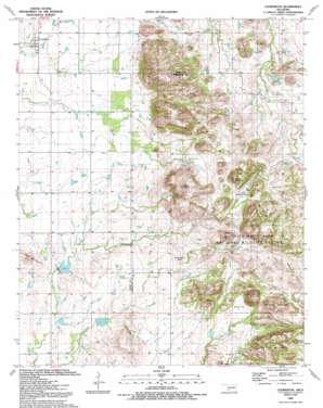
Cooperton Topo Map Oklahoma
To zoom in, hover over the map of Cooperton
USGS Topo Quad 34098g7 - 1:24,000 scale
| Topo Map Name: | Cooperton |
| USGS Topo Quad ID: | 34098g7 |
| Print Size: | ca. 21 1/4" wide x 27" high |
| Southeast Coordinates: | 34.75° N latitude / 98.75° W longitude |
| Map Center Coordinates: | 34.8125° N latitude / 98.8125° W longitude |
| U.S. State: | OK |
| Filename: | o34098g7.jpg |
| Download Map JPG Image: | Cooperton topo map 1:24,000 scale |
| Map Type: | Topographic |
| Topo Series: | 7.5´ |
| Map Scale: | 1:24,000 |
| Source of Map Images: | United States Geological Survey (USGS) |
| Alternate Map Versions: |
Cooperton OK 1956, updated 1959 Download PDF Buy paper map Cooperton OK 1956, updated 1976 Download PDF Buy paper map Cooperton OK 1991, updated 1992 Download PDF Buy paper map Cooperton OK 2010 Download PDF Buy paper map Cooperton OK 2012 Download PDF Buy paper map Cooperton OK 2016 Download PDF Buy paper map |
1:24,000 Topo Quads surrounding Cooperton
> Back to 34098e1 at 1:100,000 scale
> Back to 34098a1 at 1:250,000 scale
> Back to U.S. Topo Maps home
Cooperton topo map: Gazetteer
Cooperton: Dams
Otter Creek Site 3 Dam elevation 463m 1519′Otter Creek Site 4 Dam elevation 462m 1515′
Cooperton: Flats
Boggy Flat elevation 581m 1906′Fullingim Flat elevation 533m 1748′
Lobo Flat elevation 577m 1893′
Wells Flat elevation 514m 1686′
Wells Flats elevation 514m 1686′
Cooperton: Populated Places
Cooperton elevation 474m 1555′Cooperton: Ranges
Rabbit Hills elevation 602m 1975′Cooperton: Reservoirs
Cut Throat Lake elevation 553m 1814′Otter Creek Site 3 Reservoir elevation 463m 1519′
Otter Creek Site 4 Reservoir elevation 462m 1515′
Cooperton: Springs
Buffalo Spring elevation 553m 1814′East Sugar Creek Spring elevation 547m 1794′
Goodin Spring elevation 553m 1814′
Hale Spring elevation 510m 1673′
Sugar Creek Spring elevation 549m 1801′
Time-O-Day Spring elevation 563m 1847′
Cooperton: Streams
Boggy Hollow Creek elevation 466m 1528′West Fork elevation 505m 1656′
West Sugar Creek elevation 497m 1630′
Cooperton: Summits
Baker Peak elevation 730m 2395′Bell Mountain elevation 543m 1781′
Big Four Mountain elevation 672m 2204′
Black Bear Mountain elevation 682m 2237′
Buffalo Mountain elevation 567m 1860′
Dead Man Mountain elevation 576m 1889′
Grace Mountain elevation 693m 2273′
Mount Pinchot elevation 750m 2460′
Panther Mountain elevation 667m 2188′
Cooperton digital topo map on disk
Buy this Cooperton topo map showing relief, roads, GPS coordinates and other geographical features, as a high-resolution digital map file on DVD:


