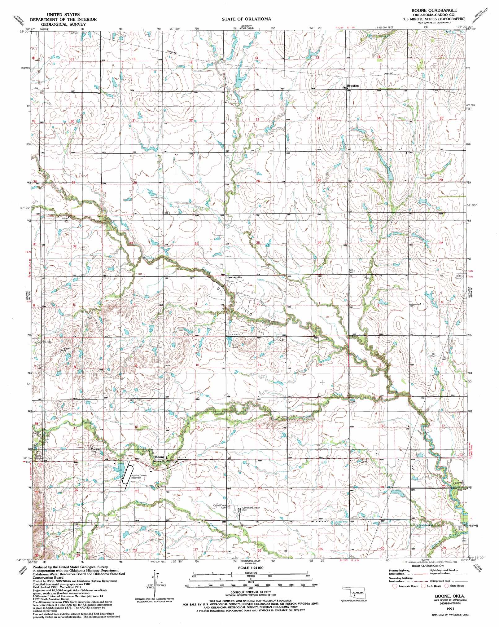
Boone Topo Map Oklahoma
To zoom in, hover over the map of Boone
USGS Topo Quad 34098h4 - 1:24,000 scale
| Topo Map Name: | Boone |
| USGS Topo Quad ID: | 34098h4 |
| Print Size: | ca. 21 1/4" wide x 27" high |
| Southeast Coordinates: | 34.875° N latitude / 98.375° W longitude |
| Map Center Coordinates: | 34.9375° N latitude / 98.4375° W longitude |
| U.S. State: | OK |
| Filename: | o34098h4.jpg |
| Download Map JPG Image: | Boone topo map 1:24,000 scale |
| Map Type: | Topographic |
| Topo Series: | 7.5´ |
| Map Scale: | 1:24,000 |
| Source of Map Images: | United States Geological Survey (USGS) |
| Alternate Map Versions: |
Boone OK 1956, updated 1959 Download PDF Buy paper map Boone OK 1956, updated 1977 Download PDF Buy paper map Boone OK 1991, updated 1992 Download PDF Buy paper map Boone OK 2009 Download PDF Buy paper map Boone OK 2012 Download PDF Buy paper map Boone OK 2016 Download PDF Buy paper map |
1:24,000 Topo Quads surrounding Boone
Cowden |
Alfalfa |
Fort Cobb Dam |
Gracemont |
Anadarko Nw |
Stinking Creek |
Carnegie |
Fort Cobb |
Anadarko West |
Anadarko East |
Bally Mountain |
Alden |
Boone |
Apache |
Cyril |
Saddle Mountain |
Meers |
Richards Spur |
Elgin |
Fletcher |
Quanah Mountain |
Mount Scott |
Fort Sill |
Arbuckle Hill |
Sterling |
> Back to 34098e1 at 1:100,000 scale
> Back to 34098a1 at 1:250,000 scale
> Back to U.S. Topo Maps home
Boone topo map: Gazetteer
Boone: Dams
Oknoname 015026 Dam elevation 415m 1361′Boone: Parks
Apache Downs elevation 432m 1417′Boone: Populated Places
Boone elevation 416m 1364′Broxton elevation 437m 1433′
Hatchetville elevation 404m 1325′
Boone: Reservoirs
Oknoname 015026 Reservoir elevation 415m 1361′Boone: Streams
Boxelder Creek elevation 377m 1236′Cook Creek elevation 439m 1440′
Tahoe Creek elevation 377m 1236′
Boone digital topo map on disk
Buy this Boone topo map showing relief, roads, GPS coordinates and other geographical features, as a high-resolution digital map file on DVD: