Rayland Topo Map Texas
To zoom in, hover over the map of Rayland
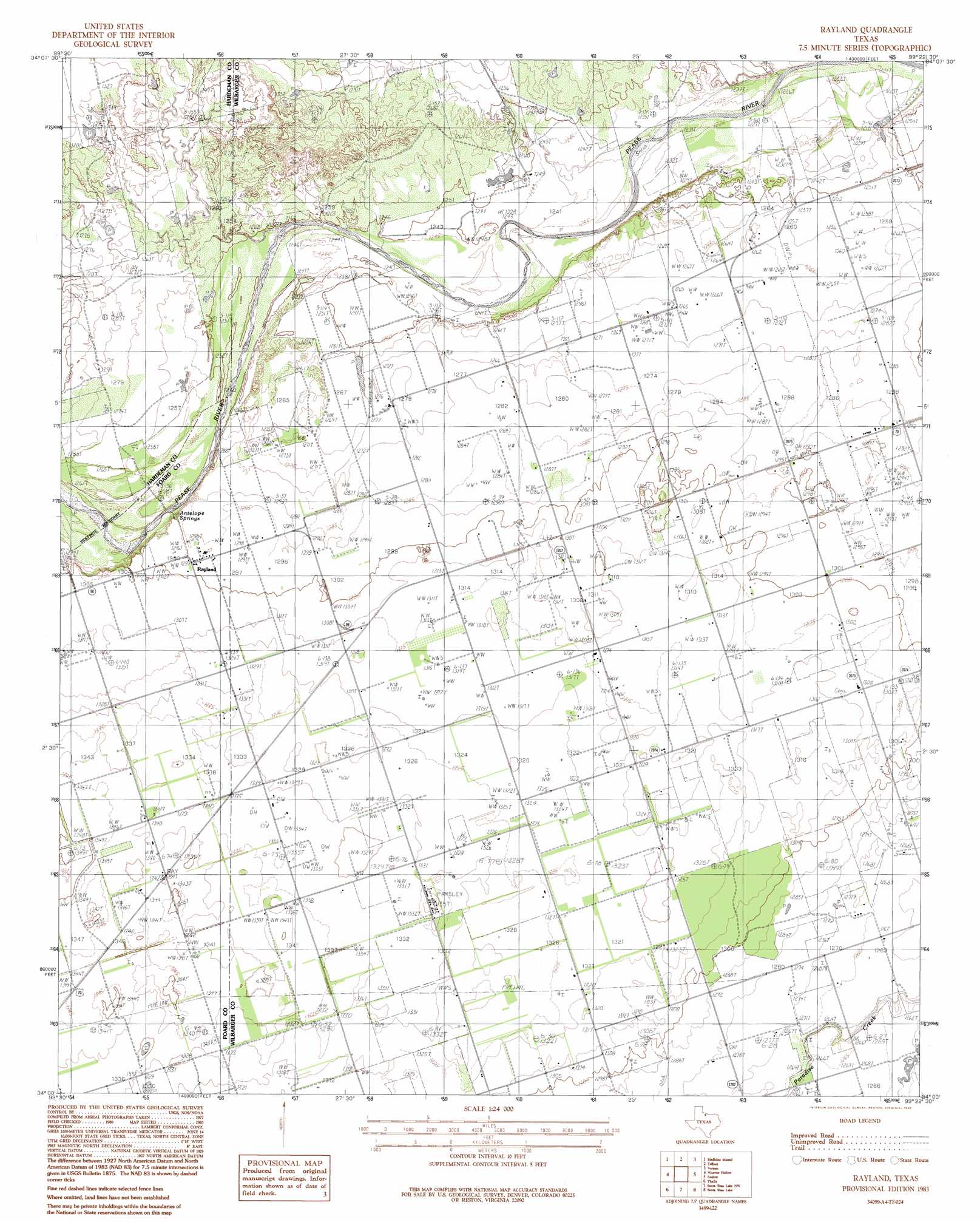
USGS Topo Quad 34099a4 - 1:24,000 scale
| Topo Map Name: | Rayland |
| USGS Topo Quad ID: | 34099a4 |
| Print Size: | ca. 21 1/4" wide x 27" high |
| Southeast Coordinates: | 34° N latitude / 99.375° W longitude |
| Map Center Coordinates: | 34.0625° N latitude / 99.4375° W longitude |
| U.S. State: | TX |
| Filename: | o34099a4.jpg |
| Download Map JPG Image: | Rayland topo map 1:24,000 scale |
| Map Type: | Topographic |
| Topo Series: | 7.5´ |
| Map Scale: | 1:24,000 |
| Source of Map Images: | United States Geological Survey (USGS) |
| Alternate Map Versions: |
Rayland TX 1983, updated 1984 Download PDF Buy paper map Rayland TX 1983, updated 1992 Download PDF Buy paper map Rayland TX 2010 Download PDF Buy paper map Rayland TX 2012 Download PDF Buy paper map Rayland TX 2016 Download PDF Buy paper map |
1:24,000 Topo Quads surrounding Rayland
Quanah East |
Chillicothe |
Odell |
Northside |
Frederick Sw |
Big Mound |
Medicine Mound |
Tolbert |
Vernon |
Oklaunion |
Margaret |
Warrior Hollow |
Rayland |
Lockett |
Boggy Creek |
Crowell |
Thalia |
Santa Rosa Lake Nw |
Santa Rosa Lake |
Grayback |
Halsell Ranch |
Colwell Creek |
Santa Rosa Lake Sw |
Northwest Lake Kemp |
Northeast Lake Kemp |
> Back to 34099a1 at 1:100,000 scale
> Back to 34098a1 at 1:250,000 scale
> Back to U.S. Topo Maps home
Rayland topo map: Gazetteer
Rayland: Airports
Lehman Airport elevation 387m 1269′Rayland: Populated Places
Lockett elevation 393m 1289′Parsley Hill elevation 402m 1318′
Rayland elevation 395m 1295′
Rayland: Springs
Antelope Springs elevation 388m 1272′Rayland digital topo map on disk
Buy this Rayland topo map showing relief, roads, GPS coordinates and other geographical features, as a high-resolution digital map file on DVD: