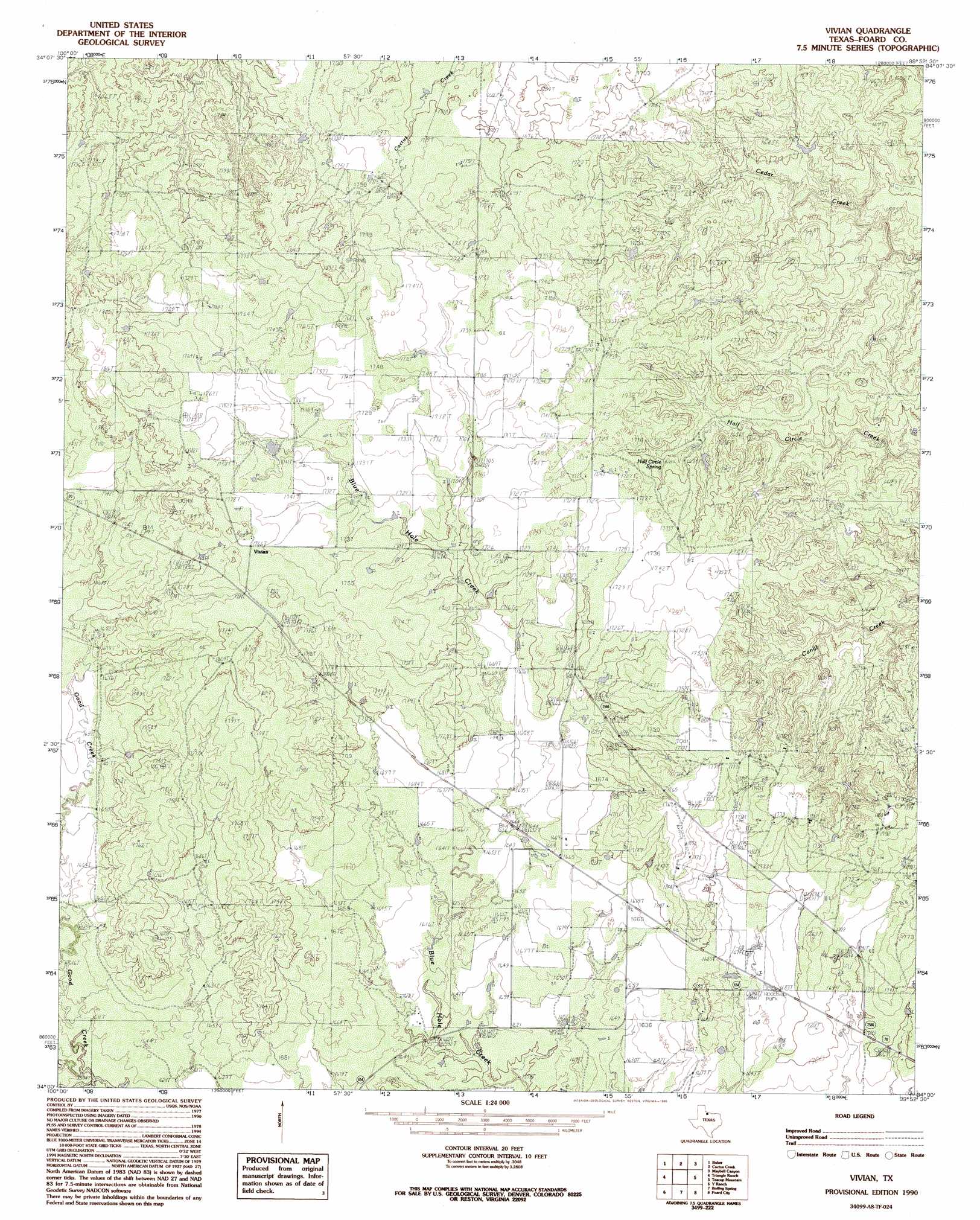
Vivian Topo Map Texas
To zoom in, hover over the map of Vivian
USGS Topo Quad 34099a8 - 1:24,000 scale
| Topo Map Name: | Vivian |
| USGS Topo Quad ID: | 34099a8 |
| Print Size: | ca. 21 1/4" wide x 27" high |
| Southeast Coordinates: | 34° N latitude / 99.875° W longitude |
| Map Center Coordinates: | 34.0625° N latitude / 99.9375° W longitude |
| U.S. State: | TX |
| Filename: | o34099a8.jpg |
| Download Map JPG Image: | Vivian topo map 1:24,000 scale |
| Map Type: | Topographic |
| Topo Series: | 7.5´ |
| Map Scale: | 1:24,000 |
| Source of Map Images: | United States Geological Survey (USGS) |
| Alternate Map Versions: |
Vivian TX 1984, updated 1985 Download PDF Buy paper map Vivian TX 1990, updated 1995 Download PDF Buy paper map Vivian TX 2010 Download PDF Buy paper map Vivian TX 2012 Download PDF Buy paper map Vivian TX 2016 Download PDF Buy paper map |
1:24,000 Topo Quads surrounding Vivian
Buckle L Ranch |
Kirkland South |
Goodlett |
Quanah West |
Quanah East |
Swearingen |
Baker |
Cactus Creek |
Maybell Canyon |
Big Mound |
Moons Camp |
Triangle Ranch |
Vivian |
Teacup Mountain |
Margaret |
Chalk |
Y Ranch |
Boiling Spring |
Foard City |
Crowell |
Chalk Sw |
Lowrance Mountain |
Big Four Ranch |
Truscott North |
Halsell Ranch |
> Back to 34099a1 at 1:100,000 scale
> Back to 34098a1 at 1:250,000 scale
> Back to U.S. Topo Maps home
Vivian topo map: Gazetteer
Vivian: Oilfields
Raspberry Oil Field elevation 543m 1781′Vivian: Populated Places
Vivian elevation 541m 1774′Vivian: Springs
Half Circle Spring elevation 517m 1696′Vivian digital topo map on disk
Buy this Vivian topo map showing relief, roads, GPS coordinates and other geographical features, as a high-resolution digital map file on DVD: