Ayers Island Topo Map Texas
To zoom in, hover over the map of Ayers Island
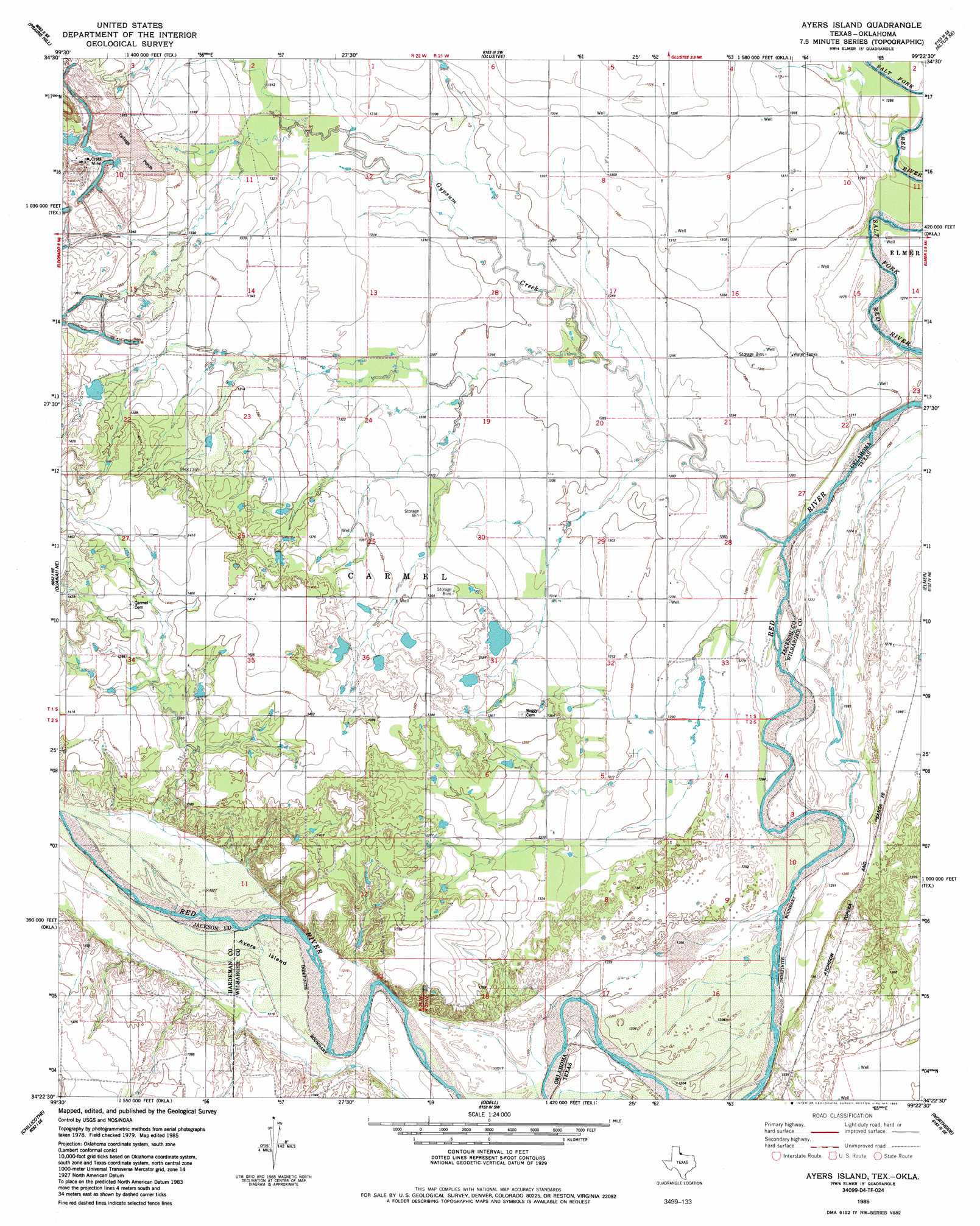
USGS Topo Quad 34099d4 - 1:24,000 scale
| Topo Map Name: | Ayers Island |
| USGS Topo Quad ID: | 34099d4 |
| Print Size: | ca. 21 1/4" wide x 27" high |
| Southeast Coordinates: | 34.375° N latitude / 99.375° W longitude |
| Map Center Coordinates: | 34.4375° N latitude / 99.4375° W longitude |
| U.S. States: | TX, OK |
| Filename: | o34099d4.jpg |
| Download Map JPG Image: | Ayers Island topo map 1:24,000 scale |
| Map Type: | Topographic |
| Topo Series: | 7.5´ |
| Map Scale: | 1:24,000 |
| Source of Map Images: | United States Geological Survey (USGS) |
| Alternate Map Versions: |
Ayers Island TX 1985, updated 1985 Download PDF Buy paper map Ayers Island TX 2010 Download PDF Buy paper map Ayers Island TX 2012 Download PDF Buy paper map Ayers Island TX 2016 Download PDF Buy paper map |
1:24,000 Topo Quads surrounding Ayers Island
Mcqueen |
Duke |
Martha |
Altus |
Headrick |
Duke Sw |
Prairie Hill |
Olustee |
Altus Se |
Tipton |
Eldorado |
Elmer Nw |
Ayers Island |
Elmer |
Frederick Nw |
Quanah East |
Chillicothe |
Odell |
Northside |
Frederick Sw |
Big Mound |
Medicine Mound |
Tolbert |
Vernon |
Oklaunion |
> Back to 34099a1 at 1:100,000 scale
> Back to 34098a1 at 1:250,000 scale
> Back to U.S. Topo Maps home
Ayers Island topo map: Gazetteer
Ayers Island: Dams
Mitchell Lake Dam elevation 410m 1345′Ayers Island: Islands
Ayers Island (historical) elevation 402m 1318′Ayers Island: Mines
Crata Mine elevation 421m 1381′Ayers Island: Reservoirs
Mitchell Lake elevation 410m 1345′Ayers Island: Streams
Gypsum Creek elevation 386m 1266′Wanderers Creek elevation 393m 1289′
Wanderers Creek elevation 393m 1289′
Ayers Island digital topo map on disk
Buy this Ayers Island topo map showing relief, roads, GPS coordinates and other geographical features, as a high-resolution digital map file on DVD: