Headrick Topo Map Oklahoma
To zoom in, hover over the map of Headrick
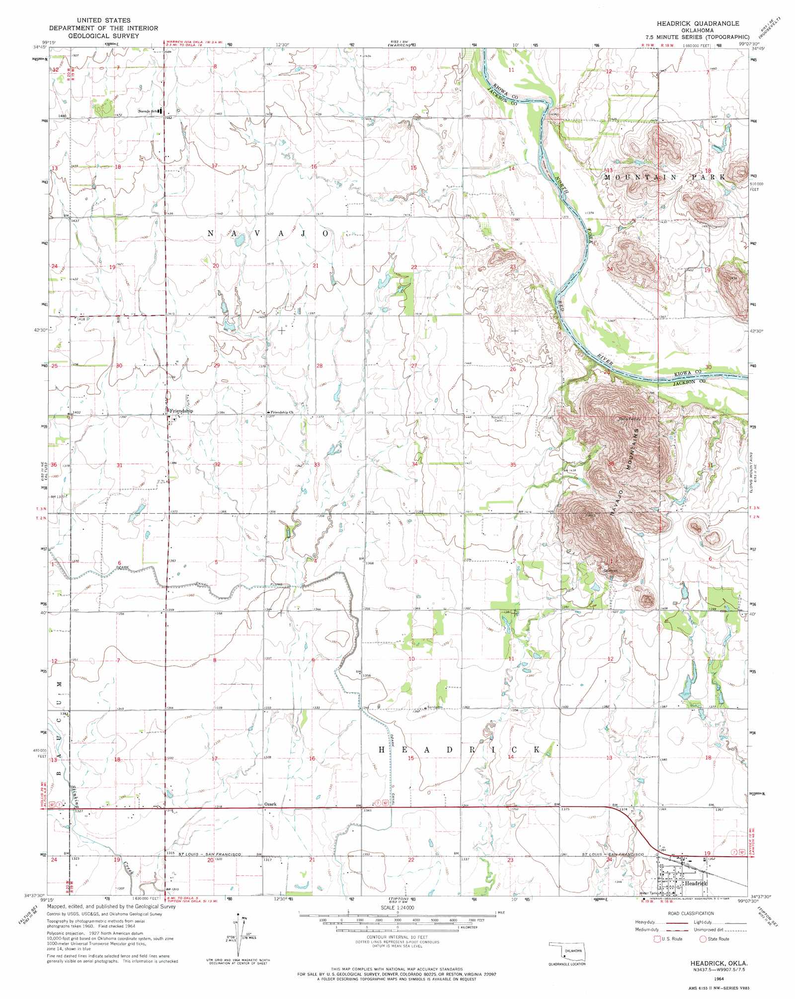
USGS Topo Quad 34099f2 - 1:24,000 scale
| Topo Map Name: | Headrick |
| USGS Topo Quad ID: | 34099f2 |
| Print Size: | ca. 21 1/4" wide x 27" high |
| Southeast Coordinates: | 34.625° N latitude / 99.125° W longitude |
| Map Center Coordinates: | 34.6875° N latitude / 99.1875° W longitude |
| U.S. State: | OK |
| Filename: | o34099f2.jpg |
| Download Map JPG Image: | Headrick topo map 1:24,000 scale |
| Map Type: | Topographic |
| Topo Series: | 7.5´ |
| Map Scale: | 1:24,000 |
| Source of Map Images: | United States Geological Survey (USGS) |
| Alternate Map Versions: |
Headrick OK 1964, updated 1965 Download PDF Buy paper map Headrick OK 2010 Download PDF Buy paper map Headrick OK 2012 Download PDF Buy paper map Headrick OK 2016 Download PDF Buy paper map |
1:24,000 Topo Quads surrounding Headrick
Granite |
Lake Altus |
Lone Wolf |
Babbs |
Rainy Mountain Creek |
Hester |
Blair |
Warren |
Roosevelt |
Glen Mountains |
Martha |
Altus |
Headrick |
Long Mountain |
Snyder |
Olustee |
Altus Se |
Tipton |
Tipton Se |
Manitou |
Ayers Island |
Elmer |
Frederick Nw |
Frederick |
Hollister Nw |
> Back to 34099e1 at 1:100,000 scale
> Back to 34098a1 at 1:250,000 scale
> Back to U.S. Topo Maps home
Headrick topo map: Gazetteer
Headrick: Canals
Ozark Canal elevation 415m 1361′Headrick: Dams
Oknoname 065002 Dam elevation 430m 1410′Headrick: Populated Places
Friendship elevation 424m 1391′Headrick elevation 415m 1361′
Ozark elevation 403m 1322′
Headrick: Ranges
Navajo Mountains elevation 483m 1584′Headrick: Reservoirs
Oknoname 065002 Reservoir elevation 430m 1410′Headrick digital topo map on disk
Buy this Headrick topo map showing relief, roads, GPS coordinates and other geographical features, as a high-resolution digital map file on DVD: