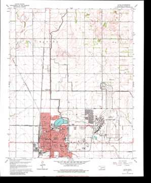
Altus Topo Map Oklahoma
To zoom in, hover over the map of Altus
USGS Topo Quad 34099f3 - 1:24,000 scale
| Topo Map Name: | Altus |
| USGS Topo Quad ID: | 34099f3 |
| Print Size: | ca. 21 1/4" wide x 27" high |
| Southeast Coordinates: | 34.625° N latitude / 99.25° W longitude |
| Map Center Coordinates: | 34.6875° N latitude / 99.3125° W longitude |
| U.S. State: | OK |
| Filename: | o34099f3.jpg |
| Download Map JPG Image: | Altus topo map 1:24,000 scale |
| Map Type: | Topographic |
| Topo Series: | 7.5´ |
| Map Scale: | 1:24,000 |
| Source of Map Images: | United States Geological Survey (USGS) |
| Alternate Map Versions: |
Altus OK 1964, updated 1965 Download PDF Buy paper map Altus OK 1964, updated 1982 Download PDF Buy paper map Altus OK 2010 Download PDF Buy paper map Altus OK 2012 Download PDF Buy paper map Altus OK 2016 Download PDF Buy paper map |
1:24,000 Topo Quads surrounding Altus
> Back to 34099e1 at 1:100,000 scale
> Back to 34098a1 at 1:250,000 scale
> Back to U.S. Topo Maps home
Altus topo map: Gazetteer
Altus: Airports
Altus Air Force Base elevation 415m 1361′Altus Municipal Airport elevation 433m 1420′
Scottys Field elevation 429m 1407′
Stewart Airport elevation 416m 1364′
Altus: Canals
Altus Canal elevation 430m 1410′Altus: Dams
Altus City Reservoir Dam elevation 421m 1381′Altus Reservoir Dam elevation 421m 1381′
Oknoname 031008 Dam elevation 465m 1525′
Altus: Parks
Lincoln Park elevation 418m 1371′Altus: Populated Places
Altus elevation 426m 1397′Hightower elevation 404m 1325′
Welon elevation 425m 1394′
Altus: Reservoirs
Altus City Reservoir elevation 421m 1381′Altus Reservoir elevation 421m 1381′
Oknoname 031008 Reservoir elevation 465m 1525′
Altus digital topo map on disk
Buy this Altus topo map showing relief, roads, GPS coordinates and other geographical features, as a high-resolution digital map file on DVD:


