Roosevelt Topo Map Oklahoma
To zoom in, hover over the map of Roosevelt
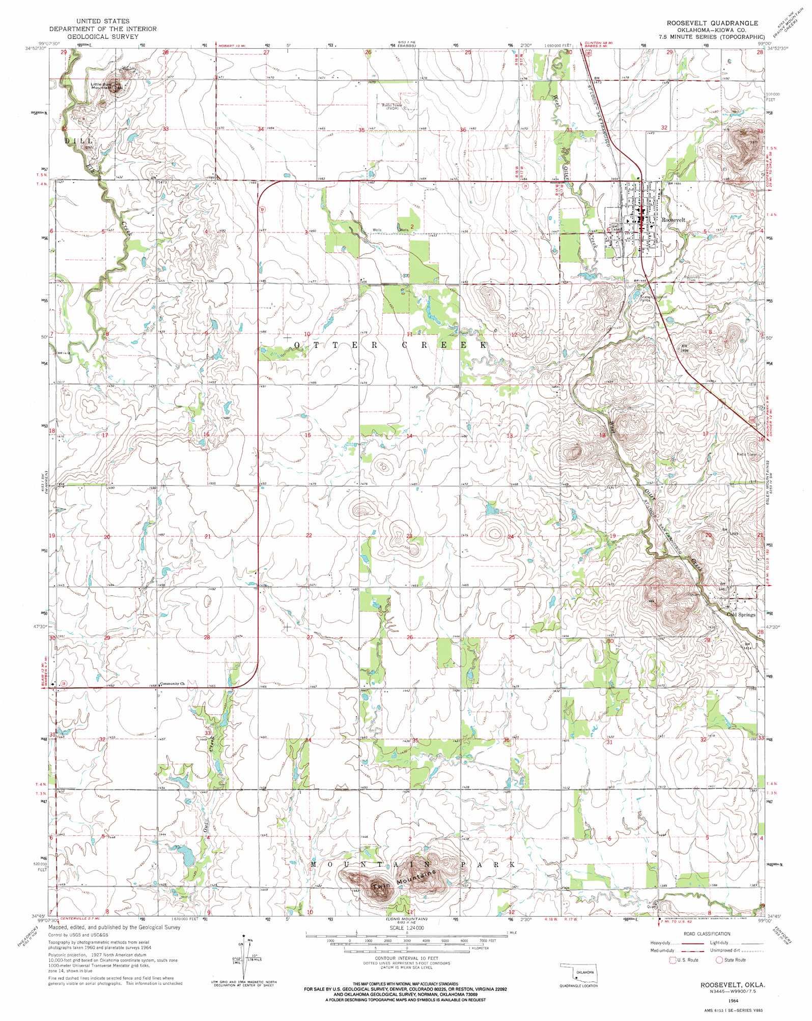
USGS Topo Quad 34099g1 - 1:24,000 scale
| Topo Map Name: | Roosevelt |
| USGS Topo Quad ID: | 34099g1 |
| Print Size: | ca. 21 1/4" wide x 27" high |
| Southeast Coordinates: | 34.75° N latitude / 99° W longitude |
| Map Center Coordinates: | 34.8125° N latitude / 99.0625° W longitude |
| U.S. State: | OK |
| Filename: | o34099g1.jpg |
| Download Map JPG Image: | Roosevelt topo map 1:24,000 scale |
| Map Type: | Topographic |
| Topo Series: | 7.5´ |
| Map Scale: | 1:24,000 |
| Source of Map Images: | United States Geological Survey (USGS) |
| Alternate Map Versions: |
Roosevelt OK 1964, updated 1965 Download PDF Buy paper map Roosevelt OK 2010 Download PDF Buy paper map Roosevelt OK 2012 Download PDF Buy paper map Roosevelt OK 2016 Download PDF Buy paper map |
1:24,000 Topo Quads surrounding Roosevelt
Retrop Se |
Cambridge |
Hobart |
Gotebo West |
Gotebo East |
Lake Altus |
Lone Wolf |
Babbs |
Rainy Mountain Creek |
Unap Mountain |
Blair |
Warren |
Roosevelt |
Glen Mountains |
Cooperton |
Altus |
Headrick |
Long Mountain |
Snyder |
Odetta |
Altus Se |
Tipton |
Tipton Se |
Manitou |
Indiahoma |
> Back to 34099e1 at 1:100,000 scale
> Back to 34098a1 at 1:250,000 scale
> Back to U.S. Topo Maps home
Roosevelt topo map: Gazetteer
Roosevelt: Dams
Oknoname 075003 Dam elevation 440m 1443′Oknoname 075004 Dam elevation 437m 1433′
Roosevelt: Levees
West Dike elevation 428m 1404′Roosevelt: Populated Places
Cold Springs elevation 436m 1430′Roosevelt elevation 446m 1463′
Roosevelt: Reservoirs
Oknoname 075003 Reservoir elevation 440m 1443′Oknoname 375004 Reservoir elevation 437m 1433′
Roosevelt: Summits
Little Bow Mountain elevation 487m 1597′Twin Mountains elevation 521m 1709′
Roosevelt digital topo map on disk
Buy this Roosevelt topo map showing relief, roads, GPS coordinates and other geographical features, as a high-resolution digital map file on DVD: