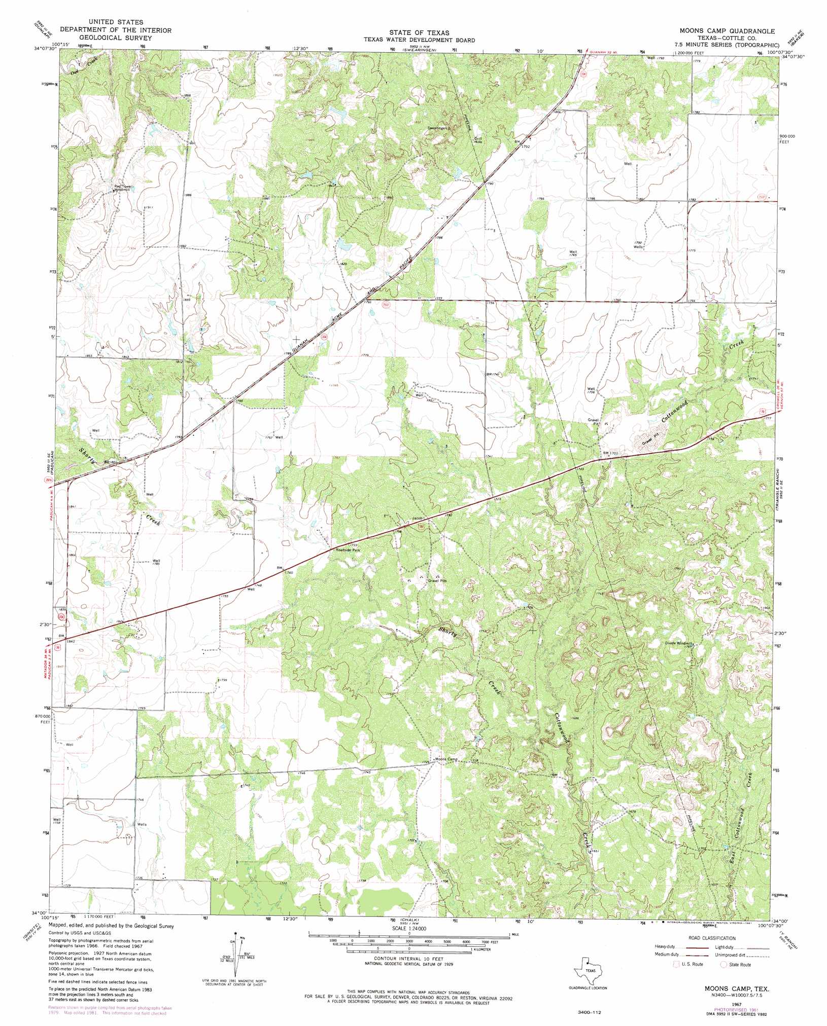
Moons Camp Topo Map Texas
To zoom in, hover over the map of Moons Camp
USGS Topo Quad 34100a2 - 1:24,000 scale
| Topo Map Name: | Moons Camp |
| USGS Topo Quad ID: | 34100a2 |
| Print Size: | ca. 21 1/4" wide x 27" high |
| Southeast Coordinates: | 34° N latitude / 100.125° W longitude |
| Map Center Coordinates: | 34.0625° N latitude / 100.1875° W longitude |
| U.S. State: | TX |
| Filename: | o34100a2.jpg |
| Download Map JPG Image: | Moons Camp topo map 1:24,000 scale |
| Map Type: | Topographic |
| Topo Series: | 7.5´ |
| Map Scale: | 1:24,000 |
| Source of Map Images: | United States Geological Survey (USGS) |
| Alternate Map Versions: |
Moons Camp TX 1967, updated 1970 Download PDF Buy paper map Moons Camp TX 1967, updated 1981 Download PDF Buy paper map Moons Camp TX 2010 Download PDF Buy paper map Moons Camp TX 2012 Download PDF Buy paper map Moons Camp TX 2016 Download PDF Buy paper map |
1:24,000 Topo Quads surrounding Moons Camp
Tell South |
Hell Roaring Creek |
Buckle L Ranch |
Kirkland South |
Goodlett |
Cee Vee |
Dunlap |
Swearingen |
Baker |
Cactus Creek |
Devils Canyon |
Paducah |
Moons Camp |
Triangle Ranch |
Vivian |
Grow Nw |
Ginsite |
Chalk |
Y Ranch |
Boiling Spring |
Buffalo Creek |
Grow |
Chalk Sw |
Lowrance Mountain |
Big Four Ranch |
> Back to 34100a1 at 1:100,000 scale
> Back to 34100a1 at 1:250,000 scale
> Back to U.S. Topo Maps home
Moons Camp topo map: Gazetteer
Moons Camp: Dams
L V Anderson Lake Dam elevation 524m 1719′Moons Camp: Populated Places
Jacobs (historical) elevation 547m 1794′Moons Camp: Reservoirs
L V Anderson Lake elevation 524m 1719′Moons Camp: Streams
Shorty Creek elevation 502m 1646′Moons Camp digital topo map on disk
Buy this Moons Camp topo map showing relief, roads, GPS coordinates and other geographical features, as a high-resolution digital map file on DVD: