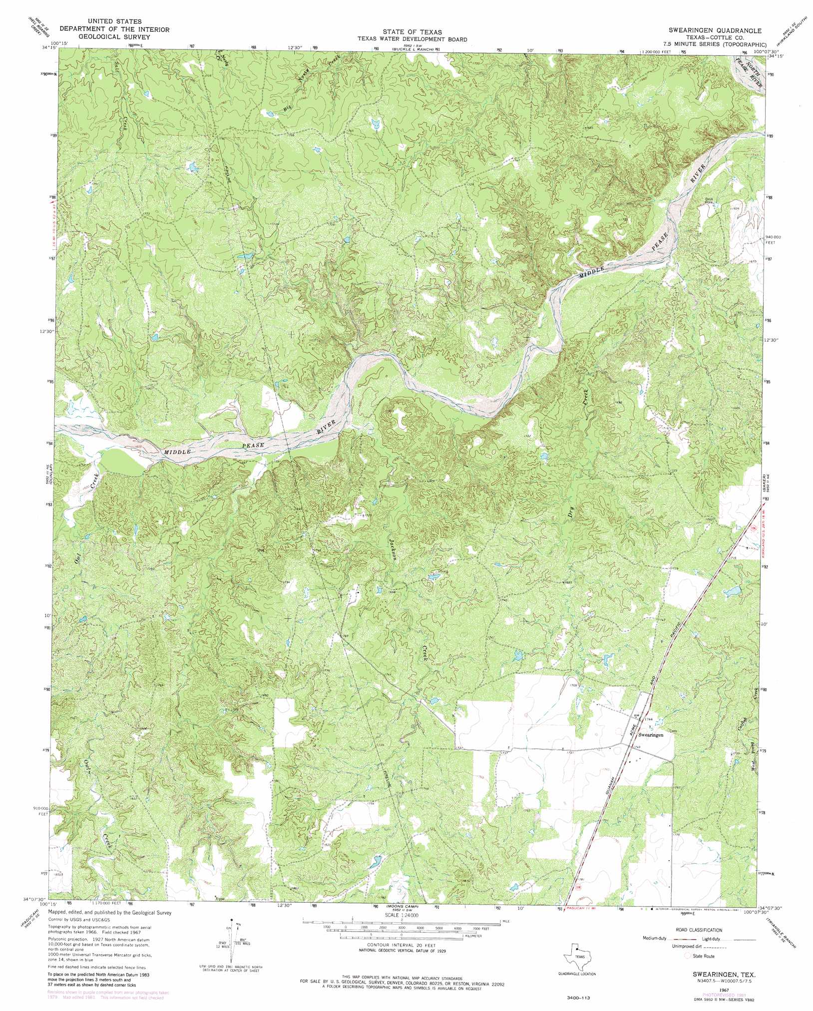
Swearingen Topo Map Texas
To zoom in, hover over the map of Swearingen
USGS Topo Quad 34100b2 - 1:24,000 scale
| Topo Map Name: | Swearingen |
| USGS Topo Quad ID: | 34100b2 |
| Print Size: | ca. 21 1/4" wide x 27" high |
| Southeast Coordinates: | 34.125° N latitude / 100.125° W longitude |
| Map Center Coordinates: | 34.1875° N latitude / 100.1875° W longitude |
| U.S. State: | TX |
| Filename: | o34100b2.jpg |
| Download Map JPG Image: | Swearingen topo map 1:24,000 scale |
| Map Type: | Topographic |
| Topo Series: | 7.5´ |
| Map Scale: | 1:24,000 |
| Source of Map Images: | United States Geological Survey (USGS) |
| Alternate Map Versions: |
Swearingen TX 1967, updated 1970 Download PDF Buy paper map Swearingen TX 2010 Download PDF Buy paper map Swearingen TX 2013 Download PDF Buy paper map Swearingen TX 2016 Download PDF Buy paper map |
1:24,000 Topo Quads surrounding Swearingen
Tell North |
Carey |
Childress |
Kirkland North |
Williams |
Tell South |
Hell Roaring Creek |
Buckle L Ranch |
Kirkland South |
Goodlett |
Cee Vee |
Dunlap |
Swearingen |
Baker |
Cactus Creek |
Devils Canyon |
Paducah |
Moons Camp |
Triangle Ranch |
Vivian |
Grow Nw |
Ginsite |
Chalk |
Y Ranch |
Boiling Spring |
> Back to 34100a1 at 1:100,000 scale
> Back to 34100a1 at 1:250,000 scale
> Back to U.S. Topo Maps home
Swearingen topo map: Gazetteer
Swearingen: Airports
Wilson Airport elevation 532m 1745′Swearingen: Populated Places
Swearingen elevation 534m 1751′Swearingen: Streams
Dry Creek elevation 469m 1538′Jackson Creek elevation 482m 1581′
Owl Creek elevation 487m 1597′
Swearingen digital topo map on disk
Buy this Swearingen topo map showing relief, roads, GPS coordinates and other geographical features, as a high-resolution digital map file on DVD: