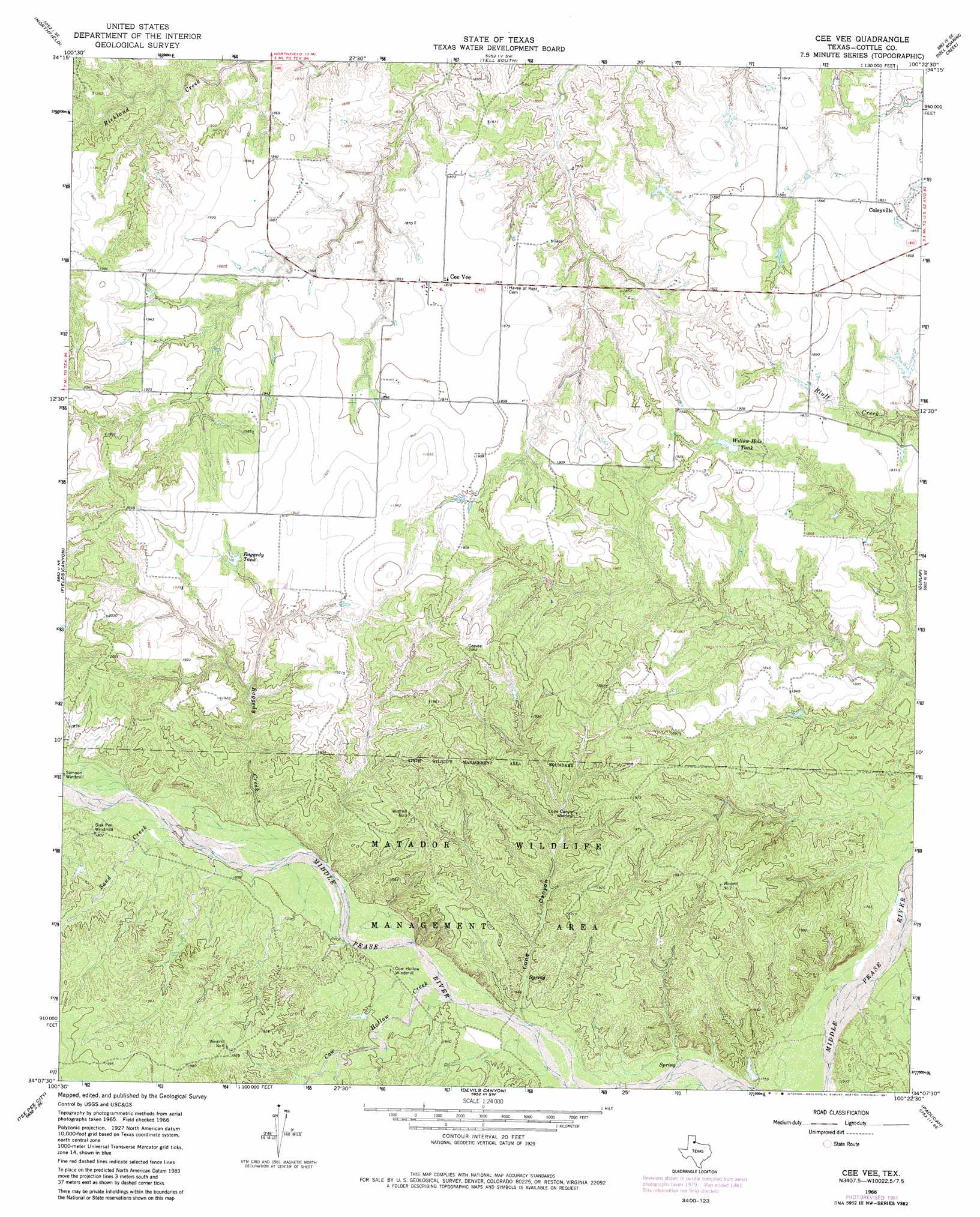
Cee Vee Topo Map Texas
To zoom in, hover over the map of Cee Vee
USGS Topo Quad 34100b4 - 1:24,000 scale
| Topo Map Name: | Cee Vee |
| USGS Topo Quad ID: | 34100b4 |
| Print Size: | ca. 21 1/4" wide x 27" high |
| Southeast Coordinates: | 34.125° N latitude / 100.375° W longitude |
| Map Center Coordinates: | 34.1875° N latitude / 100.4375° W longitude |
| U.S. State: | TX |
| Filename: | o34100b4.jpg |
| Download Map JPG Image: | Cee Vee topo map 1:24,000 scale |
| Map Type: | Topographic |
| Topo Series: | 7.5´ |
| Map Scale: | 1:24,000 |
| Source of Map Images: | United States Geological Survey (USGS) |
| Alternate Map Versions: |
Cee Vee TX 1966, updated 1968 Download PDF Buy paper map Cee Vee TX 1966, updated 1981 Download PDF Buy paper map Cee Vee TX 2010 Download PDF Buy paper map Cee Vee TX 2012 Download PDF Buy paper map Cee Vee TX 2016 Download PDF Buy paper map |
1:24,000 Topo Quads surrounding Cee Vee
Blue Tank Canyon |
Badger Nest Tank |
Tell North |
Carey |
Childress |
Cottonwood Camp |
Northfield |
Tell South |
Hell Roaring Creek |
Buckle L Ranch |
Turtle Hole Camp |
Fields Canyon |
Cee Vee |
Dunlap |
Swearingen |
Ballard Camp |
Tee Pee City |
Devils Canyon |
Paducah |
Moons Camp |
Russellville |
China Canyon |
Grow Nw |
Ginsite |
Chalk |
> Back to 34100a1 at 1:100,000 scale
> Back to 34100a1 at 1:250,000 scale
> Back to U.S. Topo Maps home
Cee Vee topo map: Gazetteer
Cee Vee: Parks
Matador Wildlife Management Area elevation 578m 1896′Cee Vee: Populated Places
Cee Vee elevation 573m 1879′Coleyville elevation 561m 1840′
Cee Vee: Reservoirs
Raggedy Tank elevation 582m 1909′Willow Hole Tank elevation 567m 1860′
Cee Vee: Streams
Cow Hollow Creek elevation 539m 1768′Raggedy Creek elevation 548m 1797′
Sand Creek elevation 551m 1807′
Tongue River elevation 530m 1738′
Cee Vee: Valleys
Lone Canyon elevation 537m 1761′Cee Vee digital topo map on disk
Buy this Cee Vee topo map showing relief, roads, GPS coordinates and other geographical features, as a high-resolution digital map file on DVD: