Turkey Topo Map Texas
To zoom in, hover over the map of Turkey
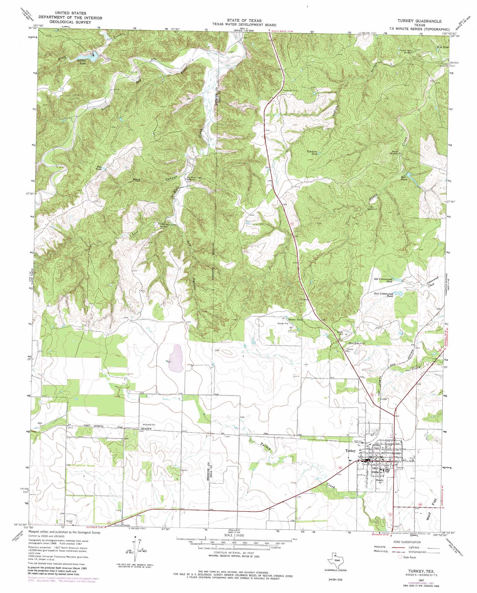
USGS Topo Quad 34100d8 - 1:24,000 scale
| Topo Map Name: | Turkey |
| USGS Topo Quad ID: | 34100d8 |
| Print Size: | ca. 21 1/4" wide x 27" high |
| Southeast Coordinates: | 34.375° N latitude / 100.875° W longitude |
| Map Center Coordinates: | 34.4375° N latitude / 100.9375° W longitude |
| U.S. State: | TX |
| Filename: | o34100d8.jpg |
| Download Map JPG Image: | Turkey topo map 1:24,000 scale |
| Map Type: | Topographic |
| Topo Series: | 7.5´ |
| Map Scale: | 1:24,000 |
| Source of Map Images: | United States Geological Survey (USGS) |
| Alternate Map Versions: |
Turkey TX 1967, updated 1970 Download PDF Buy paper map Turkey TX 1967, updated 1981 Download PDF Buy paper map Turkey TX 2010 Download PDF Buy paper map Turkey TX 2012 Download PDF Buy paper map Turkey TX 2016 Download PDF Buy paper map |
1:24,000 Topo Quads surrounding Turkey
Hardscrabble Creek |
Willow Arroyo |
Brice |
Lesley |
Memphis Nw |
Indian Peak |
Schott Mountain |
Hughes Canyon |
Heel Fly Draw |
Plaska |
Hay Lake |
Lake Theo |
Turkey |
Tampico Siding |
Blue Tank Canyon |
Edgemon Lake |
Quitaque |
Folley |
North Windmill |
Cottonwood Camp |
Wilson Creek |
Quitaque Peaks |
Flomot |
Hornica Creek |
Turtle Hole Camp |
> Back to 34100a1 at 1:100,000 scale
> Back to 34100a1 at 1:250,000 scale
> Back to U.S. Topo Maps home
Turkey topo map: Gazetteer
Turkey: Dams
Burson Lake Dam elevation 665m 2181′Turkey: Lakes
Burson Lake elevation 660m 2165′Turkey: Populated Places
Turkey elevation 711m 2332′Turkey: Reservoirs
Bell Tank elevation 661m 2168′Burson Lake elevation 665m 2181′
Green Tank elevation 751m 2463′
New Cottonwood Tank elevation 704m 2309′
Old Cottonwood Tank elevation 701m 2299′
Pole Tank elevation 708m 2322′
R A Tank elevation 635m 2083′
Timmons Tank elevation 717m 2352′
Turkey: Streams
Lost Mule Creek elevation 628m 2060′Turkey: Valleys
Gyp Canyon elevation 654m 2145′Indian Arroyo elevation 638m 2093′
Pole Canyon elevation 650m 2132′
Turkey digital topo map on disk
Buy this Turkey topo map showing relief, roads, GPS coordinates and other geographical features, as a high-resolution digital map file on DVD: