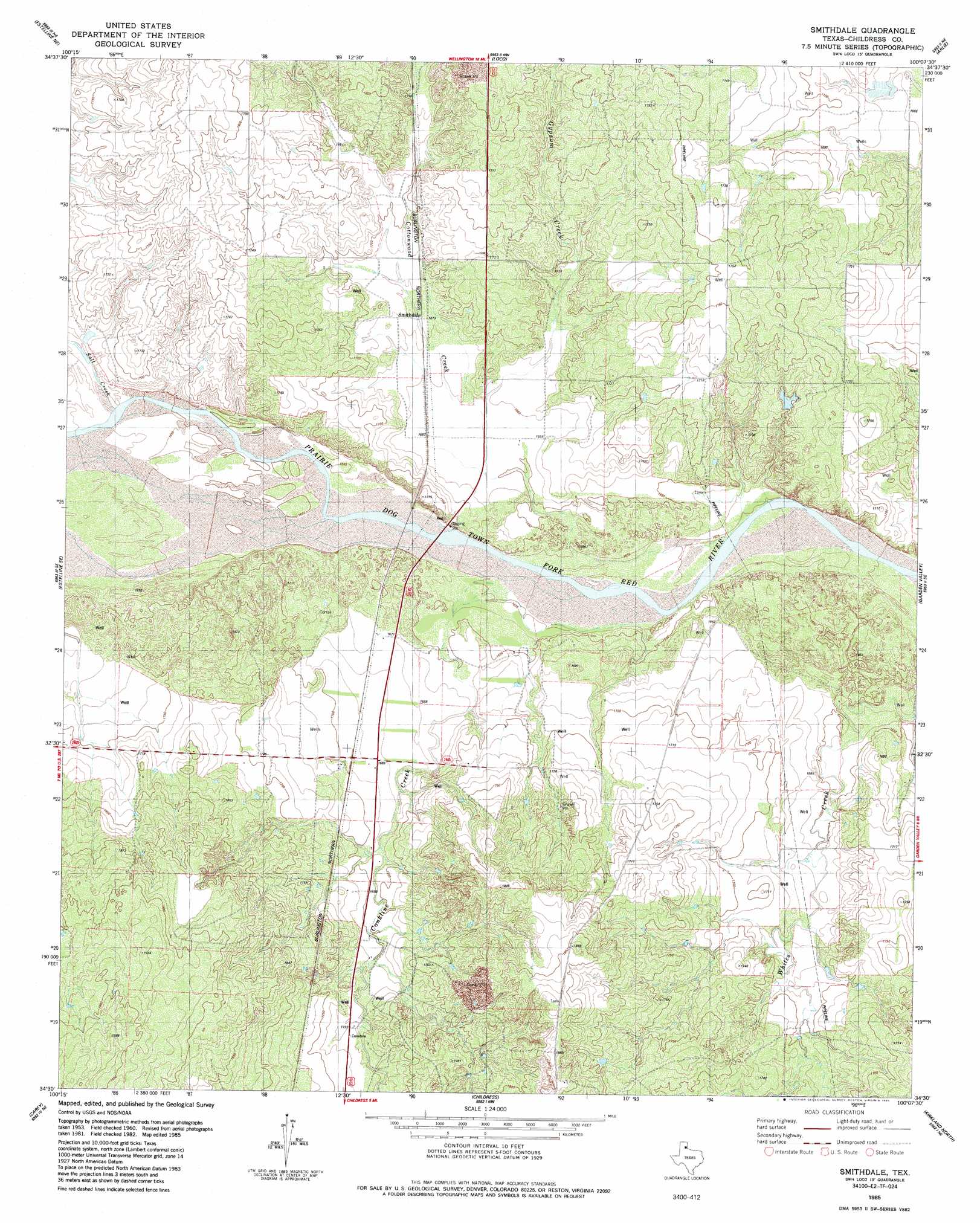
Smithdale Topo Map Texas
To zoom in, hover over the map of Smithdale
USGS Topo Quad 34100e2 - 1:24,000 scale
| Topo Map Name: | Smithdale |
| USGS Topo Quad ID: | 34100e2 |
| Print Size: | ca. 21 1/4" wide x 27" high |
| Southeast Coordinates: | 34.5° N latitude / 100.125° W longitude |
| Map Center Coordinates: | 34.5625° N latitude / 100.1875° W longitude |
| U.S. State: | TX |
| Filename: | o34100e2.jpg |
| Download Map JPG Image: | Smithdale topo map 1:24,000 scale |
| Map Type: | Topographic |
| Topo Series: | 7.5´ |
| Map Scale: | 1:24,000 |
| Source of Map Images: | United States Geological Survey (USGS) |
| Alternate Map Versions: |
Smithdale TX 1985, updated 1985 Download PDF Buy paper map Smithdale TX 2010 Download PDF Buy paper map Smithdale TX 2012 Download PDF Buy paper map Smithdale TX 2016 Download PDF Buy paper map |
1:24,000 Topo Quads surrounding Smithdale
Rolla Sw |
Rolla |
Wellington |
Dodson |
Mcknight |
Estelline Nw |
Estelline Ne |
Loco |
Arlie |
Hollis |
Estelline |
Estelline Se |
Smithdale |
Garden Valley |
Hollis Sw |
Tell North |
Carey |
Childress |
Kirkland North |
Williams |
Tell South |
Hell Roaring Creek |
Buckle L Ranch |
Kirkland South |
Goodlett |
> Back to 34100e1 at 1:100,000 scale
> Back to 34100a1 at 1:250,000 scale
> Back to U.S. Topo Maps home
Smithdale topo map: Gazetteer
Smithdale: Populated Places
Abington elevation 516m 1692′Smithdale elevation 512m 1679′
Smithdale: Streams
Conkline Creek elevation 497m 1630′Gypsum Creek elevation 495m 1624′
Salt Creek elevation 499m 1637′
Smithdale digital topo map on disk
Buy this Smithdale topo map showing relief, roads, GPS coordinates and other geographical features, as a high-resolution digital map file on DVD: