Clarendon Topo Map Texas
To zoom in, hover over the map of Clarendon
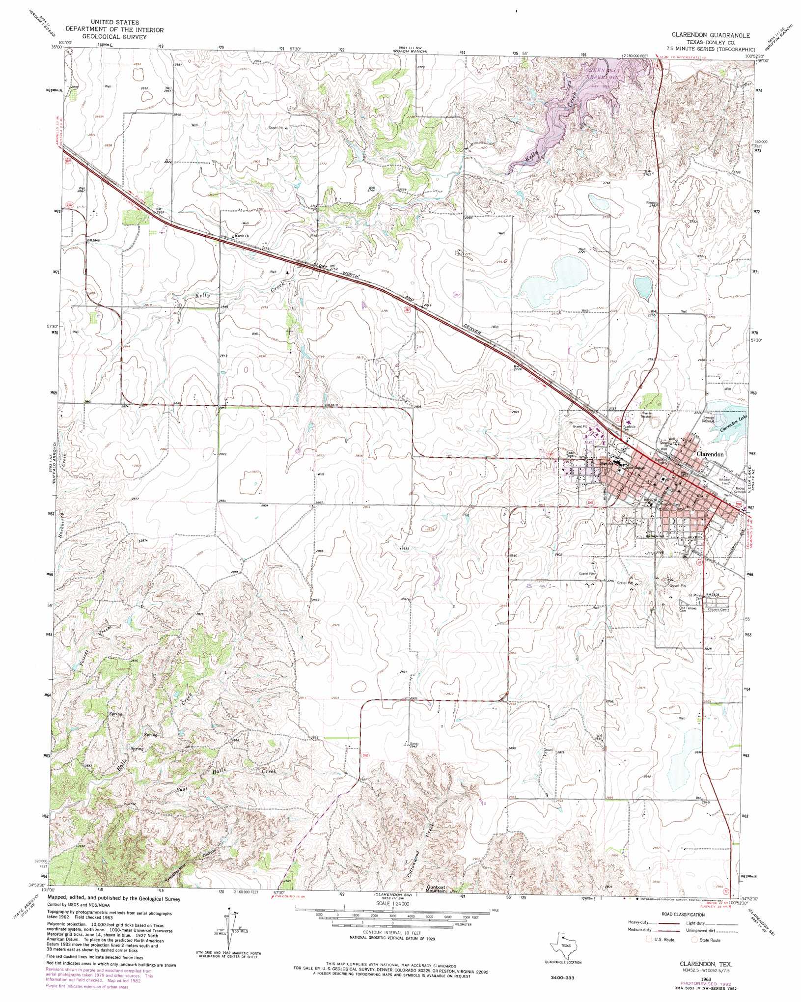
USGS Topo Quad 34100h8 - 1:24,000 scale
| Topo Map Name: | Clarendon |
| USGS Topo Quad ID: | 34100h8 |
| Print Size: | ca. 21 1/4" wide x 27" high |
| Southeast Coordinates: | 34.875° N latitude / 100.875° W longitude |
| Map Center Coordinates: | 34.9375° N latitude / 100.9375° W longitude |
| U.S. State: | TX |
| Filename: | o34100h8.jpg |
| Download Map JPG Image: | Clarendon topo map 1:24,000 scale |
| Map Type: | Topographic |
| Topo Series: | 7.5´ |
| Map Scale: | 1:24,000 |
| Source of Map Images: | United States Geological Survey (USGS) |
| Alternate Map Versions: |
Clarendon TX 1963, updated 1966 Download PDF Buy paper map Clarendon TX 1963, updated 1982 Download PDF Buy paper map Clarendon TX 2010 Download PDF Buy paper map Clarendon TX 2012 Download PDF Buy paper map Clarendon TX 2016 Download PDF Buy paper map |
1:24,000 Topo Quads surrounding Clarendon
Lark |
Groom |
Jericho |
Rockledge |
Alanreed |
Goodnight |
Ashtola |
Roach Ranch |
Griffin Ranch |
Troublesome Creek |
Blue Hole Springs |
Buffalo Arroyo |
Clarendon |
Lelia Lake |
Lelia Lake Creek |
Paloduro |
Tate Arroyo |
Clarendon Sw |
Clarendon Se |
Hedley |
Hardscrabble Creek |
Willow Arroyo |
Brice |
Lesley |
Memphis Nw |
> Back to 34100e1 at 1:100,000 scale
> Back to 34100a1 at 1:250,000 scale
> Back to U.S. Topo Maps home
Clarendon topo map: Gazetteer
Clarendon: Parks
Prospect Park elevation 836m 2742′Clarendon: Populated Places
Clarendon elevation 833m 2732′Clarendon: Reservoirs
Clarendon Lake elevation 825m 2706′Clarendon: Streams
East Halls Creek elevation 807m 2647′Clarendon: Summits
Gunboat Mountain elevation 895m 2936′Clarendon digital topo map on disk
Buy this Clarendon topo map showing relief, roads, GPS coordinates and other geographical features, as a high-resolution digital map file on DVD: