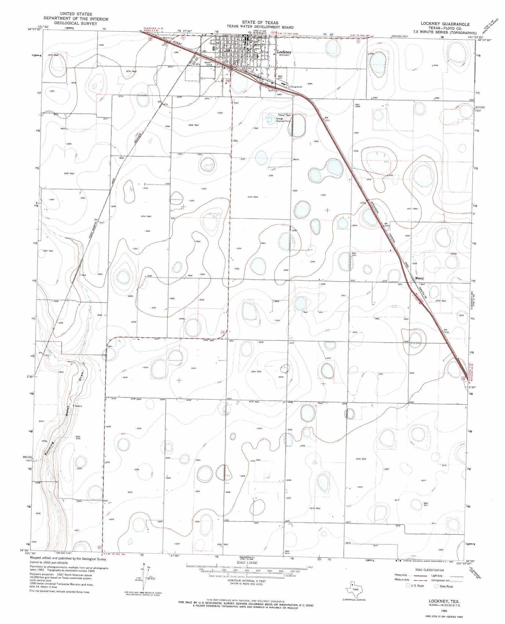
Lockney Topo Map Texas
To zoom in, hover over the map of Lockney
USGS Topo Quad 34101a4 - 1:24,000 scale
| Topo Map Name: | Lockney |
| USGS Topo Quad ID: | 34101a4 |
| Print Size: | ca. 21 1/4" wide x 27" high |
| Southeast Coordinates: | 34° N latitude / 101.375° W longitude |
| Map Center Coordinates: | 34.0625° N latitude / 101.4375° W longitude |
| U.S. State: | TX |
| Filename: | o34101a4.jpg |
| Download Map JPG Image: | Lockney topo map 1:24,000 scale |
| Map Type: | Topographic |
| Topo Series: | 7.5´ |
| Map Scale: | 1:24,000 |
| Source of Map Images: | United States Geological Survey (USGS) |
| Alternate Map Versions: |
Lockney TX 1965, updated 1968 Download PDF Buy paper map Lockney TX 2010 Download PDF Buy paper map Lockney TX 2012 Download PDF Buy paper map Lockney TX 2016 Download PDF Buy paper map |
1:24,000 Topo Quads surrounding Lockney
Kress East |
Providence |
Silverton Sw |
Whiteley |
Edgemon Lake |
Plainview |
Aiken |
Sterley |
South Plains |
Wilson Creek |
Happy Union |
Plainview Se |
Lockney |
Lockney Se |
Lockney 4 Sw |
Julia Lake |
Barwise |
Sandhill |
Floydada |
Boothe |
Heckville |
Petersburg |
Cone |
Floydada Se |
Mount Blanco |
> Back to 34101a1 at 1:100,000 scale
> Back to 34100a1 at 1:250,000 scale
> Back to U.S. Topo Maps home
Lockney digital topo map on disk
Buy this Lockney topo map showing relief, roads, GPS coordinates and other geographical features, as a high-resolution digital map file on DVD: