Edgemon Lake Topo Map Texas
To zoom in, hover over the map of Edgemon Lake
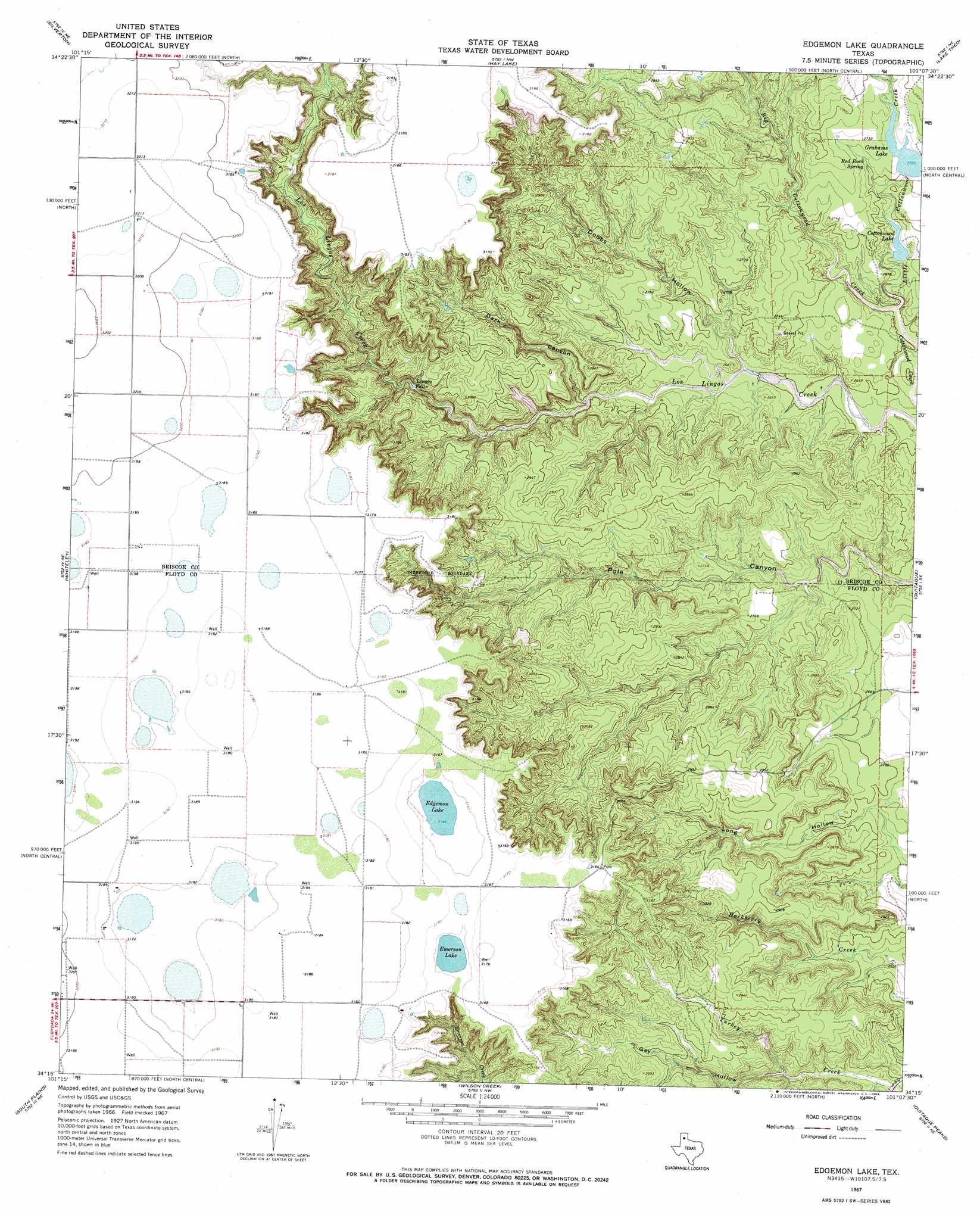
USGS Topo Quad 34101c2 - 1:24,000 scale
| Topo Map Name: | Edgemon Lake |
| USGS Topo Quad ID: | 34101c2 |
| Print Size: | ca. 21 1/4" wide x 27" high |
| Southeast Coordinates: | 34.25° N latitude / 101.125° W longitude |
| Map Center Coordinates: | 34.3125° N latitude / 101.1875° W longitude |
| U.S. State: | TX |
| Filename: | o34101c2.jpg |
| Download Map JPG Image: | Edgemon Lake topo map 1:24,000 scale |
| Map Type: | Topographic |
| Topo Series: | 7.5´ |
| Map Scale: | 1:24,000 |
| Source of Map Images: | United States Geological Survey (USGS) |
| Alternate Map Versions: |
Edgemon Lake TX 1967, updated 1969 Download PDF Buy paper map Edgemon Lake TX 2010 Download PDF Buy paper map Edgemon Lake TX 2012 Download PDF Buy paper map Edgemon Lake TX 2016 Download PDF Buy paper map |
1:24,000 Topo Quads surrounding Edgemon Lake
Cope Creek |
Ross Canyon |
Indian Peak |
Schott Mountain |
Hughes Canyon |
Rock Creek |
Silverton |
Hay Lake |
Lake Theo |
Turkey |
Silverton Sw |
Whiteley |
Edgemon Lake |
Quitaque |
Folley |
Sterley |
South Plains |
Wilson Creek |
Quitaque Peaks |
Flomot |
Lockney |
Lockney Se |
Lockney 4 Sw |
Dick Moore Canyon |
Whiteflat |
> Back to 34101a1 at 1:100,000 scale
> Back to 34100a1 at 1:250,000 scale
> Back to U.S. Topo Maps home
Edgemon Lake topo map: Gazetteer
Edgemon Lake: Dams
Cottonwood Dam elevation 804m 2637′Lake Graham Dam elevation 831m 2726′
Edgemon Lake: Falls
Lingos Falls elevation 844m 2769′Edgemon Lake: Lakes
Edgemon Lake elevation 959m 3146′Emerson Lake elevation 961m 3152′
Edgemon Lake: Reservoirs
Cottonwood Lake elevation 805m 2641′Grahams Lake elevation 830m 2723′
Lake Graham elevation 831m 2726′
Edgemon Lake: Springs
Red Rock Spring elevation 830m 2723′Edgemon Lake: Streams
Big Cottonwood Creek elevation 793m 2601′Little Cottonwood Creek elevation 789m 2588′
Edgemon Lake: Valleys
Dark Canyon elevation 811m 2660′Dobbs Hollow elevation 806m 2644′
Gay Hollow elevation 829m 2719′
Edgemon Lake digital topo map on disk
Buy this Edgemon Lake topo map showing relief, roads, GPS coordinates and other geographical features, as a high-resolution digital map file on DVD: