Hay Lake Topo Map Texas
To zoom in, hover over the map of Hay Lake
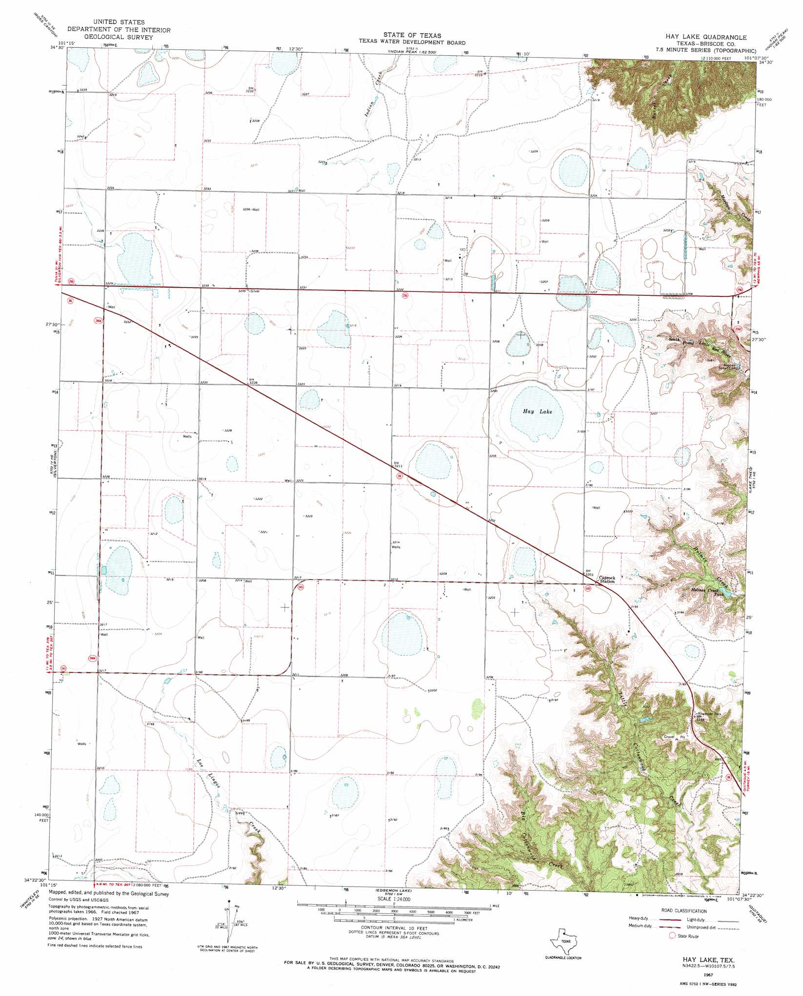
USGS Topo Quad 34101d2 - 1:24,000 scale
| Topo Map Name: | Hay Lake |
| USGS Topo Quad ID: | 34101d2 |
| Print Size: | ca. 21 1/4" wide x 27" high |
| Southeast Coordinates: | 34.375° N latitude / 101.125° W longitude |
| Map Center Coordinates: | 34.4375° N latitude / 101.1875° W longitude |
| U.S. State: | TX |
| Filename: | o34101d2.jpg |
| Download Map JPG Image: | Hay Lake topo map 1:24,000 scale |
| Map Type: | Topographic |
| Topo Series: | 7.5´ |
| Map Scale: | 1:24,000 |
| Source of Map Images: | United States Geological Survey (USGS) |
| Alternate Map Versions: |
Hay Lake TX 1967, updated 1969 Download PDF Buy paper map Hay Lake TX 2010 Download PDF Buy paper map Hay Lake TX 2012 Download PDF Buy paper map Hay Lake TX 2016 Download PDF Buy paper map |
1:24,000 Topo Quads surrounding Hay Lake
Vigo Peak |
Big Betty Reservoir |
Hardscrabble Creek |
Willow Arroyo |
Brice |
Cope Creek |
Ross Canyon |
Indian Peak |
Schott Mountain |
Hughes Canyon |
Rock Creek |
Silverton |
Hay Lake |
Lake Theo |
Turkey |
Silverton Sw |
Whiteley |
Edgemon Lake |
Quitaque |
Folley |
Sterley |
South Plains |
Wilson Creek |
Quitaque Peaks |
Flomot |
> Back to 34101a1 at 1:100,000 scale
> Back to 34100a1 at 1:250,000 scale
> Back to U.S. Topo Maps home
Hay Lake topo map: Gazetteer
Hay Lake: Lakes
Hay Lake elevation 965m 3166′Hay Lake: Reservoirs
Holmes Creek Tank elevation 893m 2929′Hay Lake digital topo map on disk
Buy this Hay Lake topo map showing relief, roads, GPS coordinates and other geographical features, as a high-resolution digital map file on DVD: