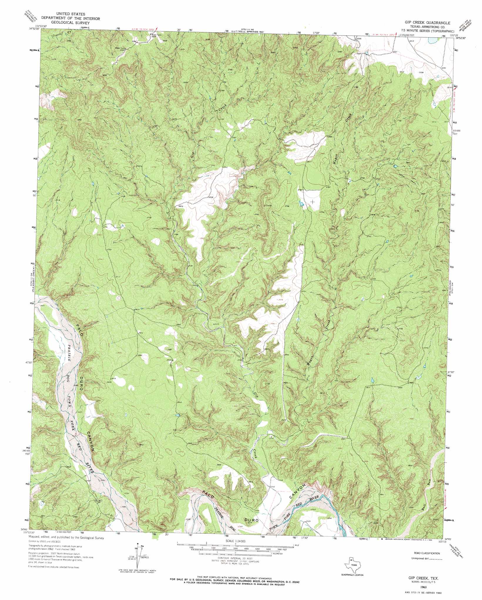
Gip Creek Topo Map Texas
To zoom in, hover over the map of Gip Creek
USGS Topo Quad 34101g3 - 1:24,000 scale
| Topo Map Name: | Gip Creek |
| USGS Topo Quad ID: | 34101g3 |
| Print Size: | ca. 21 1/4" wide x 27" high |
| Southeast Coordinates: | 34.75° N latitude / 101.25° W longitude |
| Map Center Coordinates: | 34.8125° N latitude / 101.3125° W longitude |
| U.S. State: | TX |
| Filename: | o34101g3.jpg |
| Download Map JPG Image: | Gip Creek topo map 1:24,000 scale |
| Map Type: | Topographic |
| Topo Series: | 7.5´ |
| Map Scale: | 1:24,000 |
| Source of Map Images: | United States Geological Survey (USGS) |
| Alternate Map Versions: |
Gip Creek TX 1963, updated 1966 Download PDF Buy paper map Gip Creek TX 2010 Download PDF Buy paper map Gip Creek TX 2012 Download PDF Buy paper map Gip Creek TX 2016 Download PDF Buy paper map |
1:24,000 Topo Quads surrounding Gip Creek
Fairview |
Claude Sw |
Claude |
Goodnight |
Ashtola |
Pony Flats |
Luttrell Springs |
Luttrell Springs Ne |
Blue Hole Springs |
Buffalo Arroyo |
Wayside |
Pleasant Creek |
Gip Creek |
Paloduro |
Tate Arroyo |
Jackson Hill |
Vigo Peak |
Big Betty Reservoir |
Hardscrabble Creek |
Willow Arroyo |
Love |
Cope Creek |
Ross Canyon |
Indian Peak |
Schott Mountain |
> Back to 34101e1 at 1:100,000 scale
> Back to 34100a1 at 1:250,000 scale
> Back to U.S. Topo Maps home
Gip Creek topo map: Gazetteer
Gip Creek: Streams
Deer Creek elevation 731m 2398′Gip Creek elevation 714m 2342′
Turkey Creek elevation 729m 2391′
Wagon Creek elevation 719m 2358′
Gip Creek digital topo map on disk
Buy this Gip Creek topo map showing relief, roads, GPS coordinates and other geographical features, as a high-resolution digital map file on DVD: