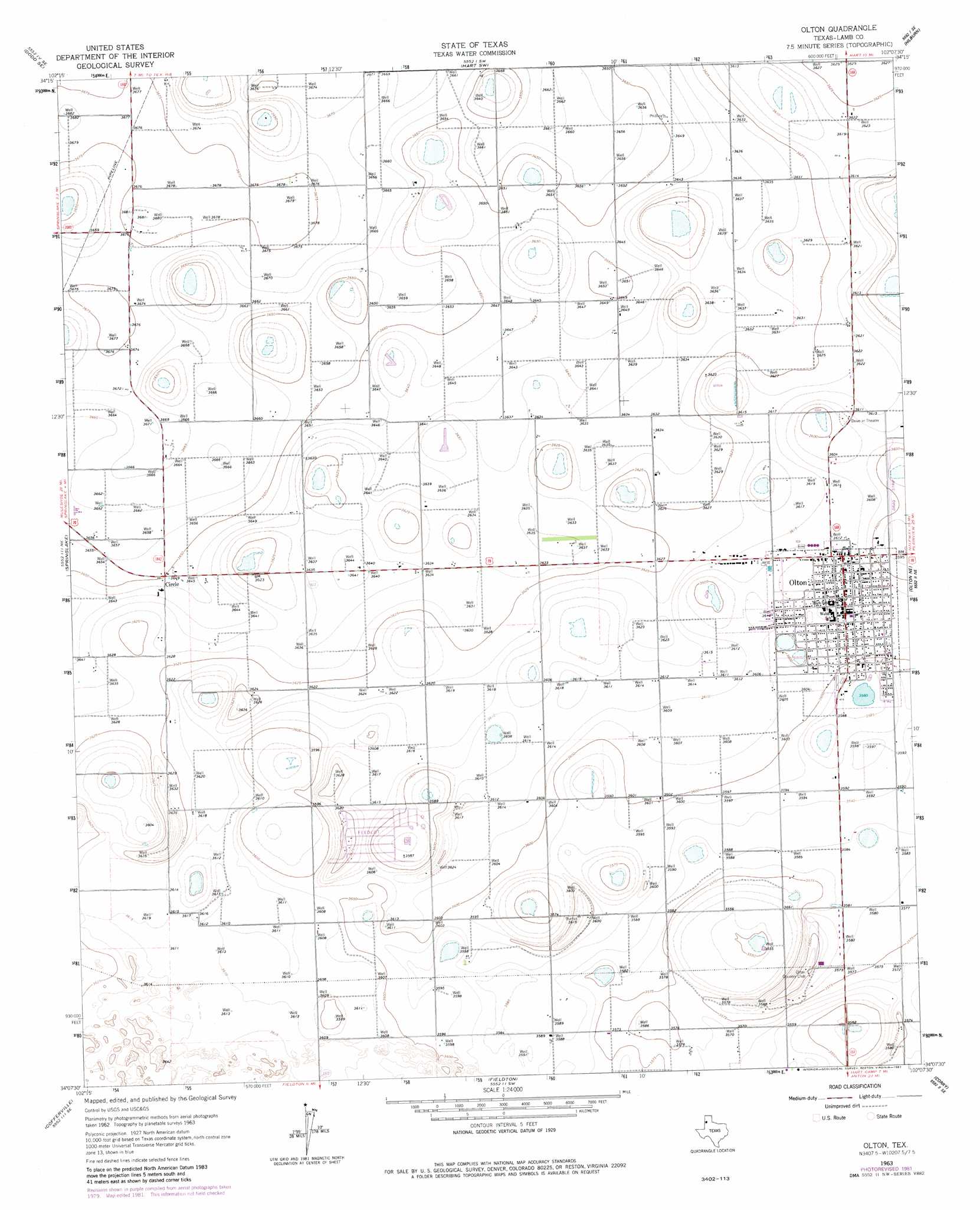
Olton Topo Map Texas
To zoom in, hover over the map of Olton
USGS Topo Quad 34102b2 - 1:24,000 scale
| Topo Map Name: | Olton |
| USGS Topo Quad ID: | 34102b2 |
| Print Size: | ca. 21 1/4" wide x 27" high |
| Southeast Coordinates: | 34.125° N latitude / 102.125° W longitude |
| Map Center Coordinates: | 34.1875° N latitude / 102.1875° W longitude |
| U.S. State: | TX |
| Filename: | o34102b2.jpg |
| Download Map JPG Image: | Olton topo map 1:24,000 scale |
| Map Type: | Topographic |
| Topo Series: | 7.5´ |
| Map Scale: | 1:24,000 |
| Source of Map Images: | United States Geological Survey (USGS) |
| Alternate Map Versions: |
Olton TX 1963, updated 1965 Download PDF Buy paper map Olton TX 1963, updated 1981 Download PDF Buy paper map Olton TX 2010 Download PDF Buy paper map Olton TX 2012 Download PDF Buy paper map Olton TX 2016 Download PDF Buy paper map |
1:24,000 Topo Quads surrounding Olton
Flagg |
Dodd Ne |
Hart Nw |
Hart |
Center Plains School |
Dodd |
Dodd Se |
Hart Sw |
Hilburn |
Edmonson |
Earth |
Springlake |
Olton |
Olton Ne |
Halfway |
Amherst |
Cofferville |
Fieldton |
Corry |
Hale Center Sw |
Bull Lake |
Littlefield |
Spade |
Anton Ne |
Cotton Center |
> Back to 34102a1 at 1:100,000 scale
> Back to 34102a1 at 1:250,000 scale
> Back to U.S. Topo Maps home
Olton topo map: Gazetteer
Olton: Airports
Del-Tex Airport elevation 1098m 3602′Olton: Populated Places
Circle elevation 1113m 3651′Olton elevation 1101m 3612′
Olton digital topo map on disk
Buy this Olton topo map showing relief, roads, GPS coordinates and other geographical features, as a high-resolution digital map file on DVD: