Gammil Well Ne Topo Map New Mexico
To zoom in, hover over the map of Gammil Well Ne
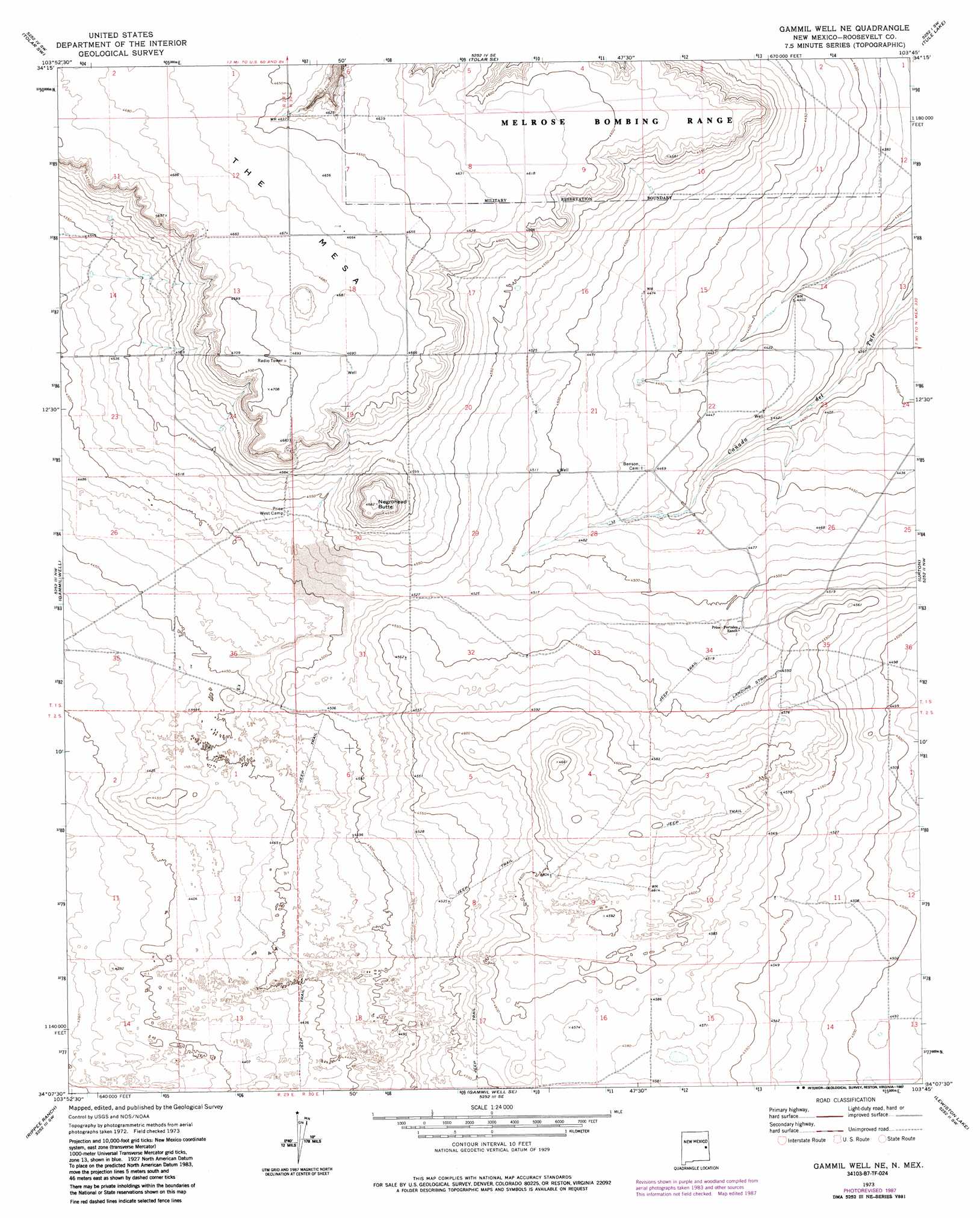
USGS Topo Quad 34103b7 - 1:24,000 scale
| Topo Map Name: | Gammil Well Ne |
| USGS Topo Quad ID: | 34103b7 |
| Print Size: | ca. 21 1/4" wide x 27" high |
| Southeast Coordinates: | 34.125° N latitude / 103.75° W longitude |
| Map Center Coordinates: | 34.1875° N latitude / 103.8125° W longitude |
| U.S. State: | NM |
| Filename: | o34103b7.jpg |
| Download Map JPG Image: | Gammil Well Ne topo map 1:24,000 scale |
| Map Type: | Topographic |
| Topo Series: | 7.5´ |
| Map Scale: | 1:24,000 |
| Source of Map Images: | United States Geological Survey (USGS) |
| Alternate Map Versions: |
Gammil Well NE NM 1973, updated 1975 Download PDF Buy paper map Gammil Well NE NM 1973, updated 1987 Download PDF Buy paper map Gammil Well NE NM 2010 Download PDF Buy paper map Gammil Well NE NM 2013 Download PDF Buy paper map Gammil Well NE NM 2017 Download PDF Buy paper map |
1:24,000 Topo Quads surrounding Gammil Well Ne
Taiban |
Tolar |
Krider |
Melrose West |
Melrose East |
Lomas Gatos |
Tolar Sw |
Tolar Se |
Tule Lake |
Melrose Se |
Watts Hill |
Gammil Well |
Gammil Well Ne |
Upton |
Floyd |
Howell Ranch |
Rippee Ranch |
Gammil Well Se |
Lewiston Lake |
Floyd Se |
Olive |
San Juan Mesa West |
San Juan Mesa East |
Elida |
Badger Lake |
> Back to 34103a1 at 1:100,000 scale
> Back to 34102a1 at 1:250,000 scale
> Back to U.S. Topo Maps home
Gammil Well Ne topo map: Gazetteer
Gammil Well Ne: Populated Places
Benson (historical) elevation 1363m 4471′Gammil Well Ne: Post Offices
Benson Post Office (historical) elevation 1363m 4471′Gammil Well Ne: Summits
Negrohead Butte elevation 1428m 4685′The Mesa elevation 1437m 4714′
Gammil Well Ne: Wells
11641 Water Well elevation 1422m 4665′11642 Water Well elevation 1341m 4399′
12726 Water Well elevation 1352m 4435′
Gammil Well Ne digital topo map on disk
Buy this Gammil Well Ne topo map showing relief, roads, GPS coordinates and other geographical features, as a high-resolution digital map file on DVD: