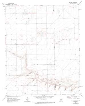
Bellview Topo Map New Mexico
To zoom in, hover over the map of Bellview
USGS Topo Quad 34103g1 - 1:24,000 scale
| Topo Map Name: | Bellview |
| USGS Topo Quad ID: | 34103g1 |
| Print Size: | ca. 21 1/4" wide x 27" high |
| Southeast Coordinates: | 34.75° N latitude / 103° W longitude |
| Map Center Coordinates: | 34.8125° N latitude / 103.0625° W longitude |
| U.S. States: | NM, TX |
| Filename: | o34103g1.jpg |
| Download Map JPG Image: | Bellview topo map 1:24,000 scale |
| Map Type: | Topographic |
| Topo Series: | 7.5´ |
| Map Scale: | 1:24,000 |
| Source of Map Images: | United States Geological Survey (USGS) |
| Alternate Map Versions: |
Bellview NM 1971, updated 1974 Download PDF Buy paper map Bellview NM 2010 Download PDF Buy paper map Bellview NM 2013 Download PDF Buy paper map Bellview NM 2017 Download PDF Buy paper map |
1:24,000 Topo Quads surrounding Bellview
> Back to 34103e1 at 1:100,000 scale
> Back to 34102a1 at 1:250,000 scale
> Back to U.S. Topo Maps home
Bellview topo map: Gazetteer
Bellview: Populated Places
Bellview elevation 1358m 4455′Hollene elevation 1342m 4402′
Bellview: Post Offices
Bellview Post Office elevation 1358m 4455′Hollene Post Office (historical) elevation 1342m 4402′
Bellview: Streams
Tierra Blanca Creek elevation 1291m 4235′Bellview: Wells
10102 Water Well elevation 1359m 4458′10103 Water Well elevation 1340m 4396′
10211 Water Well elevation 1377m 4517′
10228 Water Well elevation 1365m 4478′
10229 Water Well elevation 1364m 4475′
10231 Water Well elevation 1354m 4442′
10232 Water Well elevation 1354m 4442′
10233 Water Well elevation 1344m 4409′
10234 Water Well elevation 1346m 4416′
10252 Water Well elevation 1360m 4461′
10755 Water Well elevation 1323m 4340′
10912 Water Well elevation 1323m 4340′
10927 Water Well elevation 1360m 4461′
10929 Water Well elevation 1357m 4452′
10930 Water Well elevation 1350m 4429′
10932 Water Well elevation 1342m 4402′
10933 Water Well elevation 1349m 4425′
10934 Water Well elevation 1339m 4393′
10935 Water Well elevation 1356m 4448′
11450 Water Well elevation 1318m 4324′
11451 Water Well elevation 1341m 4399′
11452 Water Well elevation 1352m 4435′
11463 Water Well elevation 1322m 4337′
11464 Water Well elevation 1345m 4412′
11479 Water Well elevation 1345m 4412′
11489 Water Well elevation 1354m 4442′
11547 Water Well elevation 1352m 4435′
11548 Water Well elevation 1349m 4425′
Bellview digital topo map on disk
Buy this Bellview topo map showing relief, roads, GPS coordinates and other geographical features, as a high-resolution digital map file on DVD:


