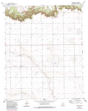
Forrest Topo Map New Mexico
To zoom in, hover over the map of Forrest
USGS Topo Quad 34103g5 - 1:24,000 scale
| Topo Map Name: | Forrest |
| USGS Topo Quad ID: | 34103g5 |
| Print Size: | ca. 21 1/4" wide x 27" high |
| Southeast Coordinates: | 34.75° N latitude / 103.5° W longitude |
| Map Center Coordinates: | 34.8125° N latitude / 103.5625° W longitude |
| U.S. State: | NM |
| Filename: | o34103g5.jpg |
| Download Map JPG Image: | Forrest topo map 1:24,000 scale |
| Map Type: | Topographic |
| Topo Series: | 7.5´ |
| Map Scale: | 1:24,000 |
| Source of Map Images: | United States Geological Survey (USGS) |
| Alternate Map Versions: |
Forrest NM 1971, updated 1974 Download PDF Buy paper map Forrest NM 1971, updated 1987 Download PDF Buy paper map Forrest NM 2010 Download PDF Buy paper map Forrest NM 2013 Download PDF Buy paper map Forrest NM 2017 Download PDF Buy paper map |
1:24,000 Topo Quads surrounding Forrest
> Back to 34103e1 at 1:100,000 scale
> Back to 34102a1 at 1:250,000 scale
> Back to U.S. Topo Maps home
Forrest topo map: Gazetteer
Forrest: Populated Places
Cowan (historical) elevation 1444m 4737′Forrest elevation 1454m 4770′
Plain (historical) elevation 1452m 4763′
Forrest: Post Offices
Forrest Post Office (historical) elevation 1437m 4714′Plain Post Office (historical) elevation 1452m 4763′
Forrest: Wells
10294 Water Well elevation 1420m 4658′10295 Water Well elevation 1416m 4645′
10296 Water Well elevation 1419m 4655′
10297 Water Well elevation 1415m 4642′
10298 Water Well elevation 1430m 4691′
10299 Water Well elevation 1431m 4694′
10391 Water Well elevation 1420m 4658′
10400 Water Well elevation 1423m 4668′
10401 Water Well elevation 1425m 4675′
10402 Water Well elevation 1407m 4616′
10414 Water Well elevation 1472m 4829′
10416 Water Well elevation 1457m 4780′
10417 Water Well elevation 1472m 4829′
10418 Water Well elevation 1453m 4767′
10419 Water Well elevation 1449m 4753′
10420 Water Well elevation 1440m 4724′
10422 Water Well elevation 1456m 4776′
10423 Water Well elevation 1442m 4730′
10424 Water Well elevation 1449m 4753′
10425 Water Well elevation 1441m 4727′
10426 Water Well elevation 1438m 4717′
10427 Water Well elevation 1431m 4694′
10428 Water Well elevation 1438m 4717′
10429 Water Well elevation 1427m 4681′
10430 Water Well elevation 1423m 4668′
10431 Water Well elevation 1432m 4698′
10432 Water Well elevation 1431m 4694′
10433 Water Well elevation 1435m 4708′
10434 Water Well elevation 1418m 4652′
10435 Water Well elevation 1435m 4708′
10508 Water Well elevation 1416m 4645′
10552 Water Well elevation 1475m 4839′
10576 Water Well elevation 1482m 4862′
10577 Water Well elevation 1475m 4839′
10581 Water Well elevation 1442m 4730′
10582 Water Well elevation 1454m 4770′
10583 Water Well elevation 1452m 4763′
10584 Water Well elevation 1458m 4783′
10585 Water Well elevation 1461m 4793′
10586 Water Well elevation 1454m 4770′
10594 Water Well elevation 1437m 4714′
10637 Water Well elevation 1484m 4868′
10638 Water Well elevation 1449m 4753′
10639 Water Well elevation 1435m 4708′
10640 Water Well elevation 1442m 4730′
10641 Water Well elevation 1451m 4760′
10642 Water Well elevation 1443m 4734′
10643 Water Well elevation 1441m 4727′
10644 Water Well elevation 1438m 4717′
10645 Water Well elevation 1426m 4678′
10646 Water Well elevation 1435m 4708′
10729 Water Well elevation 1427m 4681′
10749 Water Well elevation 1416m 4645′
10754 Water Well elevation 1477m 4845′
10759 Water Well elevation 1436m 4711′
Forrest digital topo map on disk
Buy this Forrest topo map showing relief, roads, GPS coordinates and other geographical features, as a high-resolution digital map file on DVD:


