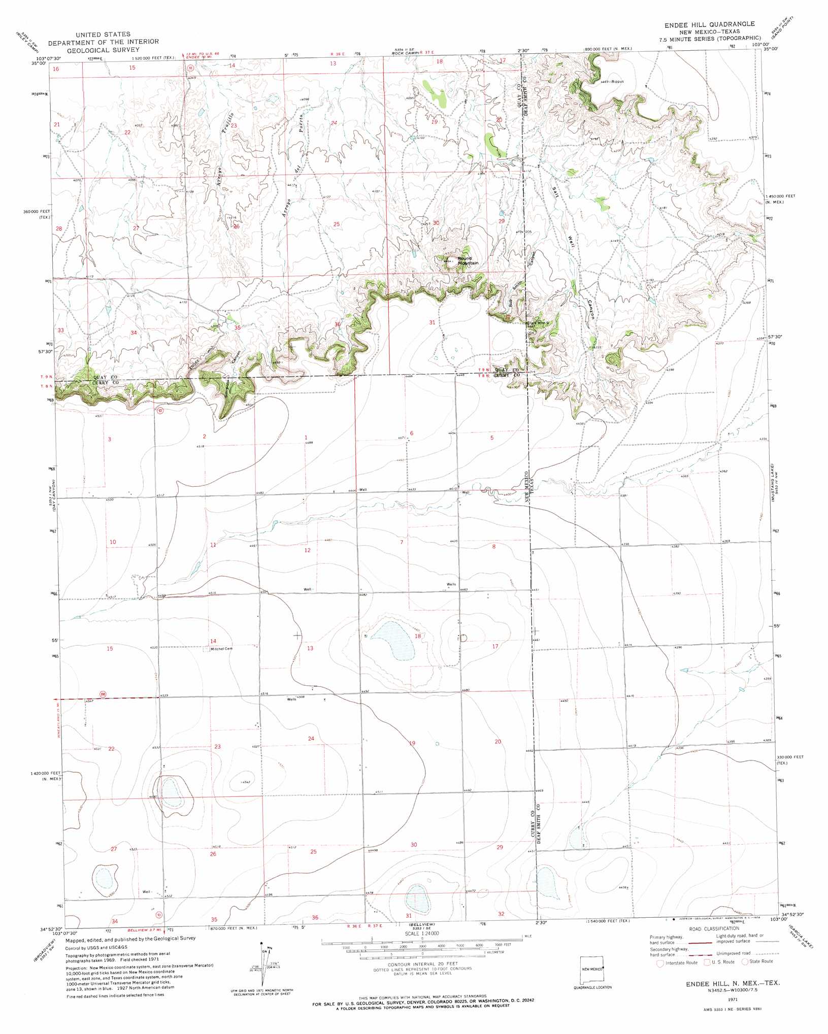
Endee Hill Topo Map New Mexico
To zoom in, hover over the map of Endee Hill
USGS Topo Quad 34103h1 - 1:24,000 scale
| Topo Map Name: | Endee Hill |
| USGS Topo Quad ID: | 34103h1 |
| Print Size: | ca. 21 1/4" wide x 27" high |
| Southeast Coordinates: | 34.875° N latitude / 103° W longitude |
| Map Center Coordinates: | 34.9375° N latitude / 103.0625° W longitude |
| U.S. States: | NM, TX |
| Filename: | o34103h1.jpg |
| Download Map JPG Image: | Endee Hill topo map 1:24,000 scale |
| Map Type: | Topographic |
| Topo Series: | 7.5´ |
| Map Scale: | 1:24,000 |
| Source of Map Images: | United States Geological Survey (USGS) |
| Alternate Map Versions: |
Endee Hill NM 1971, updated 1974 Download PDF Buy paper map Endee Hill NM 2010 Download PDF Buy paper map Endee Hill NM 2013 Download PDF Buy paper map Endee Hill NM 2017 Download PDF Buy paper map |
1:24,000 Topo Quads surrounding Endee Hill
Porter |
Bard |
Glenrio |
Moser Ranch |
Boise |
San Jon |
Riley Camp |
Rock Camp |
Sand Point |
Norton Lake |
Wheatland |
Day Canyon |
Endee Hill |
Mustang Lake |
Walcott |
Grady |
Broadview |
Bellview |
Garcia Lake |
Bootleg |
Smith Ranch |
Pleasant Hill Nw |
Pleasant Hill Ne |
Rhea |
Twin Lakes |
> Back to 34103e1 at 1:100,000 scale
> Back to 34102a1 at 1:250,000 scale
> Back to U.S. Topo Maps home
Endee Hill topo map: Gazetteer
Endee Hill: Airports
Mitchell Farms Airport elevation 1360m 4461′Endee Hill: Parks
Clark Monument 9 elevation 1354m 4442′Endee Hill: Summits
Endee Hill elevation 1328m 4356′Purcell elevation 1360m 4461′
Round Mountain elevation 1360m 4461′
Rusk Hill elevation 1277m 4189′
Endee Hill: Valleys
Bob Smith Canyon elevation 1262m 4140′Bob Smith Canyon elevation 1273m 4176′
Salt Well Canyon elevation 1255m 4117′
Simmons Canyon elevation 1291m 4235′
Endee Hill: Wells
10775 Water Well elevation 1349m 4425′Endee Hill digital topo map on disk
Buy this Endee Hill topo map showing relief, roads, GPS coordinates and other geographical features, as a high-resolution digital map file on DVD: